


Burry Holms…. ….and Worms Head
Warning! – some of the scenery that follows is beginning to get quite spectacular!
PROGRESS MAP
– Spot the distance difference from the last Episode – clue – we’ve been Mumbling about somewhere sounding like Goa?
Thanks to Ordnance Survey for kind permission to use their Physical Map Of the British Isles with my added Scarlet Worms. Still no recent movement around Anglesey! Northern Scarlet Worm is becalmed.

Dear Rosie, Lauren, Stan, Jake, Rowan and Maisie,
It’s April Fools’ Day and the weather is playing tricks with us. We picked a good day to start and managed 11 miles from the Mumbles to Oxwich along rapidly improving coastal scenic beauty. It would be difficult not to get better after visiting Port Talbot. But anyway the day finished prematurely when the previously threatening rain eventually arrived and halted progress.
The forecast is more of the same and we’re going to have to take our chances nipping in and out when the rain relents.
Remember last Episode finishing at the Wales Coast Path signs under the Brisbane Blue Sky – here we are back again – someone’s been busy with a new seat.
 Start point of this trip – Bracelet Bay Car Park near The Mumbles.


Same sign – new bench since last visit; and the Wales Coast Path heading off round the Gower Peninsular to……


………Langland and Caswell Bays are surfing bays round the corner from The Mumbles – not much happening on a cold Easter Sunday with the tide absent.


Brandy Cove – a smuggling flavour: Pwlldu Bay more National Trust.


Pwlldu Bay from Pwlldu Head and Oxwich Bay on the horizon.


Descending to Three Cliffs Bay – get ready to wade across Pennard Pill and peek into the smugglers’ caves…..


Two water courses cross the sands at Three Cliffs Bay and Oxwich Bay; Pennard Pill – tide out not too deep – but wet and cold; followed by the slightly faster and deeper un-named drain to Oxwich Marsh, equally inconvenient. Now I’m totally wet but across Home Free on Oxwich Burrows, heading for the National Trust Car Park and Vicky and Marilyn. They have survived gridlock in the carpark caused by an Easter Egg Hunt.
The rain is on its way and we’re off to the Swansea Ibis to dry out. See you on Day Two!
Day Two – such a hurry to get away yesterday I forgot to take finishing photos – I can sneak in some pictures taken now, but eagle-eyed grandchildren will notice the tidal sea-change. All the bays are full of water…. walking mudflats not an option for a while. The weather started to change – not a sign of the Yellow Torrential Rain Warnings? Yes – I got wet again but not to the extent forecast. The going was very slippery and, but for my sticks, I would have fallen countless times. So although I only achieved 12 miles on day two, these were worth double for all the sliding.


Leaving Oxwich Beach above on Day Two with the tide in, heading for St Illtyd’s Church and Oxwich Woods before turning Oxwich Point below.


The sea turbulence where the Bristol Channel, Celtic Sea and Atlantic all try to occupy the same space is quite dramatic. It’s difficult to know which is which….


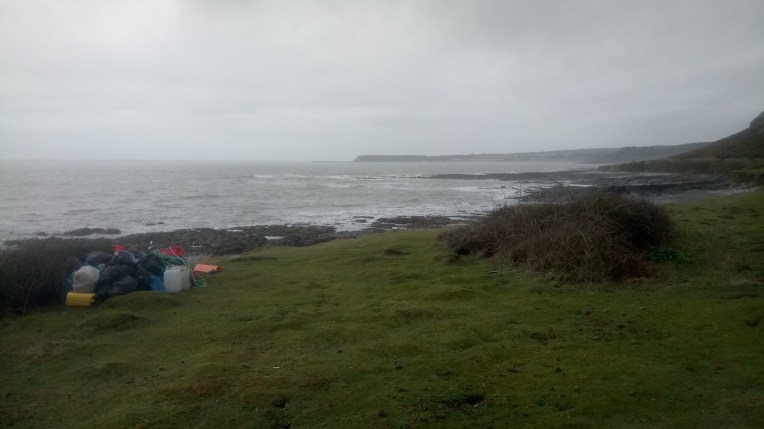
Someone has been collecting plastic rubbish – …. thank you whoever you are

Maybe this occupant has something to do with it?


Caught out in the open with no shelter and an enormous black cloud making ground on me, animal instincts showed me how to turn a gorse bush into a makeshift lair. I backed in and snuggled down while the offending cloud passed over without a single raindrop.
Intrepid.


Nearing end of day two, I turned off the Wales Coast Path at Pen Thurba Head heading for Pitton and rendezvous with Nanny and Vicky over the hill.
Although Rhossili is just next door the coast path does exactly that, the long way round, and takes me the scenic clifftop route via Mewslade Bay and Kitchen Corner with views over the Atlantic.


And then Worms Head comes into view and as I progress round the corner so too does the vast expanse of Rhossili Bay stretching up to Burry Holms


Arriving at Burry Holms after walking along the wet sand, although the formal route takes the clifftop for most of the journey. One last view looking back at Worm’s Head below.


One final view from the dunes of Rhossili Bay with a glimpse ahead of Broughton Bay and the final walk this trip back to Nanny and Vicky – the speck in the centre of the lower picture. I had managed to finish before the rain arrived. Home to the Mill.
And finally Nanny’s favourite photos of Worm’s Head and Rhossili Beach…


