
Seal of Approval
Continuing my letter to our six Grandchildren and anyone else foolhardy enough to follow my circumnavigation of England’s diminishing coastline made into a complete circuit by including Offa’s Dyke Path and Hadrian’s Wall Path.
Coincidentally, Episode 66 published today on the 50th Anniversary of England winning the World Cup at Wembley in 1966, Saturday, July 30th.
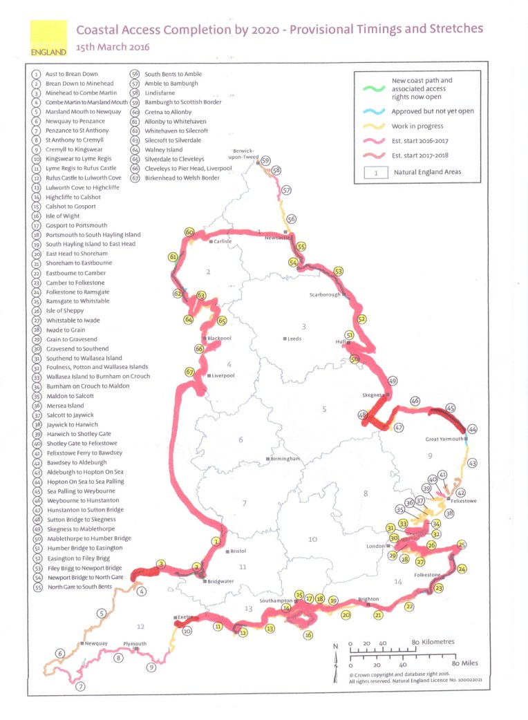
SPOT THE LATEST WALK ON STRETCH MAP (45) , BELOW
Dear Rosie,Lauren, Stan, Jake, Rowan and Maisie,
NUMBERS.
30th July 2016.
Fifty years since England won the World Cup, in 1966, at Wembley. I went with three schoolmates, Dave, Pip and Dick. We had tickets for all England’s matches, and we drove to Wembley in Nanny Tab’s Ford Anglia, or Dave’s Hillman Minx, and parked in the Wembley side streets outside Dick’s Uncle and Auntie’s house and walked to the stadium. After a cup of tea and much fussing from Auntie…. we won the cup and drove home! Simple?
Dave also sent some souvenirs – and a picture of Southend Boys when I was Rosie’s age; see if you can spot me and Dave?
David Lloyd, Trevor Rhodes, Greg Hatt and Nigel Chapman were from Southend High School as well. Old Southendians might spot them?


The accompanying write up said I scored a goal from Dave’s ‘gentle’ free kick and I thought I shinned another ,but the report gave it to someone else! The goal post broke when Greg Hatt ran into it; he was a big lad! Some Old Earls Hallians may remember Greg too. He and Trevor were later scouted by Arsenal, and David and his less well educated , bandy left foot, abandoned me on the left wing, and representative soccer, in favour of tennis and winning Junior Wimbledon, and had a string of Tennis, Fitness and Leisure Centres named after him…. whereas Dave, Nigel and I carried on educating the rest of our bodies, brains and minds in the sixth form
Those were the days my friend(s) I think…..
Last Monday we celebrated Great Aunt Janet’s 70th Birthday in Leicestershire, we couldn’t be much further from any coastline. Tuesday morning saw us hurtling Eastwards to resume my confrontation with the rolling Norfolk coast.
So Great Aunt Susan, Great Uncle John and now Great Aunt Janet have all exceeded the seventy limit – that only leaves me, and before I do it I must have walked round England…… derestricted.
Back to Walking Days 182 to 184, Tuesday to Thursday,26th to 28th July, 2016, accompanied by Nanny as Back up driver, and therefore not camping but this time staying at the Very Best Exotic Mount Lavinia B & B, in Sheringham. Highly recommended.


This latest journey, trying to follow the Norfolk Coast Path, which irritatingly , irregularly and irrationally, but normal for Norfolk, disappears or turns into The Paston Way. I restarted on that first day at Cley Windmill, after squeezing between two houses and heading due North along the River Glaven until meeting the North Sea. After which I turned sharp right and followed a fairly level easterly course mostly along the seashore, sometimes atop a fragile cliff edge, in places eroding at alarming pace. I passed through Salthouse Marshes to Kelling Hard and left O/S Explorer Map 251 for Map Number 252 and onto Weybourne and Sheringham. Eleven miles and enough for the day, we retired to the B & B, after an F & C supper.
The following day everything was expected to be in place for an epic record day’s hike; early start, prevailing wind at my back, level coastline; clearly defined route and regular back up from Nanny. We made the re-start at Sheringham at the same time as the first storm clouds and waited while they emptied themselves as we sheltered in the car.
Eventually the rain relented and I set a South East course for Happisburgh, via Cromer Pier, Overstrand, Mundesley, Bacton and Ostend. After nineteen miles, I relented on achieving a record day’s walk at Happisburgh when the route got somewhat irregular. Not surprisingly since the cliff edge and village are disappearing rapidly. Back to a Crab Salad at the superb No 1 Cromer Fish and Chippery.
The final Day’s walk got me off Map 252 and onto OL 40 Explorer Map named self importantly The Broads. I kept very near the coast all the way to Winterton on Sea, only losing the sea view when the sand dunes got too high to look over.
But what a surprise when I regained the shoreline……. look at the pictures! Very carefully….
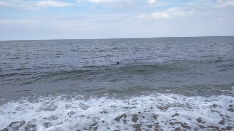
For all three days walking I managed a respectable 41 miles; making the Grand Total 2510 with an estimated 566 to the finish line. For most of the last day and over four miles I was escorted by many seals who appeared friendly, playful and communicative. But photo shy. They kept me company when no one else was around. Very uplifting.
Pictures


Leaving Cley Marshes Nature Reserve and following the Norfolk Coast Path along the shoreline with the tide going out.
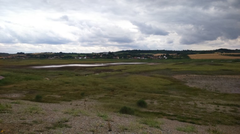
Salthouse and Salthouse Marshes three miles or so into the walk.


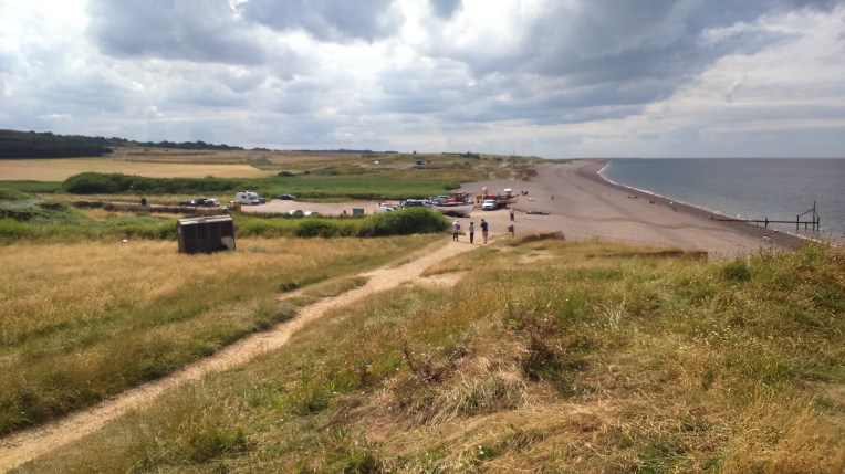
Rendezvous at Weybourne for refreshments while a bulldozer hauled a fishing boat from the tide and the fishermen unloaded their catch
Looking back, ascending the shallow cliffs in late afternoon with the tide receding and the sun struggling to break through the threatening cloud, and the fishermen’s catch ready for sale elswhere


The fragile nature of the cliffs approaching National Trust’s Sheringham Park , and the cornfields turn into a golf course


Top; Sheringham approaches and the I R B Station and slipway; and bottom, the railway station for North Norfolk Railway. This is the terminus for this service, but it is linked in line, across the Sheringham level crossing with the National Rail Service , heading for Cromer and beyond. I finished my walk here today.


Resuming the next day from Sheringham seafront, the glow from the brightly coloured fishing boats dimmed as the the clouds gathered , the rains came and the walk was delayed – despite full wet weather gear


Everything is a bit fragile, the erosion is relentless…


Early morning, Lifeguards keeping an eye on us even as the tide recedes and the weather is foul and very few people around.


Cromer Pier in the distance and when I got there a Chinook flew low overhead clinging to the coastline? I visited the Lifeboat House whilst on the pier.


Life inside the Lifeboathouse. Maureen in the Gift shop tried everything to find a souvenir mug with the local boat’s name on it, to add to my collection. Even visiting the mess room to see if there were a used version in the washing up! But no luck – it seems RNLI are no longer selling them.
So I purchased the Cromer teatowel instead!


Cromer Pier and RNLI Station from the outside


RNLI Museum at Cromer, a short walk from the pier. Volunteers Angela and Pat serving and very helpful. Views of boats inside and outside taken from the upper levels of the museum


Moving on, a mile along the beach looking back and forwards, tide incoming , careful not to be cut off when it reaches full strength and comes in with a bit of surge


Retreating inland to find the rain had left the clifftop very muddy, but I eventually followed the lane

Came across this heavily protected ball along the way – can’t identify it nor give away its position just in case I shouldn’t….


Back to the shoreline and the sun’s back and tide going out, heading for Happisburgh and then to Mount Lavinia. for B and B.
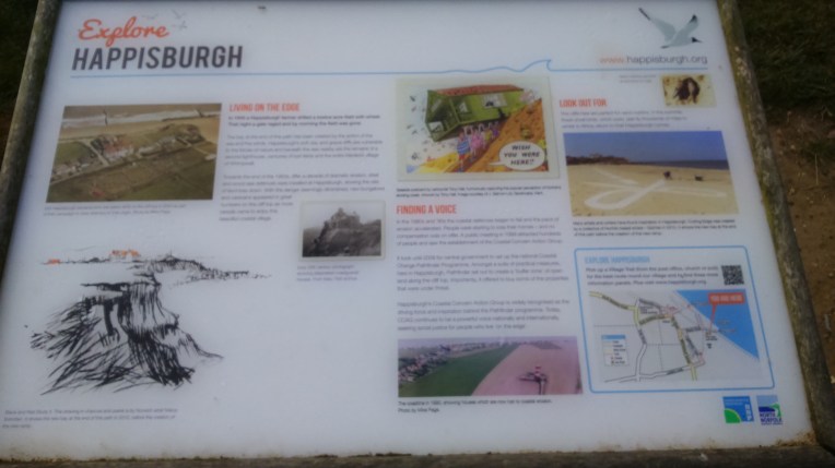
Sadly Happisburgh is rapidly disappearing into the sea, a victim of the constant erosion. The story is told above and it seems nothing can be done to significantly affect it.


Even the lighthouse is vulnerable – its predecessor has already disappeared. But happily just about here, one mile out of Happisburgh, I travelled my 2,500th mile of this walk; its downhill all the way now


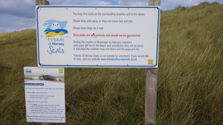
Approaching Sea Palling the vast open expanse of beach and flats are empty. The sea defences have recently been reinforced by eight artificial reefs formed off shore providing habitat for sea birds nesting on the sands. Security guards stand by should any wayward holiday maker intrude beyond the markers….


Boards explaining the flood defences and note the siren which goes off as a flood warning if the defences are breeched.

You are being watched……

….I can see you…
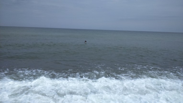
…at first there was only one seal….. but
a lone elderly swimmer got a bit of a surprise and as I progressed along the beach the seals left to go their own way and I went mine, or so I thought…….
 ……….but they returned and called to me when I had not immediately noticed them….
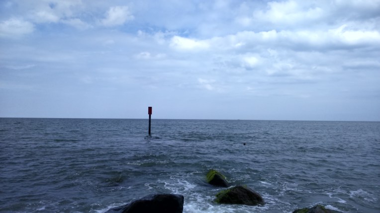 ……and soon there were more . Every time I moved to a new bay formed by the breakwaters they appeared; this time there were several but it was difficult to capture them surfacing altogether. They swam just below the surface and accompanied me to the end of the groynes. It was difficult to move on and leave them behind when they seemed to want to communicate. There were few other people around and they seemed to have adopted me as I walked along their beach while they swam alongside for several miles.

Instructions for operating the seals. They were good company and it was sad to say goodbye before I reached Winterton on Sea.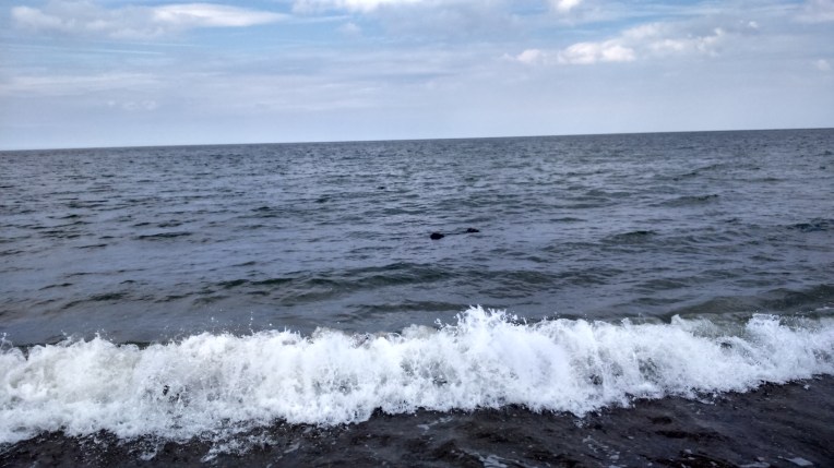
Byeeee….
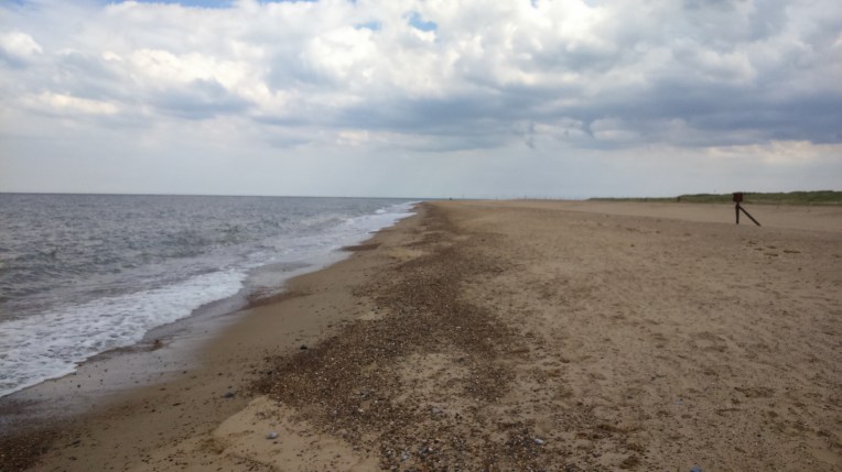
….and all gone; only the wide expanse of Winterton Dunes National Nature Reserve….

until Nanny came striding towards me, to see what had been keeping me.
We returned to Winterton on Sea Car Park having completed eleven miles today and made many new seal friends. This is the Volunteer Coastwatch tower. Starting place for the next walk…
