
Read on to discover my progress on walking round England’s Coastline, with added Offa’s Dyke and Hadrian’s Wall making a complete circuit
Here’s a map of where I’m at, the description is by way of a letter to our Grandchildren and photos highlight the notable points along the way

Dear Rosie, Lauren, Stan, Jake, Rowan and Maisie,
Before reporting the latest walk, let us wish Maisie all the best for her recovery from the injury to her poor bad leg. I hear she has been very brave and so far is a perfect patient. I cannot believe that she will not find an ingenious way to get around somehow and terrorise Jake with her plaster cast. Speedy recover Maise! And you’ll soon be joining me on the Coastal Walk. I think I could probably carry you……

Velator Quay Start point on the South West Coast Path this trip.
My circumnavigation of England on foot, following the South West Coast Path stretches, was approaching Barnstaple in Devon. The specific task this visit was to pick up the walk from my previous visit to Velator Quay near Braunton, and negotiate the Rivers Caen, Taw and Torridge, and traverse Barnstaple, Instow, Appledore and Westward Ho! finishing up 27 miles later at Horn’s Cross. The accumulated total walked at the end of this stretch, is now 2571 miles, leaving about 500 miles to go to the finish. I have achieved this on 190 non- consecutive days since November 2013. All this latest walk was recorded in pink highlighter on O/S Explorer Map139, making the sheet look like a bowl of spaghetti had been spilt over it.
I was based at Marshford Camp Site near Diddywell, Northam and I relied on buses 19, 21 and 319, and the Appledore/Instow ferry to position myself in between Coast Path walks.
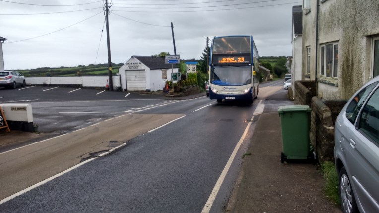
Stagecoach 319 delivered me to Horn’s Cross


The Instow/Appledore Ferry across the River Torridge – acceptable alternative for the Coast Path but only for an hour or so either side of high tide.


Signage of the South West Coastal Path was not the best and once I found my self the wrong side of a thick bramble, which extracted an armful of blood from thorn scratches, as toll for letting me through from a housing site which unfortunately seemed to have obliterated the footpath – or my interpretation of the map was in error….


Alongside the A361 and the River Taw, I followed the Coastal path inland heading for Barnstaple


The Taw Bridge, midspan, completed a few years ago, has simplified the route of the Coast Path into Barnstaple and I headed for The Railway Station and Bus Interchange for buses back to the Campsite, and Instow and Westward Ho!


The South West Coast Path is also the Tarka Trail from Barnstaple to Instow and follows an old railway line. All the paraphernalia of the railway is still in evidence including Fremington Station – except for traintracks. But the Yelland Power Station has gone, fed from coal from South Wales, that dried up on the demise of the Coalmines and the raison d’etre for the railway line in the eighties.


The ex-railway track feeds into Instow Harbour and the passenger Ferry carries the Tarka Trail across the River Torridge from Instow ……………..to Appledore Quay.


Housing in Appledore is tight and the lifeboat is permanently moored in the Harbour ready for a quick getaway. But the LifeBoat Station was closed , so no souvenirs – perhaps next time round?


The Taw/Torridge Estuary, Nature Reserve a Country Park and Golf course. Salt Marshes, Pebble Ridge and Sand Dunes. A dynamic and sustainable combination and a gentle, level stroll back to the coastline.


But sand dunes appear and the walk becomes more of an ordeal through the undulating soft dry sand and the wind picks up and moves the sand around.


So a different tactic involved walking the sands which were firm but wet, and consequently my walking boots filled up. Not the first time. The nights under canvas were damp and not surprisingly the tent attracted other creatures in search of shelter. One morning putting my boots on, I judged that one of my arch supports had shifted. Quick investigation revealed not an arch support but a distinctly shaken, slightly flattened, fat slug, who had made his/her home for the night in my boot.


Tally Ho! Lo and behold; and so Westward Ho! hoved into view – the wide bay; and the hotels and big church built into the hills giving them a wonderful panorama.
Originally Charles Kingsley’s novel Westward Ho! was written about Bideford nearby. It was a best seller and developers saw the advantage of a Hotel called Westward Ho! on the prominent part of the seafront; it multiplied and the settlement grew and took the same name; The only destination in England with an exclamation mark!

Panorama of WESTWARD HO! See my footprints.

Looking north, from Westward Ho! towards Braunton Burrows


I had the choice of walking the cliff edge which was quite difficult with the constant rise and fall , not to mention the instability. So I won’t mention it. Or the seashore which was littered with boulders all shapes and size, except those of a size convenient to walk on. There was the occasional shower of debris from the eroding cliff face, a stern reminder that the whole lot could come tumbling down in a moment. The National Trust’s Greencliff looked daunting from a distance and so I chose the seashore route; I was rewarded with steeply inclined and very eroded strata above, and then another likewise but also folded in on itself. I suspect a geologist’s fantasy. The tide was high and I kept an eye on the width of beach available to walk without getting cut off. There was no formal way off the beach when I decided my allotted time on the beach was up, so I chose the lowest cliff around and scrambled to the top. Several earlier footprints suggested others were of the same mind. Incidentally , now the school holidays are finished it is a relief that the congestion of walkers has subsided and I’ve got the walk back to myself. I’m not totally antisocial, but when the walk turns into follow-my-leader and dodge the traffic coming the other way, it’s not so inspiring. Although at times , when alone, you miss the opportunity of sharing something unexpected – the rock formations, or seals, with someone else. And doubts sometimes descend; someone kindly pointed out what if you turned your ankle? Or worse – ran out of food – or – ..I just don’t go there, but keep subscribing to the RNLI and the Air Ambulance.

Not too many people would see this as the route goes along the cliff top.

You can just see wooden steps ascending Greencliff behind the green debris; I chose the seashore since the climb was a steep 60 metre or so. But could I get round that bluff in the distance? Only one way to find out!


The S W Coast Path carries on but I turn inland at Peppercombe Castle heading for Horn’s Cross, where be public transport – or taxis for the three lads ahead of me.
This is where I’ll begin again next time out.
This stretch from Horn’s Cross to Westward Ho! was actually done South to North, but I have written it up as if it were vice versa, for reasons of continuity. I got caught out by being too descriptive of my avoiding Greencliff climb…I’ll walk backwards next time..
