


In reality Nant y Big is probably a bit previous. There is a planned trip next to the white pin currently becalmed at St Ismael near Haverfordwest
The gap between black and white pins (approximately Abersoch to St Ismael or Cardigan Bay plus St Brides Bay) is about 270 miles. To be completed by the end of July. 2019 ?
That’s nine adventures at 30 miles per trip.
Come on in.
The water’s getting warmer.
Dear Rosie Lauren, Stan, Jake, Rowan and Maisie,
Last weekend Nanny and I took a good look at the weather forecast and believed the impending high temperatures expected imminently for The Llyn Peninsular. Totally unplanned, we jumped into Car no 66* and arrived at Mount Pleasant to find clear blue skies and unseasonably high temperatures, which lasted for the whole of our two day visit. Even the prevailing wind was with us. Only the up inclines were against us , but for every up there was a down.
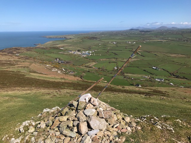
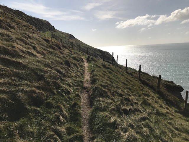
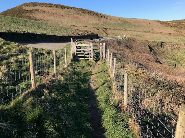
The plan was to complete The North Wales Coast Path from Bryn Mawr near Cyndyn Isaf to the top of Mynydd Mawr with classic views over Bardsey Island. Then follow the coast path for two days or until we got to overlook the St Tudwalds Islands, some 24 miles in total. Nanny joined in and made the walk complete
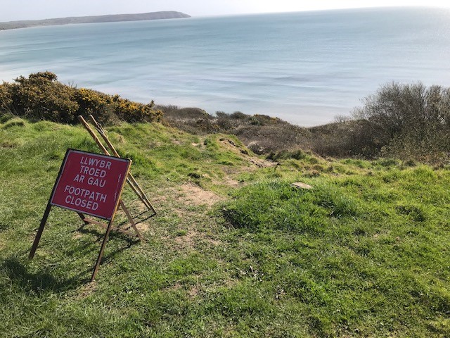
The tracks were damp but only slightly muddy; although I did forgo an inspection of National Trust’s Plas y Rhiw because of the state of my footwear. Nanny carried on her visit while I went in search of the mobile coast path last seen sliding down the hillside towards the Porth Neigwl or Hell’s Mouth,
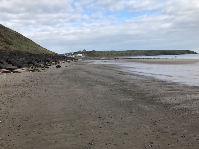
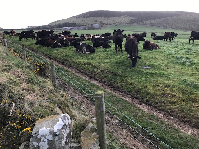
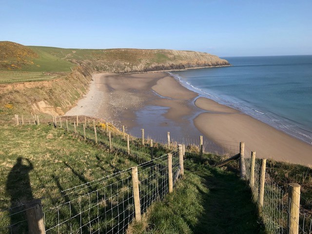
I eschewed ( good word but forsook would be better) the inland route of the Wales Coast Path because it was through farmland, and I already had had a contretemp with a field full of dairy cattle. Instead I scrambled down the collapsing cliff face just after high tide and followed the expanding beach, as the tide receded, to Mynydd Cilan at the other end of Hell’s Mouth. This was pure coastwalking – no way out except at the end, and maybe the sand did seem a little soft in places and the crumbly cliffs very unstable above me. Dodging the washed up jelly fish was another necessary past time.
I had arranged a rendezvous with Nanny and Car No 66 at Ysgbor Hen.- Correct Pronunciation courtesy of a very pleasant Welsh Lady who mistook me for Richard (?) in need of an Airb&b . Obviously all Coast Path Walkers look the same. Anyway she assured me my rendezvous with Nanny and Car no 66* was perfectly possible at Ysgbor Hen because that’s where she lived.
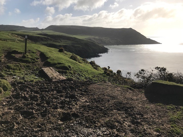
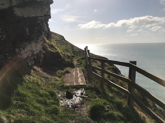
What she didn’t mention -or perhaps even know – was that the Wales Coast Path had decided to part company with the map and go nowhere near the lane to Ysgbor Hen, instead follow its own devices along the cliff edge. All new post and wire fencing and appropriate waymarkers convinced me they’d changed the route, which is all very well but I was now well beyond the rendezvous heading for the cliff edge at Trwyn yr Wylfa. A few frantic phone calls to halt me heading off into the sunset, and a bit of trespassing and fence climbing returned me to the previous route of the Wales Coast Path .
No contest for the next stage of the journey.
Home.
*You deserve an explanation about Car No 66*. Remember back up cars Vera and Vicky and now ZUD? Well we feel you are all much too old to be naming things anymore – except pets, teddy bears and Bobl. So when our car downsizing programme crashed, and we became in need of another second vehicle, as ZUD was accumulating mileage frantically, we happened on Car No 66*.
Never any doubt!
1966 was a glorious year in many ways, and it all fitted. Even down to the ugliness – difficult to say which of the two is the most gruesome, ZUD or Car No 66* AKA Nobby.
It’s obvious!
Of course you wouldn’t remember Nobby Stiles, bereft of teeth, dancing with the WORLD CUP IN 1966 but you’ll immediately recognise and understand why we chose this car… look at the number plate!
So here’s the trip in photos – but remember Eric Morcambe……he knew all the right notes but not necessarily in the right order. That’s my walk! Nanny always manages to find me – so far?
Must be very tempting…..


Monday Day two.
The walk so far had been along reasonably strong cliff tops or farmland inland since leaving Aberdaron. I was searching for a safe way down to the beach – but I eventually found an unsafe way after visiting Plas Y Rhiw. I denied myself entry to this 17th century house rescued by the Keating sisters because of the muddy state of my boots. But Nanny started to tour the property while I further muddied my boots clambering down the shifting cliff.


Walking Hell’s Mouth beach was a delicate balance; too near the face risked being sconned by falling debris; too far away you got wet! It is a very weak structure


Waterfalls by Muriau

The scenery is magnificent but I was expecting to meet a lane for my rendezvous with Nanny…
PICTURE OF THE WALK.
OR MAYBE THIS ONE?
