STILLOENGLAND/78 – 222 Days walking 2,878 miles of England’s Coastline. 28 miles this trip on the South West Coast Path from Brownsham Cliff to South Hole Farm in North Devon.

PRE-RAMBLE…..

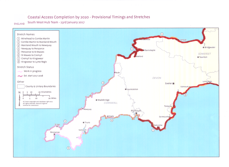
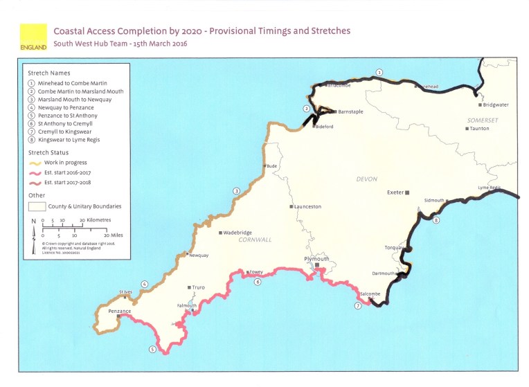
Natural England’s website gives details of the proposed England Coast Path due to be completed by 2020. Time is of the  essence   for me and I cannot wait till then.  I started my version about November 2013, after completing Offa’s Dyke Trail,  by extending the trail both Northwards and Southwards until now when I have very nearly circumnavigated the whole of England. I hesitate to guess how many more miles I need to walk before I’ve finished  (maybe 400) – it seems someone keeps adding bits, but I must  complete  before my 70th Birthday in November. I am aided and abetted by Nanny and Vera (RAV4), the versatile go anywhere back up  duo that rescue and shelter  me in times of need..

There is a growing conga of guest walkers who also join in  from time to time.

If you want to partake, in any way ,shape or form – get in touch – I’m running out of miles, time and energy. But there’s no doubting the determination  or enthusiasm…..


This blog is a series of letters to our grandchildren with clear instructions of how not to do it. And lashings of pictures.


Dear Rosie, Lauren, Stan, Jake, Rowan and Maisie,

It’s Stan’s 6th Birthday on Monday, HAPPY BIRTHDAY Stan!

I happen to know he is going to get a creepy, crawly present from Nanny and Bobl, something that likes dirt and mud and is noisy and smelly!

I expect Rowan will like it too.

Can you guess?

No! Not another Flash?

You’ll have to read Episode 79 to find out! And  Jake’s birthday clue  will be then  unveiled too!

Rosie and Lauren are with us for half term, and hopefully, with Stan and Rowan, they can choreograph the Conga for the Finale of the Walk, on Southend Pier. I’m a bit worried about crowd loading.  And only nine months to go…..and the Jive lessons have nose dived.

And soon we’ll see  Maisie and Jake, when Jake turns five! Any one for tennis?


Let’s see how the walk is going;


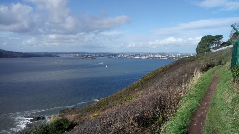
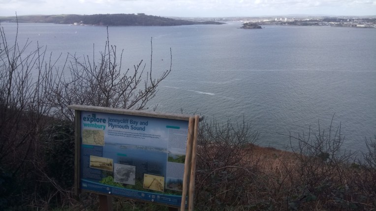
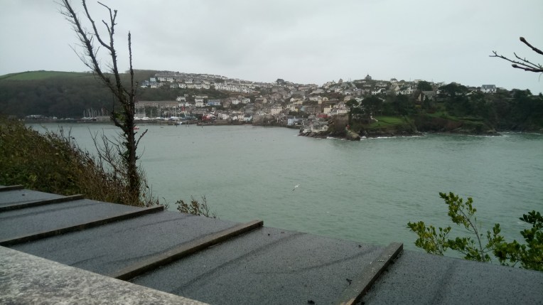
The race to Land’s End continues with The Northern Crimson Worm adding another  direct 14 miles and rapidly approaching the Cornish Border. Meanwhile, although already in Cornwall, the Southern Crimson Worm remains  hooked up and disorientated around Fowey, with a big chunk still missing from Looe to Plymouth.  

South Hole Farm.png

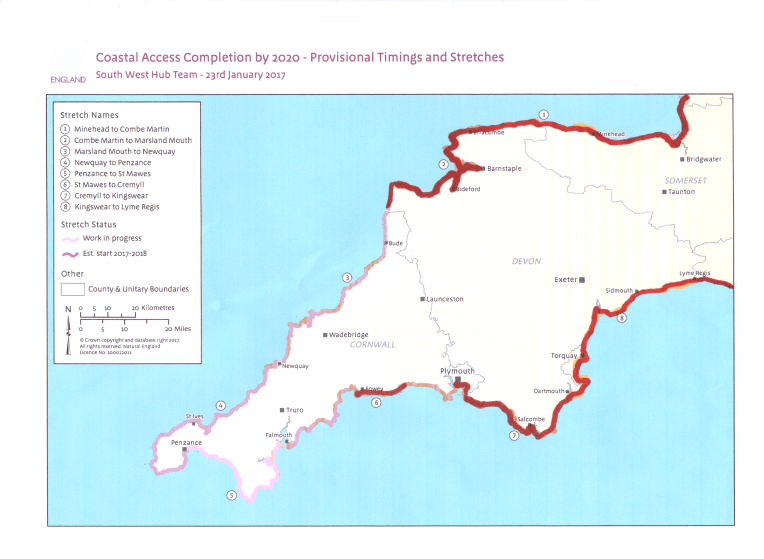
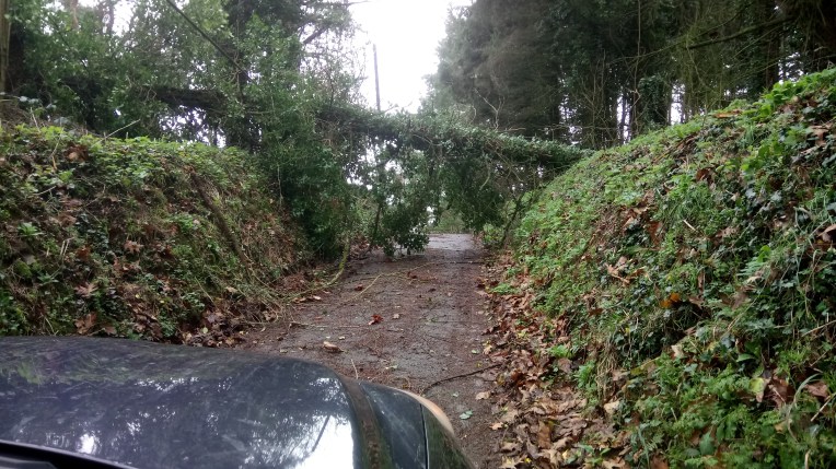
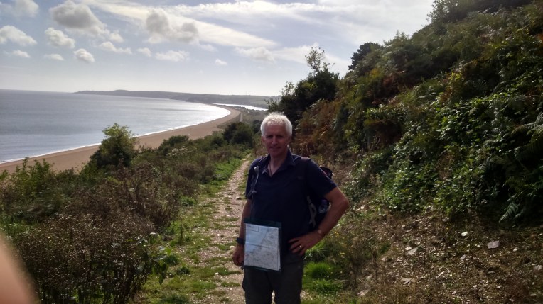
This last trip, re-starting from Brownsham Cliff, on the Northern South West Coast Path, took me round Hartland Point and its lighthouse, mainly on eroding cliff edges, past Hartland Quay finishing just inside the county boundary at South Hole Farm. Although I walked 28 miles only half of it was direct progress. Because no public transport was available, nor luxury  back up, I had to walk there and back in a series of circuitous walks – if I was to keep in contact with Vera.


dsc_0766

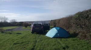
I returned each night to the now familiar Hartland Camp Site, which was much drier than my last visit. I use the technological masterpiece of the several day weather forecast offered by each Sunday’s Country File to plan my trips; it has rarely let me down but does suffer occasionally from Post Fish Syndrome, which allows for the worst to happen, just in case!  It rarely does; I filter the information and make my own judgement – but I never go out without complete change of wet weather gear. I also won’t start in the rain; and never go out if mist or poor visibility threatens. Nor snow.  Furthermore, still with several options where to walk , I can often chose according to the prevailing wind  An anecdote later illustrates very simply how disasters  are usually the result of several misjudgements coinciding. So I try to eliminate the obvious – but not always.

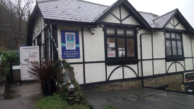
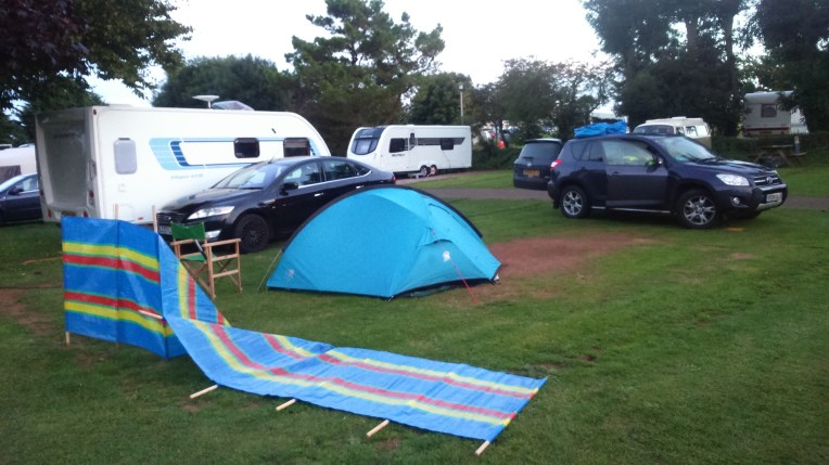
That this winter , so far has been fantastically mild  has allowed me to accumulate many more miles than I should and use the tent much more comfortably than I could have wished. The logistics are much easier being self sufficient; I can get going earlier, and much more easily. Camping Barns, Hostels, Pods, Guest Houses, B & B, Hotels are all over rated and in order of being  too accommodating. Noticeably missing from the overnight sleeping hierarchy   is Henry’s ‘Otel; unfortunately it only exists in Fowey.

Any prolonged period of bad weather would put my schedule in jeopardy, and I am physically rapidly slowing down, particularly on the SW Coast Path ascents. Chatting to one of the National Trust Rangers about my project and my self criticism that I left the SWC Path too late in the priority of walks, he  considerately offered that next time I should do it first.

He was joking.

– I think?

The other significant factor threatening my completion date, is the additional surplus miles required to accommodate circular walks. Without public transport and lacking back up, I effectively walk the S W C P twice – out and back . A cursory glance at accessibility of the path heading for Land’s End  makes me think  I’ll be walking most of the rest of the path twice.

I can only apologise now for the pictures that follow; I have culled them ; but the rest of this document is  full of images I could not bear to part with. The scenery is simply incredible.

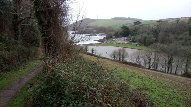
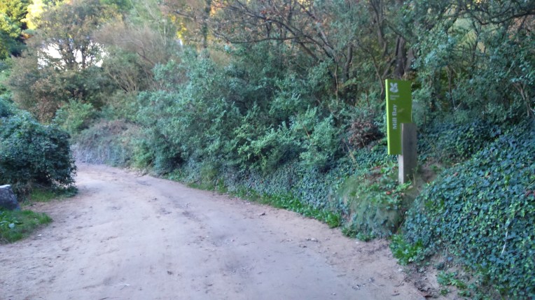
The sequence of pictures follows my journey from North to South, starting at Brownsham NT Car Park and ending at South Hole Farm

Getting started; still sunny in Brownsham N T Car Park; but very muddy; note the sticks; plenty of stiles and the slopes aren’t exaggerated. I like the grid references.

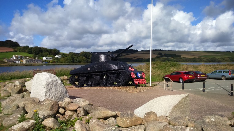
A circular walk round National Trust’s  Beckland  Woods on  the first day took me past the memorial to the crew of a Wellington Bomber crashing at sea, nearby in April 1943.


The next day started inauspiciously.

dsc_0800

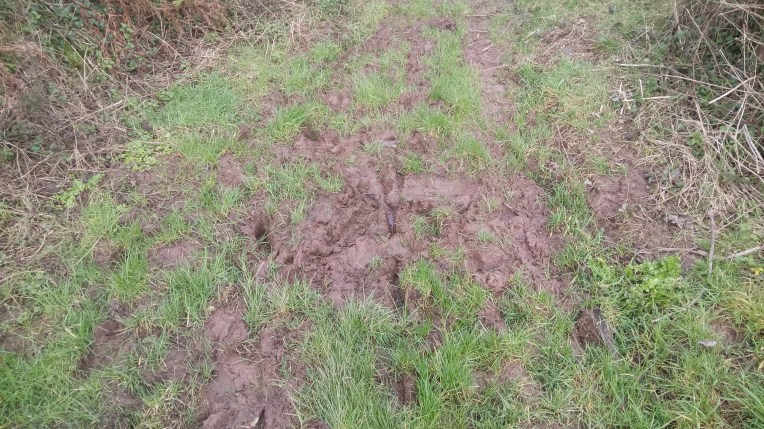
This is no ordinary patch of mud – it is part of a regularly used bridle path which I chose to walk as an alternative to the SWCP; wearing Wellies as a conscious decision to combat the mud; and I unintentionally left my sticks with Vera. Three very poor actions.

As I strode through the mud, I went in as deep as a horse’s hock, enough to suck the wellie off my right foot. My sticks would have forewarned me as to softness and depth. No matter, just keep balance and re-insert in empty wellie. Mud suction not so accommodating and stocking foot now immersed as I struggled in vain to avoid sock and mud meeting, several other attempts just encouraged wellies to migrate and submerge, until it was inevitable  I was going to lose my balance as the booted leg sunk deeper. I was going down… but I had time to consider which elevation was going to get plastered.  I chose a sideways fall, but the stuck boot thought otherwise. This isn’t going to end well. Even in slow motion….

Eventually after writhing like a mud wrestler on the ground I reinserted a very wet, muddy foot in the vacant boot . It was also cold..but strangely comfortable! I could feel the weight of mud on the rest of my clothes. Now’s the time to be decisive, so how come I chose to pretend nothing happened and walk it off. And hope I met no one else.


Back under way, albeit a little damp and very muddy; NT Car Park at Exmansworthy; sun and threatening cloud but no rain to wash me down; another circular walk back to Vera via  East Titchberry Cliff outwards on the SWCP and a nervous return on the very soft bridle path, but no more falls. Fortunately there was no one around to see a complete change of gear in the empty car park.


dsc_0801

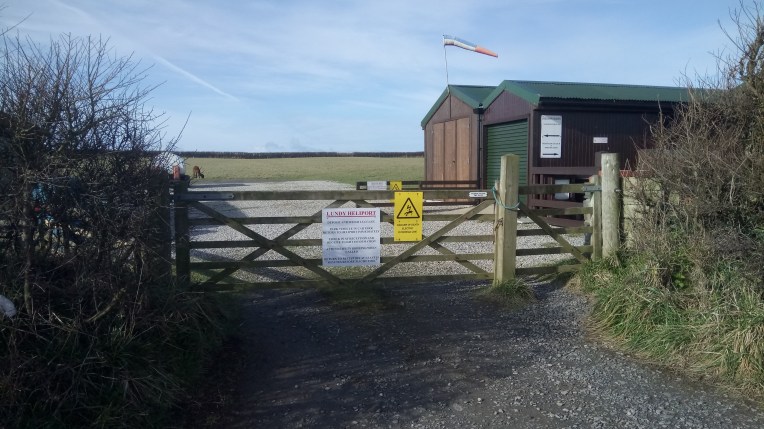
Hartland  International Heliport…..for Lundy Island


DSC_0811.JPG

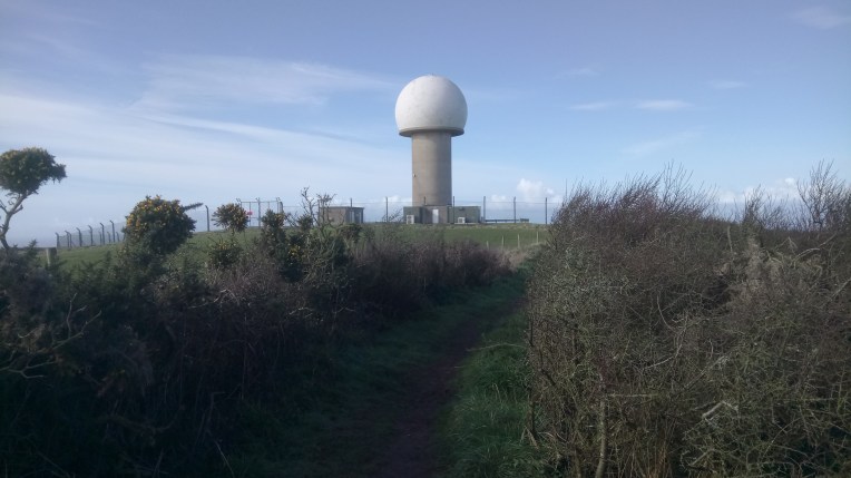
Radar Station at West Titchbury.


dsc_0814

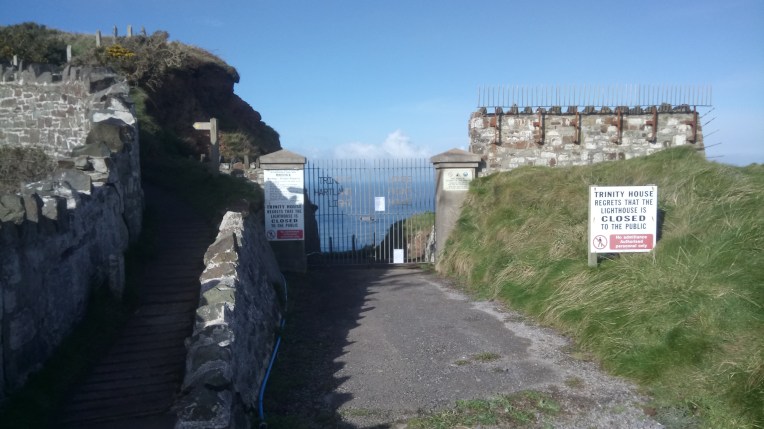
Access to the lighthouse at Hartland Point denied……


dsc_0816

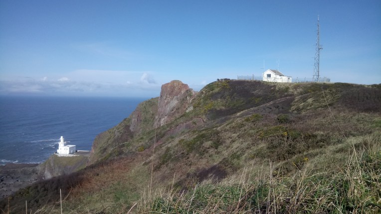
…..so turning the corner and looking back from Blagdon Cliff, there’s Hartland Point Lighthouse.


dsc_0818

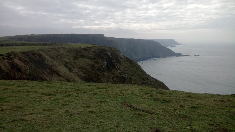
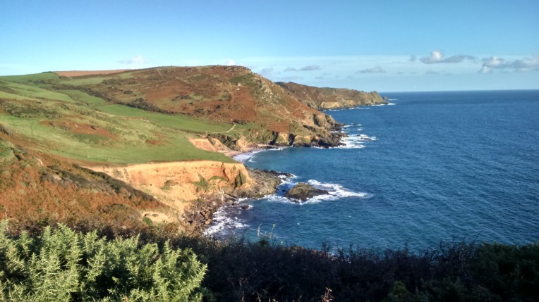
Upright Cliff – The rock formations take on a distinctive character as I head South


dsc_0826

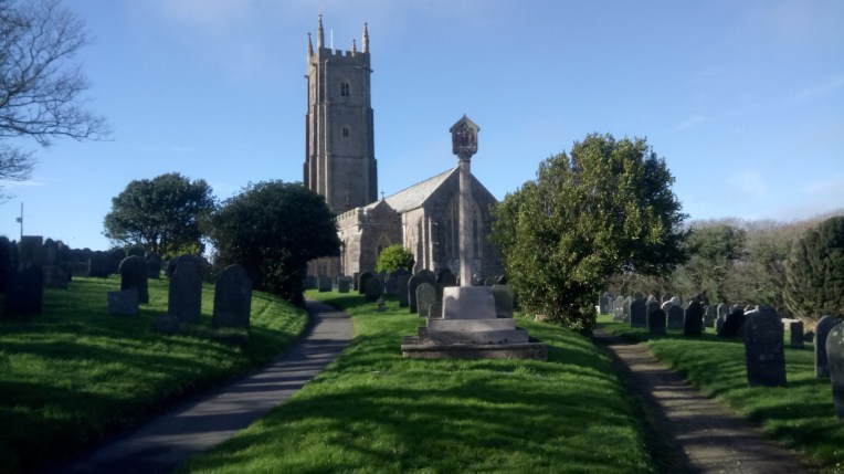
St Nectans Church, Stoke. The Tower can be seen for miles .


dsc_0828


dsc_0831

It’s steeper than you think…


dsc_0834


dsc_0838

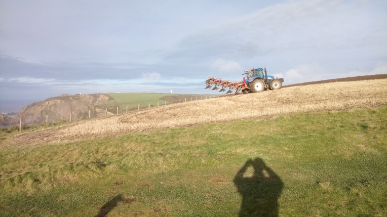
This tractor ploughed within a few feet of the fence, which marked the cliff edge…..


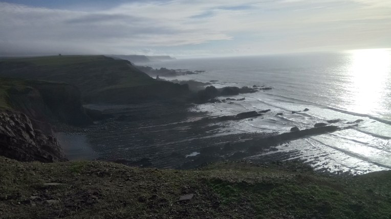
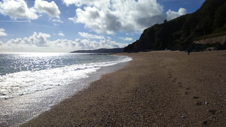
The Cliff edge seemed slightly suspect, so I found access to the beach; the tide was out so it was reasonably safe . Apart from bits of falling cliff….


The journey over the pebbles and boulders wasn’t comfortable and fortunately I found an escape – steep concreted steps emerging near  Black pool Mill.


Sunset on the second day near Hartland Quay


Hartland Quay Hotel and carpark – finish of day two and start of day three, 222


Every so often something extra breathtaking happens….

Like a finger post with gloves and the path disappearing over the edge.


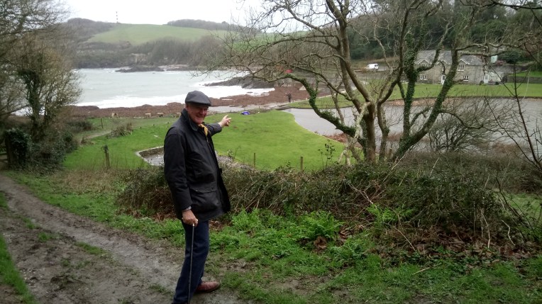
South Hole, looking North – just been there..


dsc_0878.South Hole, looking South – that’s where I’m heading


dsc_0881

South Hole Farm  – finish for now


STILLOENGLAND/77 – 219 DAYS – 3,049 MILES SO FAR, WALKING THE SOUTH WEST COAST PATH, PART OF THE PROPOSED ENGLISH COAST PATH, FROM MOTHECOMBE TO PLYMOUTH PLUS LOOE TO CHARLESTOWN – 41 MILES THIS TRIP.

DISCLAIMER – This blog is aimed at intellects from two to twelve years old, but any adult may attempt to understand if accompanied by a child.

I have  walked over three thousand miles around the perimeter of England since  I  retired, probably in November 2013. Although some may say I retired in 1959, the year I left Earls Hall Junior School. The map below shows how much there is to complete on the South West Coast Path.  Specifically, from near Hartland Point on the Northern Coast  to Fowey on the Southern Coast . Elsewhere,there are several loose ends ie Plymouth to Looe; Clacton to Orfordness,  Newcastle to Berwick, and the odd River crossing, to colour crimson before I can claim a complete circumnavigation. I wasn’t trying to cut corners; those unexplored coasts got neglected because of the ravages of time, tide,  weather, erosion, poor planning or just getting lost. Fear not, I will return to them and all should be complete by my 70th Birthday in  November, 2017 when the tour finishes at the end of Southend pier.

Maybe see you there?

The map below, by courtesy of English Nature, shows my progress in the South West …. 

devon-coast-scarlet-worm-9-feb-2017Walking 41 miles from Mothecombe  to Charlestown on this last visit to the  S W Coast Path has  made the Southern Crimson Worm favourite to win the race to Land’s End. The Northern Worm has slithered to a stop approaching  Hartland Point. But The South is in danger of disqualification by leapfrogging the stretch from  Plymouth to Looe – frogs like to eat worms!

Let me explain….

Are you sitting comfortably?

Dear Rosie, Lauren, Stanley, Jake , Rowan and Maisie,

You all have your moments and provide unlimited entertainment for grown ups, but look what happens when oldies get together and venture outdoors in stupid weather and slippery mud, when they should know better and be tucked up inside with their Bovril, Horlicks, and Werthers.

This is the tale within a tale of  a Mill Owner, the Millar’s Wife, a Retired Magistrate and an Entrepreneurial Bookseller, all aboard the Stagecoach Vera, wetting themselves  on the South West Coast Path looking for an alternative to Brexit. Instead they found the local inhabitants light years ahead already wishing to cast Cornwall adrift and claim a Unilateral Declaration of Independence.

Bobl, Nanny, Elizabeth  and Henry,with a combined age far higher than Rowan can count met up at La Palais d’Henri near Fowey. I have previously extolled the virtues of this excellent staging post, and put it on a pedestal up to which  all other campsites should aspire.{ Note never end in a preposition no matter how clumsy the grammar.. why not?.}

bob-and-henry

The Street Bookseller trying to offload D H Lawrence Classics to the Millar, who can’t read, nor write judging by this account………

After these few days camping indoors, [my tent can actually be erected on one of the beds] the pedestal must go higher, I can only say that Henry’s ‘ospitality exceeded all known civilised bounds, even when taunted by Elizabeth into realising he’d missed certain rites of passage in his childhood. This was evened up by said Elizabeth throwing a hissy-fit (not rhyming slang) when Henry challenged the collective navigation. This was all sorted out with lashings of cold coffee, Cornish pasties and cakes, ferried in by Nanny in VERA (aka RAV4)  in back up mode.

henry-and-elizabeth

….Now, he’s up before the beak for walking three miles less than scheduled. Transportation the only sentence available.

And The Beak wrote a ‘pome’ to celebrate. The rest of the World may not be ready for this, but here goes.

All along the coastal path

Through the muddy squall

Bobl led his old school friends,

Stout boots, poles and all.

Maps out, decisions made,

Telephones a quiver,

Pork pies out of sight

until we made the river.

Nanny should get the prize

for finding us together,

Hungry, tired and footsore,

but enjoying the fine weather.

It’s always fun to walk with Bobl,

Can’t wait to go again……

Henry Provided comfy beds,

And magicked off the rain.

Who knows what the future is?

Will Bobl finish on time?

Will we be in Cornwall?

Or Newcastle under Lyme?

Wherever it is,

It’s going to be great,

And I am sure that we will be

Heads down, poles up, with lots to see.

Copyright Elizabeth 2017.

We went through the whole gamut of emotions, with hysteria dominating, and I have ,without doubt, prior to the walk completing, already nominated these last five days as the funniest yet. Also the wettist and slipperiest.

Because of the leapfrogging, my natural propensity for letting anyone else navigate and being shrouded in low visibility, I rarely knew where we were and the photos that follow are not  in any particular order. Nevertheless I have captioned some without necessarily being correct, but my future publishers would probably require that. No one ever checks?

So without further ado lets cut to the pictures- some of which are still damp. Some days I didn’t even get the camera out, it was so wet, but generally the scenery was stunning it didn’t matter where you focussed, it was bound to be an exceptional exposure. Talking of exposure, on my final descent into Looe I entered a low front composed of hail and sleet  of the coldest variety and was   freeze dried before I could don my wet weather gear. Then it cleared to reveal the bluest of blue sky, I have ever seen in Britain. Almost Brisbanesque.

dsc_0611

The journey to Mothecombe Coastguard Cottages and ferry slipway, where the walk was to resume, was rudely interrupted by a fallen tree across the road – giving us a flavour of the weather to come. So  a premature start for me and a reversal for Nanny.

Eventually I arrived where I left off last – the previous freezing wading episode across the River Erme. This time wading is not necessary and I can begin the walk along the S W Coast Path reasonably dry – but not for long.

Heading towards Eastern Lodge, Stoke Point and looking back at where I’ve been

The weather is changing, it’s getting darker and later and I missed the rendezvous with Nanny and Vera.  Last known point Stoke Point. No more pictures – weather and light problems.

Final pictures of the day – Probably Warren Cottage – radio silence. I had walked too far – well beyond Vera  rendezvous and no access roads  .Eventually I reached Gapmouth Rock and turned back to Worswell Barton Farm and found my favourite back up driver – Nanny at the edge of civilisation. That’s it for the day. No crossing the River Yealm tonight.

Next day – Day two of the trip  continuing the walk from River Yealm heading for Plymouth. Note Henry’s bench – albeit upside down. And Great Mew Stone all at sea.

The River Yealm still has to be crossed – perhaps at Easter when the ferry starts again….

Intrepid bathers brave the cold water – on the whole of my walk I haven’t gone swimming – although I have waded several Rivers in winter.

dsc_0667

Plymouth Sound

dsc_0672

Jennycliff Bay – Plymouth Sound

The ferry from Mount Batten to Plymouth Marina.

dsc_0678

Plaque to Tollpuddle Martyrs – just as evidence I arrived at Plymouth too.

And now we leap frog ahead to Polperro, Polruan, Fowey and Looe, not necessarily in the right order, but as they came out of the camera. We were now under new management as Henry and Elizabeth  joined the walk as guests. I relinquished navigational responsibilities-

– herewith the journey in pictures….

Chez Henry; with  Nanny and Elizabeth – below- the view from our suite…

Polperro to Polruan walked by Bob, Henry and Elizabeth with Marilyn and Vera as Back-up

The intrepid walkers…..

What can you say – the views are stunning, but the climbs were steep too! Heading for Polruan.

Six and a half miles from Polperro – arrival in Polruan, waiting for back-up and taking the ferry across the River to Fowey

And so to Sunset.

And the next day, Henry and Bobl set off from  Fowey to Polkerris and to Charlestown.

dsc_0718

Via Polridmouth and Gribben Headdsc_0719dsc_0721

Henry has seen the back-up crew – the cavalry has arrived with Cornish pasties and coffee, but first there’s a wind swept weir to navigate – no matter we were already soaked through.

Gribben Tower on Gribben Head  towards Polkerris and …..

dsc_0729

….Polkerris Village Hall. Where our back up crew rescued Henry  and I carried on to  Charlestown and established a forward post in the Pier House Hotel awaiting relief.

So sorry P H H for leaving puddles around your lounge – pure rainwater I can assure you. In fact this would be the only evidence of my reaching Charlestown, apart from the empty pint glass of Fullers London Pride at reasonable price – I was so wet they thought I  was a local – but no photos  – the cameraman had the shakes and the camera was drowned. Rescue arrived just in time.

And so on the final day, Bobl and Nanny left Henry, very reluctantly, hoping to gain a few extra miles on the South West Coast Path before heading home to Shropshire.

Bye bye Henry…

….and bye bye Polperro – I’m heading for Looe through the muddy harbour and hoping to catch up on my fishing boat picture haul, some of which young Mark might fancy as watercolour material….

And finally bye bye fishing boat leaving Looe Harbour as I arrive to intercept Marilyn and Vera, in the Harbour carpark complete with Cornish Pasties and lashings of hot chocolate.

Home now Vera.

STILLOENGLAND/76 – 214 DAYS WALKING ENGLAND’S COASTLINE – PASSED 2,800 MILES AT CLOVELLY ON THE S W COAST PATH. THIS TRIP 18 MILES FROM BUCK’S CROSS TO BROWNSHAM CLIFF IN 3 WET DAYS

tDevon Coast Scarlet worm.png

The Crimson Worms have reached Mouthmill Beach to the North and Mothecombe to the South. Which me will get to Land’s End first?


+Clovelly; the harbour, the  steep cobbled lanes and the sledges used as transport up and down and the RNLI slipway.

Dear Rosie, Lauren, Stan, Jake, Rowan and Maisie,

In the last week we have managed to see all of you and get a pre-taste of Lauren’s birthday cake and a foretaste of her being a ten-ager. Happy Birthday Lauren! Well done Rosie in your tests – all you have to do now is whatever you want! Stan has been climbing higher mountains and Rowan has been counting to enormous numbers and still going. We checked out the  Peak District and find Jake and Maisie well recovered from their visit to your NZ Cousins.

Are you sitting comfortably?.

Then I’ll begin the very wet story of me passing the 3,000th mile on my walk round  England’s coastline, at Clovelly on the Northern side of the South West Coast  Path. I was last here in September just gone, when I finished at Horn’s Cross on the A39. This visit I left my very wet campsite at Hartland Cross and after parking up at Horn’s Cross squelched my way four miles to Buck’s Cross  and returned to the car via bus route 319. And a complete change of clothing. The next day was similar only advancing another six miles to Clovelly. It was just here that the 3,000th mile of my complete journey was about to tick over; so I paid the £7 to enter the private village and celebrated with a large cup of free trade hot chocolate, my mistake, it wasn’t free – far from it – it was all but 1p short of £3. I spent a slippery two miles slithering up and down the tortuous cobbles and visiting Clovelly  Harbour. I found the extremely steep back door exit to the harbour and laboured my way uphill hoping a passing motorist would take pity. I was obviously too wet.

Eventually, in need of oxygen, back at the heights of the Visitor Centre car park , I bumped into Tina,  patronising  the rubbish recycling centre and I  enquired about buses  back to my car.  Better than offer directions she offered me a lift in her van, despite me leaving pools of water wherever I sat down.   She kindly offloaded me at Buck’s Cross Post Office  where hot drinks were half the price of Clovelly and the sticky buns were too temptatious.

The Post mistress was clearly antipodean; having arrived here for six months some 40 years ago. I paid the ultimate insult by accusing her of being Australian. It is the worst thing you can say to A KIWI!   It was compounded by me admitting my Naturalised Kiwi Status, Dreadfully sorry Dale!  Thank you for letting me rest awhile and sort of dry off. But I did frequent  the PO Stores several times after that.. We must look after our remote Post Offices.


Having amassed only 12 miles in two days I determined to add as many miles as possible before heading back home on the third day. Everything was soggy – I was on my last set of waterproofs and the tent drying out in Vera was making everything else damp.

Fortunately the last day was clearing and eventually the sun shone and a drying wind helped me reach Brownsham Cliff and Mouthmill  Beach. Some very steep climbs and descents and slippery too. But the clear views at last repaid all the damp effort so far expended. But I was totally drained  And I now had to retrace my footsteps. Time to go back to Vera. No transport – no Tina  – no donkeys. And the hills had got very much steeper on the way back.  Back at the car. Sneak into the visitor centre and use the toilets and head for home. Can’t afford the free trade coffee. And I noticed I was very, very muddy!


You’ll notice a lack of photos – it was too wet – I was too wet; too layered up to go delving for the camera at every/any photo opportunity. Maybe I’ll be back next time when the sun’s shining.

Tina’s van, my transport  from Clovelly to the Post Office at Buck’s Mill supervised by  Dale. Maybe it’ll stay dry enough to get mugshots of Dale and Tina next time!


A bientot


Photo gallery

Leaving Clovelly I was mugged by two ruffians, who ran off when I said I had no food.

Approaching my limits -more  foul weather was forecast so I cut short the journey at the next stile.  Signposted Windbury Point 1.25 miles/Mouthmill 0 miles.

My start point next time out.

Brownsham Cliff 


l

STILLOENGLAND/75 – 2,791 MILES and 211 DAYS WALKING ROUND ENGLAND’S COAST. THIS VISIT 24 MILES ALONG THE S W COAST PATH IN SOUTH DEVON CROSSING THE RIVER AVON, TO BURGH ISLAND AND THE RIVER ERME .

dsc_0566

So far – so good? The trail of blood signifies my progress round England – so far. So good reading  .ONLY Newcastle to Berwick, Clacton to Orford Ness  and half the S W Coast Path to finish

Wales next – but no likelihood of Scotland ever joining in – Nicola wouldn’t agree. Just look at those mountains!


PREFACE.

Three rites of passage explained:

1/. How to cross the River Avon……

First, find the right river, with all the inlets it is easy to cross Stiddicombe Creek instead…Then, bump into a native who will point out the local café, where Linda is serving and meet Pete who says he might be able to help with the river crossing; visit Pete’s Nest where he keeps his oars; disguise the nervousness you are now feeling; now visit the Harbourmaster’s Office for permission to depart? No passports needed. Forget to take photos during the voyage and only manage a picture of Pete and Dinghy as he shouts onward encouragement after he has deposited you on the beach under enemy fire. Negotiate the ‘shoot’, and their  beaters and retrievers whilst  heading  back to Aveton Gifford and the safety of parked RAV4, Vera.


2/. How to cross to Burgh Island……….

Check tide times; crossing from Bigbury on Sea carpark is easy at low tide – just follow the exposed stretch of causeway. At high tide a unique, big wheeled contraption drives along the causeway with the passengers platform safely above the waves .


3/. How NOT to Cross the River Erme

dsc_0532

No one mentioned how cold the water was,  otherwise ten out of ten for affording crossing advice.


Dear Rosie, Lauren, Stan, Jake, Rowan and Maisie,

If it seems like last year that I walked anywhere, then you’re right. I’ve spent a month not going out much, rehabilitating after a few re-arranged discs -( or is it disks?) played havoc with my equanimity? In my back and my laptop.

My back took a number one direct hit whilst attempting to make  the garden backbreak-free.  I  was installing   raised flower and vegetable beds, and with the first swing of the pick, my back seized up.

Then, whilst recuperating, my laptop ditto’d and went offline with a slipped hard disk occasioned by me tripping over its cable during my lowered state of mobility. Nanny says these things happen in threes, whereupon her laptop promptly withdrew any facilities for typing ‘k’, and my ‘walk’ was reduced to a ‘wal’. She’s right, you ‘now….

So nothing to write about and no blog to write it in, and the back-up laptop a few consonants short of a full  ‘eyboard’ – till now.

I have been on a proving walk to test my resolve and ability to complete the epic walk round England. Except, you’ll have to be patient while I learn all the new ropes of a totally different laptop  operating system. They sneaked  Windows 10 onto me, when they replaced the hard drive. Fortunately my spine was not similarly reconfigured. I just haven’t got the backbone to manipulate that. It’s a long story, but telling you six descendants  might be useful to warn you to look after your backs.

A long time ago, in faraway New Zealand, Maisie and Jake’s paternal homeland, a Consultant told me I was abnormal, inflexible and not built as other people and it was Nanny Tab’s fault passing on a congenital aberration in the  spine. As with all things medical, I closed my ears and said “I’m not listening etc. etc” and promptly fainted , but I did occasionally resort to the metal reinforced Corset prescribed and built for me, until I outgrew it. I did live happily everafter and all is well generally until I do something unnecessary – like swing a pick – or get beaten up by grandkids.  So if you’ve get any back trouble in your travels, just check out your spinal configuration before you let any one manipulate it. Tell uncles Donald and Andy and Aunty Ann, too.

Meanwhile, you six descendants have recently returned to school/nursery following a very busy Christmas and New Year  Schedule. To wit; Stanley; achieved great heights ascending Pen Y Fan in the Brecon Beacons; Rowan has been recruited to look after Nanny on Monday whilst Auntie Sarah is inducted into school; Jake and Maisie travelled downunder to Auckland to meet their Kiwi cousins, James, Scarlett, Connor, Loughlin, Ryan and Liam and Great Grandmother Omi (Margot); Lauren is the next upcoming birthday on Saturday (preview  Friday); and Rosie is preparing for her School entrance  tests. Good luck everyone in the New Year. Can’t wait for Maisie and Jake’s explanation of NZ.

My first 2017 walk was therefore also a trial, to see if I could carry on and finish the last few hundred miles around England’s coastline. I was quite concerned I might not be able to hobble anywhere, let alone carry a rucksack and overnight camping.

As a proper workout I chose the next Stretch of The S W Coast Path from Bigbury on Sea to the River Erme in South Devon. But first of all, I had to cross the River Avon to link up with my previous visit last October. The scenery was stunning and the weather outrageously, permanently springlike, in the depths of winter. All three days, the sun shone from a cloudless sky, keeping the temperature at a comfortable level for walking. All three nights , as soon as the  sun had set, were extremely cold, and although the stars were bright and skies clear, the wind AND extremely  low temperature made sure I stayed indoors, with no hope of moonlight walking.

I was staying near Ivybridge, as the lone occupant at Harford Bunkhouse and Camping Site, very well appointed and convenient but empty; where I chose the centrally heated  Bunk in favour of the frozen tent. Well you would, wouldn’t you, when temperatures  are below zero and falling.

Below – me arriving at Harford Bunkhouse and departing . The smoke is from the wood burning furnace, powering the welcoming central heating. You’ll appreciate why I chose the bunk and not the tent…….well – it is on the edge of Dartmoor. And midwinter. I may be stupid -but not that stupid…….


Here begins the first walk of the New Year.

Crossing the River Avon was a project on its own; the ferries had ceased, not available till Spring and there were no instructions how to ford, other than the blooming obvious ,to wait until the tide was out and the water was 20 degrees warmer.

I parked up at Aveton Gifford and found the Avon Estuary Walk , keeping reasonably in sight of the River Avon. It was not particularly level which is the only criticism I could have of the total walk,

Eventually, near the coast path, I found the very pleasant  Bantham Village Stores and Café occupied by Linda, serveuse,  and Pete, customer and Pete’s dog who was very interested in my scrumptious  Hot Homemade  Pasty.  Pete quickly established my need for transport across the river, and marvellously volunteered to solve the problem in his rowboat.

And that’s how I came to be rowed across the River, discussing Pete’s and my common topic of New Zealand Rugby; Sherlock had clocked Pete’s All Black Beanie hat. He even took time to advise me the best route through the Shoot, heavily underway in the vicinity of my destination. I advanced at speed not wishing to be mistaken for a Peasant…

I continued my journey back to the car at Aveton Gifford and serendipity dictated the tide was sufficiently ebbed to reveal the tidal road, so that I reached safety as dry as I had departed.


Couldn’t say the same for crossing the River Erme which barred my further progress westwards once I had negotiated the, at times, steeply undulating cliffs from Burgh Island to Beacon Point.

There were no rowboats to ferry me across, but plenty of dogs and owners. On both sides of the river. It soon became apparent,no one, nor EVEN  their dogs crossed over; the water was freezing., and  that the only non-dog owner was intending to ford the river at low tide ,some three hours hence . I drew an audience and many adverse comments. I grew impatient and waded in , the first effort was a shorter, 30 metre shallower stretch followed by a longer slightly deeper stretch. On completion of the outward journey I carried on to the slipway several hundred yards away, keeping blood flowing until I could feel my legs again.  I was now on the opposite bank to Vera, my car, with the  reserves of dry towels and clothing. The return fixture  was just  another immersion away. I gave it the charge. No point thinking these things through.


It took a while to thaw out . As yet no evidence of frostbite.


The whole three days walking were in glorious sunshine and I managed 24 miles to add to the total, now 2990 miles. My back has survived the task, maybe the numbness from the River Avon has anaesthetised my lower back. I’m more confident of finishing this year now.  And  the laptop is now refurbished with a new hard drive while I unwillingly compete with Windows 10 and reconcile what I’ve lost.Don’t worry – all 75 Episodes of the blog remain intact!


Spare Photo Gallery

National Trust signs grow in abundance.


Burgh Island cut off by the high tide;  vain attempt to cross the Erme Estuary in the wrong place, note my safe passage as the tide ebbed; and looking back at the Erme which I had traversed there and back without frostbite.


New start point next time out – slipway and Coastguard Cottages at Mothecombe


STILLOENGLAND/74 – 2766 MILES & 208 DAYS WALKING ROUND THE COAST OF ENGLAND. RADIATING OUT ON THE SUFFOLK COAST PATH FROM CRAZY MARY’S HOLE, PAKEFIELD TO SIZEWELL POWER STATION .


Dear Rosie, Lauren, Stan, Jake, Rowan and Maisie,

Let me explain to the uninitiated what’s going  on in the pictures below – Christmas has come and gone – maybe because there’s evidence been forwarded to Santa, that you all beat up Bobl,  but really ‘cos Jake and Maisie are doing a Brexit to NZ, to intercept Santa on his Southern Hemisphere route. I suppose they are going home really, as Uncle Andy was born in Takapuna . We also hear rumours that they will return to these shores in the New Year with a new family All Black, named Cassie…..Flash is no longer Top Dog.

img_22156-grandkids-4th-dec-2016

So, last week, we had an early Christmas at Stansbatch and the Mill. Actually you are all in the crime scene; Stanley’s bogbrush hair can just be seen behind Bobl ; and Rosie’s mauve sweater  is visible behind  Lauren; Maisie is lookout and Rowan and Jake are sneaking round he back.

At the Christmas Dinner Table, all the kids were lined up against the grown ups and Bobl; what are Jake and Stan conspiring about?; Aunty Caroline is blocking any escape .         Scroll to the end to see the full ensemble…..


I don’t know how Santa manages every year, but diverting Christmas present takes a lot of effort , and walking went out the window for a month, but last Thursday, 8th December , I felt the need to walk off the pounds to make room for the real Christmas future, in two weeks. Actually what has happened, is my auto-gyro has kicked in and psychologically I’m in the depressed post-Christmas phase that lasts all winter. Another Christmas Day dawning meant a strenuous visit to The Suffolk Coast Path would banish the gloom.

Haw Wood Farm Campsite – I only ever arrived in darkness – and it was a while before the hospitable owner tracked me down – the pictures show a very sodden tent  on the fence drying out awaiting sunrise on the final day stay.  Blustery conditions at night gave rise to fears of who was prowling around the tent……spooky.

And so it came to pass, I returned to Crazy Mary’s Hole near Pakefield  and pitched up at Haw Wood Farm, near Darsham; an excellent establishment but I was one of only a very few occupants , which gave an extra frisson to the ghostly activity by Crazy Mary and also the Black Shock infamous for haunting and  prowling the countryside. Too much information from HWF Campsite in that splendidly unavoidable advertising position , just above the urinal, was a notice giving the heads up on the spectres frequent sightings. How I managed to complete my visit to Pakefield in torchlight, through the sand dunes without disturbing either  poltergeist remains a mystery, and probably slightly foolhardy, if they do exist. The hairs on my neck are currently tingling. I don’t rule anything out. If I’m walking every last yard of the English Coast, then I expect something inexplicable. I experienced something sinister as I approached  the Scottish Borders, near Bowness on Solway; at the time I explained it away as Nicolalex  spitting venomous invective at the Sassenachs. Or was it the Whisky….?

Come on, Author get back on track; Sorry – below is Natural England’s Map of their proposed England Coast Path.

my-way-12-12-16

To complete my circumnavigation of England’s coastline, I have to walk stretches 5 to 9 and 38 to 42 and finally 56 to 58.  Estimate  about 450 miles , single. But could be much more if I take a return, as happened with most of this last walk on the Suffolk Coast Path. I only ever do a return (circular) walk if there is no transport to carry me. 

Offa’s Dyke Path links 66 to 1; and Hadrian’s Wall Path likewise links 59 to 56.

Come on ! Keep up!

Summary of this walk.

Over the four days Thursday to Sunday, 8th to 11th December, walking days 205 to 208, the weather was so mild, I achieved 41 miles in a circular fashion, from Pakefield, Pontins Holiday Camp to Kessingland, via Benacre National Nature Reserve to Southwold, crossing the R Blyth to Walberswick following the Dunwich River to Dunwich  and past the National Trust Coast Guard Cottages  at Minsmere Cliff and Nature Reserve finally  running out of energy at Sizewell Nuclear Power Station. Next time out I’ll be passing Aldburgh and trying to navigate Orford Ness.


The story in Pictures…..


The Suffolk Coast Path sometimes follows the shoreline as here at Kessingland Beach by way of a formal path , or grassed areas or sand dunes. But often the trail diverts inland  as at the Benacre National Nature Reserve, where fragile shallow cliffs  make beach walking more adventurous. I kept unswervingly to the beach, hoping the tide didn’t come in too quickly!

The cliffs are constantly eroding, nothing stays put, this WWII Pillbox got upset and had a headache, and the trees are following suit; the tide was well out and walking was kept well away from the cliff base. Meanwhile I appeared to be under observation from a vessel keeping up with my pace. Crazy Mary? The story goes she is looking for her shipwrecked fisherman husband and is often seem about nine in the evening wringing her hands with anxiety…. about the time I was trying to finish my walk into nearby Pakefield.


More trees falling off the edge followed by housing complete with underground services.


A special on Southwold….. I was quite taken by Southwold and voted its Pier World’s best so far visited – fascinating and understated. And its connection with George Orwell, is exploited on the Pier wall, Murial! His parents lived here, and his early life and time in his thirties were passed here.


From a distance the Pier is like any other but maybe a few more buildings – on closer inspection it was stylish and the occupants were upmarket – quite a surprise. Even the slot machines were something different ….but the camera was having an off day. I think the mirrors threw it a wobbly.

A rude Water Clock that was electrically powered and performed on the half hour – nearly – camera wobble again.


And guess who found the mirrors – I really am seriously out of shape…


Views from the end of the Pier – I spent some time in the Art Gallery cum souvenir shop. Even the photo shoot  scenery was  up-market tacky.

dsc_0304

One final look at the complete Pier before……..


….looking round and about Southwold  and its defences…. and fetched up in Southwold Harbour heading for Walberswick on the other side of the River Blyth.


The Harbour entrance and associated eclectic buildings for the RNLI Station and the museum with a pleasure boat office but no ferry until March. But a mile  walk through the boatyard hard would bring me to …..

…… a very alternative crossing heading into the sunset. Judging from the sun’s position, I’ve got about an hour to tour Walberswick  and return to the car in Southwold Sailors Home, before nightfall. ( I’m fearing meeting Crazy Mary again)

The Home is really a pub – I just about did it.


dsc_0376

Next day on my way to Dunwich, I discovered thousands of pigs, some of whom got the hump.


The mudflats and saltmarshes of the Blyth Estuary are internationally reknown for the National Nature Reserve and enormous variety of birdlife. And finally numerous lesser spotted fishermen occupy their measured pitches in a sea fishing match. I believe bodily contact is frowned upon, but the atmosphere was tense..


I left Dunwich via the beach heading for Sizewell, it was tough walking on the loose shingle, but the tide was low and I found firmer footing at the low water mark. I met no one doing the same journey – isn’t Sizewell very popular? The cliffs were eroding and investigating at the locked top gates I found many abandoned caravan sites on edge. Together with the Nuclear Power Station  and shifting coast line, it’s not got a lot going for it.


National Trust’s Dunwich Heath, Coastguard’s Cottages and Barn complete with toilets,  café and shop all of  which I used.


Memories of Sizewell Power Station. A welcoming notice.  And a special mention of Buses 146 and 99 both of which reduced the circular walking considerably. The horses were Apache and Dewy.They were full and seemed to be going anywhere they wanted to..


See you next time – probably next year?


In the meantime it’s goodbye from me and goodbye from  them

dsc_0279

HAPPY NEW YEAR!


STILLOENGLAND/73 – 204 DAYS WALKING THE COAST OF ENGLAND. RESUMING IN ESSEX – 42 MILES FROM MALDON TO CLACTON PIER. GRAND TOTAL 2725 MILES with 500 TO GO…maybe

My present final position is Clacton-on-Sea heading for the Suffolk Border. I have completed my version of The Essex Coast Path from London via Tilbury, Canvey Island, Southend -on-Sea, Shoeburyness, Foulness Broomway,  Burnham, Bradwell, Northey Island,  Maldon, Salcott cum Varley, Mersea Island, Clear Point, Jaywick and Clacton Pier.

All the Islands are proving problematic.

essex-map-10-nov-2016

The Proposed England Coast Path in Essex courtesy of Natural England.

For my project, Walking Round England I think the proposed path circumnavigating  each individual Island in Essex is excessive. Some are unapproachable or forbidden eg Foulness; some are private, and unwilling to accept visitors eg Osea; others are  protected but accept visitors by invitation eg Northey. Other Islands are almost inland, eg Potton and Wallasea and some are connected by causeways eg Mersea Island and Canvey Island is below Sea level.  So the strategy is to complete the  Mainland Coast Path wherever it is defined and then  join each island by the most  direct route and leave by the most direct exit which in some cases might be by  ferry. I would be surprised if the final Coast Path does include all the options above – I cannot , for instance see that the Authorities are going to persuade Foulness Island to be accessible.

. My completed version will represent the coast path on the seaward side of each island – if permitted. I will revise the map accordingly for the next episode. The Definitive England Coast Path  will not necessarily be finalised until 2020.

Wednesday, November 9th 2016


Dear Rosie, Lauren, Stan, Jake, Rowan and Maisie,

Nanny and Bob! returned to their roots in Essex for four days last week to continue walking the English coastline. We even managed to attract two Essex ladies to join in minus white stilettos and handbags; Elizabeth for  a huge 12 miles on Saturday and Marilyn(II) for several unspecified but respectable miles on Monday. My gps gizmo is playing up, so I’m lost without it….           It’s interesting to see my batteries last longer than the cyber aids I carry with me.

Meteorologically speaking, in summery, the  weather was wintery, and we avoided the rain, but for a brief  forecasted personal lone drenching on Sunday. I managed to keep my guest walkers on the straight and narrow salt marsh paths and only got lost again when on my own, with added mud, because I thought I saw a short cut through the marshes. I didn’t. It wasn’t. But I still keep the wasted  miles for my overall tally. I’m at pains to report that the 2725 mile Grand Total represents nothing other than my continuous joined up journey round England’s coast. An accurate measurement of England’s perimeter it ain’t. To two decimal places , as well.

I started on O/S Map 176 near Heybridge Basin  near Maldon with Elizabeth walking and Marilyn (I) in the RAV4 Back Up programmed to intercept at regular intervals in case of emergencies. We kept obediently to the seawall past Goldhanger and made it comfortably? – sometimes uncomfortably due to lack of convenience –  to Tollesbury Marina and the very convenient Yacht Club Coffee Shop before the shortened daylight closed in on us.   Yet again I have to concede an accommodation upgrade totally out of my usual camping standards courtesy of Elizabeth, who having been driven to the limits of her endurance had the very good grace to invite us home. Although you may never know how difficult it is for me to forsake the luxuries and return to relative camping squalor. And the habit catches on to the back up crew, subsequently demanding equivalent hotel status after the Elizabeth hospitality was complete. Thank you Elizabeth and your guest walk of twelve miles was impressive. I hope you recover!

The second day saw me onto O/S Map 184 with a target of getting onto Mersea Island. I achieved this via country lanes dodging white van man and Essex Boy Racers. The two Marilyns found me fetched up in a layby approaching West Mersea at twilight and I was fed, watered and returned to the hotel.

I started day three back on Mersea Island  to pursue the coast path to reach the ferry for Brightlingsea and Point Clear. If it had been operating. Only a summer service. So more work needed here to avoid leaving a hole in my itinerary. After a rendezvous with the Marilyns at the friendly Seaview Café, Marilyn II joined me for the second half along the foreshore, and we kept up quite a pace to the next  rendezvous with Marilyn I. By the ferry car park – if it were running.More food liquid and home comforts. Thank you also , Marilyn II, for the further hospitality and civilised home  comforts afforded to us.  The alternative of changing out of damp dirty clothes into damp clean clothes in a sodden pup tent isn’t inspiring as winter approaches.

Day four began at the ferry discharge point at Point Clear on the opposite bank of the River Colne – if it had been running -. Target one was to extricate myself from a vast decaying caravan park , through ditto Jaywick  to Clacton and finish at the Pier.  Target achieved by Midday at Clacton RNLI, and then Clacton Pier, after paying homage at the site of Butlins Holiday Camp, now housing. Forty two miles to add to the total this trip.


And so back home to Shropshire – you can follow the walking  journey below  – in pictures


dsc_0133

Something missing? – snow? Bobl and guest Elizabeth starting out  at Heybridge Basin.

Distinctive Essex marshes;Essex Girl;Essex Boy; Essex dog walkers; and Angel of the East. In  Essex?


Various views of the River Blackwater, marshes, seawall and Bradwell Power Station on the other bank – soon? to be built by the Chinese, much to the consternation of the locals.

Elizabeth minus sticks – we ditched them early doors – no snow…..


The marshes gave way to Tollesbury Marina – end of day one


Day Two started at Tollesbury Marina again, with a variety of accommodation, whilst the coast path now heads inland. Flooding is always an option.


The route to Mersea Island via Salcott cum Virley,Great and Little Wigborough, Peldon and Mersea Island Causeway, The Strood,  and finally  back at the waterside where I finished  the second  day.


On the third day  I returned to Mersea Island and found West Mersea Marina.

The  Marina and RNLI Station looking towards the Salcott and Strood Channels.


dsc_0181

Fiddlers’ Green -One sailor’s last voyage, fetched up on the hard at West Mersea Marina.


Maybe Lady Grace is the answer to my ferry problems – next time out I’ll take its advertised boat trip to  Point Clear – or not?

The RNLI Station was closed and my short cuts from hard to pontoons always involve sticky mud


The shoreline from West Mersea approaching Mersea Flats, generally level but anything higher has some erosion problems.


dsc_0201

Marilyn II, pondering the lack of ferry from East Mersea to Point Clear opposite. Arriving in Summer would have helped, but we had the bale out option of Marilyn I tracking us by car – which in view of that cloud, was evidently imminently necessary.  We had alternative views of Marilyn II but captured on video rather than still photo. Sadly this blog does not support movies – I won’t pay the premium – so we stay put and remain static…..


We rendezvous with Marilyn I at the National Nature Reserve Car Park, after disturbing the locals


Day four begins with Ferry Boat Inn, Point Clear and its eclectic buildings, but no ferry.


A few miles apart, compare and contrast the Abbey at St Osyth and worn out housing in Jaywick – the graffiti appeared to be against new flats….. caught in the middle was the promenade at Seawick.


dsc_0225
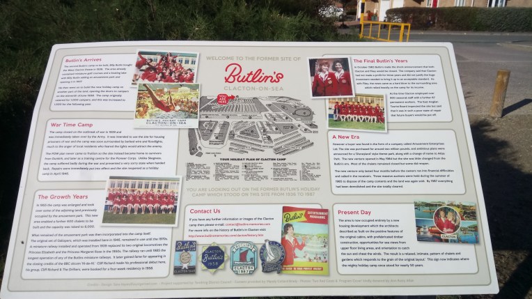
This is the plaque commemorating the demise of Butlin’s Holiday Camp at Clacton-on-Sea. The Camp was opened in 1938 only to be taken over by the Army for  the War years and reopened in 1946 after hostilities ceased. Very  popular for over thirty years, following three years of losses the camp closed in 1983 only to reopen and fold again in 1984; by 1987 everything had been dismantled, demolished or disposed of. It is now a housing site…. Bye Dee Bye….

There was no indication of a week’s visit in the early sixties by Bob!, Dave and Pip. My main recollection was endless playing of the Kinks  Sunny Afternoon…. I think.


Welcome to Clacton! The RNLI Staion  on the Clacton Promenade; and inside the RNLI Shop with  Tony and Pam dispensing souvenirs; and then the Pier hoves into view.


Clacton on Sea Pier, final venue for this trip


STILLOENGLAND/72 -200Days-22Miles WALKING THE COAST OF ENGLAND in DORSET, SOUTH WEST COAST PATH. EAST PORTLEMOUTH TO BANTHAM. GRAND TOTAL 2683 MILES 400 TO GO. .

The Race to the bottom of England….

coastal-path-200-days

………the 200th Day walking  round the Coast of England took me as far as Bantham on the South West Coast Path, about 22 miles beyond Salcombe . I think the Black Worm on the South Coast will reach Land’s End before the North Coast Worm. Other coloured worms are available on the Isle of Wight and Suffolk Coast paths. And another due to be started at Wallsend going North towards Berwick on Tweed, Watch this space!

Dear Maisie, Rowan, Jake, Stan, Lauren and Rosie,

I’ve been walking round the coast of England for 200 days, and by now you would have thought I’d know where I’m going and that I’m old enough to know better. Sadly this isn’t either case, and what’s more the 200 days accumulated don’t include about eight hundred days resting….

This trip I returned to East Portlemouth on the South West Coast Path where last time out I managed to miss the last Ferry that would have taken me to Salcombe where the bus was waiting to take me to Kingsbridge where the car was also patiently waiting to take me to my tent. But for the good Samaritans of an East Portlemouth family who drove me to the car, I would have taken refuge for the night in the Ferry Shelter below, with not so much emphasis on shelter.


dsc_0097

The Ferry Shelter that was very nearly my refuge for the night last time out…nice lifebelt.

Finally, I get to cross the Kingsbridge Estuary; East Portlemouth to Salcombe, observed by two unidentified massive military transporter aircraft and Felicity’s Skipper.


My place of safety this trip was the higher quality campsite at Higher Rew, within very steep walking distance of Salcombe. Yet again the owners and occupants were excellent; and yet again I needed assistance when the RAV4 refused to start, which even yetter again cut my visit short, because once started I couldn’t stop until I got home. Refuelling was interesting, on the move…

{I feel a minor rant coming on – in the run up to this trip, following a major service, the car was returned to me just in time , with a battery warning that it needed to be replaced but was not in stock. I also recoiled at the price and the RAC advised a cheaper outlet.  But more concerning was the oil warning light coming on a hundred miles into my trip, sidelights that had apparently suddenly failed and an access panel in the bumper that had detached itself after remaining in place for 130k. Service? Strange word? Misnomer more like…..Living in the sticks arranging a “service” is an all day event. A return of service after an incomplete service is a double fault. I feel I’ve been highly  restrung a net cord and there’s definitely chalkdust from a smoking gun.. Somewhat mixed metaphor but you get my point? Game set and match. RAV4 is booked in for Friday. So no walking that day then. Of course – it could be all my fault – I will report back – but I feel the next car isn’t a Toyota.}


The  Campsite, environs, sunrise and stranded RAV4 at Higher Rew near Salcombe- how do you bump start a car with keyless ignition? The barn was in the way anyway. And the dashboard was telling me to check the engine oil. And my blood pressure. But it’s just been fully serviced. One of the caravanners and the camp owner came to my rescue with jump leads. Thank you. The people around here are as nice  and chocolate boxey as the environs.


Leaving Salcombe was tortuous, steps and alleys everywhere and fascinating views and architecture – it took over an hour to vacate by way of North and South Sands with a final look back over the shoulder to see the early morning Kingsbridge Estuary.


Now back on the S W Coast Path heading for Bolt Head and climbing 130 metres – there was an alternative as you’ll see later.


But the views after all that climbing are spectacular with a final view of Ham Stone. How do the pigs get there? Of course, they fly!  Grid Reference SX 717 367


The journey from Bolt Head to Bolt Tail via The Warren  and Bolberry Down ended with a descent into Hope Cove  with views into Inner Hope and Outer Hope and one fishing boat that might interest Mark?


Hope Cove was an ideal stop for lunch


The descent into Thurlestone and Bantham  was gentle, all the pathways disappear into the distance with a preview of Burgh Island best approached by causeway at low tide; the same applies to the River Avon to get to the SW Coast Path at Cocklebridge, but a  seasonal ferry does also run. Looks like a soaking coming up next time. A local told me the best way across – so that’s alright then…..


My final port of call was the Harbour Master’s HQ at Bantham to investigate the possibilities of crossing the River Avon out of season. A kindly seafarer offered me a crossing there and then, but couldn’t bring me back – so I sadly declined his generous offer. I will have to wait for the next holiday season or part the red seas.

This now meant walking to Thurlescombe to get the buses back to Malborough and a two mile walk to the tent. I asked advice about the quickest route, which turned out to  be the steepest hill I have ever climbed; no steps; no handrail; no footholds; no ropes; not even a Stannah Stairlift. The picture looks harmless. Believe me it left scars.


The final day I spent walking to Salcombe to complete unfinished business; I wasn’t going far with a dud battery in the car.


This was the short cut mentioned earlier, that avoided the taxing climb from South Sands to North Sands. The tide was going out and I sought local knowledge about walking the shoreline. The response was positive if I waited for low water, and I clung to the rocks like a limpet, for the water was not quite at its lowest. But I did it without a soaking, although I ended up on a landlocked and sealocked beach that needed climbing skills to escape from the remains of Salcombe Castle.


Sue from Salcombe RNLI serving me my Salcombe RNLI Beanie Hat; The Baltic Exchange III moored in the Salcombe Harbour and the Lifeboat Station and Shop


Some more of my favourite things from Salcombe; three views of the only fishing boat suggestible to Nephew Mark, the Skipper obligingly turned it to face me to get its best profile; my favourite Devon Pasty Shop and my all time favourite Tally Ho Bus Company services 162 and 606, whose drivers really do go that extra mile to deliver me safely to my car! The only clue was that I’d left it outside the Catholic Church – and my prayers were answered.


The only other numbers worth mentioning are OL 20, my Ordnance Survey Map of South Devon and Auntie Sarah was twenty one again, for the nineteenth time last week. One of my two most favourite Daughters-in-law.


STILLOENGLAND71-198 Days, 23 Miles on the SW COAST PATH from TORCROSS to KINGSBRIDGE ESTUARY and EAST PORTLEMOUTH. TOTAL MILEAGE 2661 with 415 TO GO.

dsc_0617

The Author obstructing the view of Slapton Sands and Slapton Ley Nature Reserve

dsc_0622

Mine ‘Ost. It’s an ‘appy life, ‘Enery.


coastal-access-path-2-october-2016-blog-71

Getting there. The Black Worms represent progress on the S W Coast Path as far as Salcombe (South) and beyond Bideford(North). The Brown and Pink Worms are Natural England’s Proposed England  Coast Path due for completion by 2020


Dear Rosie, Lauren, Stan, Jake, Rowan and Maisie

Every adventure has its peaks and troughs; this one reached its zenith in hospitality, accommodation, company, scenery,  weather and act of kindness, in one hit this visit, with one apparently irrecoverable slough of despond very late on in the walk. .  The actual topography followed suit in providing energy sapping rock climbs and descents  equal to anything so far attempted, much of it perched on cliff edges.

Without doubt, I was based at  the most exclusive accommodation in the entire walk.. Tricky to find and difficult to leave. Unlikely to be equalled in the rest of my voyage, I must make the most of it. Thank you Henry and Karen Staunton.

The first walking  day, Thursday, 29th September,  Number 197, was spent in the excellent and humorous company of old school friend  Henry Staunton. We first met on combined School Trip to  the Isle of Wight nearly sixty years ago.

Clever logistics and use of two vehicles and a helpful breeze, allowed us to walk nearly eight miles in glorious late summer sun from Stoke Fleming to Torcross, and have enough time to enjoy a proper meal  at The Globe, in Lostwithiel with Henry’s charming wife Karen and her sister Jo. Not my usual lone grazing formula. It’s fantastic having company on the walk, sharing numerous views and observations and frequently getting off piste through lack of concentration. Literally side tracked.

Next Walking Day 198, was my departure from the luxury basecamp, saying goodbye to mine hosts, driving to Kingsbridge and all day parking the workhorse RAV4. I jumped on Stagecoach Route 3 to Torcross intending to walk the coast path to East Portlemouth and take the ferry to Salcombe, where I could catch the bus back to the car at Kingsbridge. Easy-peasy. Keep up!

Everything was fine , I kept up a good pace despite the strenuous climbs and descents and at 6-10pm  I approached the ferry slipway with time to spare having walked 15 miles, and the possibility of getting an earlier bus. Sadly that day the ferry timings had switched to winter timetable when the last ferry departed at 6-00pm. Ah well! Looks like a £30-00 taxi fare the long way round. Only problem  – no taxis – and taxi drivers  elsewhere not willing to do the business.

Rapid reconnaissance of the locale could not detect a pub, nor B&B, nor shop. I was looking forward to either a night in the ferry shelter or a  10 mile walk on narrow unlit lanes to Kingsbridge and the car.  I didn’t fancy either – it looked like a toss up. Shelter or walk. This was certainly the deepest  trough I’d been avoiding  since the walk started. Seemingly I had no answer.

Out of nowhere,  came a lady with her father and daughter and I asked her if she had any thoughts on the matter. Without hesitation she offered her father to drive me, and in half an hour I was reunited with my car in Kingsbridge and willingly  parted with the taxi fare for his inconvenience and fuel. If that isn’t serendipity…..I didn’t get any names but I know their house and I have to return to start the walk again from this spot. I remember kindnesses.


The final decision of an up and down few days, Id heard rumours of an approaching rain deluge. Staying around and pitching the tent late at night and the likelihood  of heavy rain didn’t seem sensible. The alternative was to cut my losses and head for home. I think I stopped for coffee at every  Services on the length of the M5 and arrived  home around 4am.,


The story in pictures……


Head Honcho Henry and the accommodation that sets the gold standard – nowhere else can compare. The views over the River Fowey are incomparable. The tent would look out of place, so I reluctantly accepted a room….


The logistics for the walk today involved leaving one car at Torcross Carpark, the other in National Trust’s Little Dartmouth Carpark (first photo) and walking via Stoke Fleming (2nd photo) and Strete across Slapton Sands to pick up the first car and drive to the second car. The central picture shows the postbox in  Stoke Fleming, and the third is the final car park, day one walk end. I needed Henry’s  help with that , my brain hurts wondering where all the cars are. Similar exercises like this on my own have resulted in me forgetting where I’ve left the car and enlisting bus drivers to help find which village I left it in. Under Henry’s chairmanship this was unlikely.


dsc_0612

The post box in Stoke Fleming is at an awkward height – maybe they write long letters?


We started off inland at the National Trust Car Park near Little Dartmouth and headed through Stoke Fleming to the beach at Blackpool Sands

dsc_0630


The beaches at Slapton Sands near Torcross….


dsc_0629

…….and the monument to the US Army who were based here for training for the D Day Landings in World War Two.

dsc_0631


The first day’s walk was  completed here with nearly eight miles walked in wonderful conditions and excellent company.


dsc_0638


The second day , walking alone this time  continued from Torcross  heading for  Kingsbridge Estuary  via Start Point. Above , the view of Start Bay from the lookout at Start Point.


Past Beesands and Tinsey Head – maybe fishing boats for Nephew Mark’s art collection


dsc_0639

Overview of Start Point


Which was closed for my visit, so began the race against time to catch the bus back to my car  in Kingsbridge. The last bus leaves Salcombe at 7-30pm; I have to catch a ferry at East Portlemouth to get to Salcombe.


The Coast Path going away from Start Point clung to the cliff edge


Three hours left before the last bus goes to Kingsbridge and that’s the fast lane. Probably 6miles to go. The gate leads to the lookout Station at Prawle Point.


National Trust territory at Gammon Head


dsc_0662Looking back at Gammon Head and Prawle Point. I ‘ve just walked all that!


Leaving the Coast and turning into the East Portlemouth bank of the Kingsbridge Estuary. The last bus leaves in 80 minutes from Salcombe on the other side. Now where’s the ferry.


dsc_0668It’s now well gone six o’clock and I met a lady who told me the ferry slipway was only half a mile away,  but that the last ferry for the day had left. The winter timetable began today. I would miss my bus . In fact I was now stranded, no taxis , no shops, no B&B  – only the ferry shelter to pass the night in!

Surprisingly I omitted to take any more pictures whilst trying to solve my dilemma . I did get out of it because I checked and I’m now back home. It involved bludging a lift from a very kind family who helped out by dropping me off in Kingsbridge, right alongside my car. With inside information on the expected storm, I eschewed any desire to go pitch a tent and executively decided to start the drive home, via every Services on the M5, alternately swigging coffee or sleeping.  Serendipity rules. OK?

In my hurry very few photos wee taken in the final hroes – I will obtain a 20-20 hindsight lense and take some retrospective shots when I return, and seamlessly insert them in the text next time.

A bientot -sorry – can’t do the accents……


STILLOENGLAND70, 196 Days, 37 MILES ALONG THE S W COAST PATH FROM TORBAY MARINA TO STOKE FLEMING – 2638 MILES WALKED AROUND ENGLAND -ABOUT 440 TO GO.

Progress on the South West Coast Pathcoastal-path-devon-and-cornwall-24-september-2016

The Crimson Worms have changed to Black. On the South Coast we have reached Stoke Fleming, past Dartmouth.  On the North Coast, just past Westward Ho!  near Bideford.


My continuing circumnavigation of England’s Coastline on foot, commenced around November 2013 and is due to finish November 2017. I have spent 196 days actually walking and the rest is – er – well – rest. The last walk was from last Thursday to Saturday, 22nd to 24th September, using  OS Explorer Map OL 20; Stagecoach buses 12, 23, 18 and 3. This letter to our Grandkids is now necessarily brief following thousands of complaints from one or two readers that previous Episodes have been rambling.

dsc_0427

Dear Rosie, Lauren, Stan, Jake, Rowan and Maisie,

I spent three interesting nights at Beverly Holiday Park, Paignton, a camping Holiday Centre, at the end of the  Summer season. The facilities were excellent but the entertainment by Beverly Bear, not quite my style, but kids loved it! Shouldn’t they be back at school? The camp was a short bus ride from the South West Coast Path and on day one I walked Northwards  along it from Paignton to  Torbay Bowls Rink  near Torre Abbey to connect with my last walk finish point at Corbyn’s Beach. Really!

I returned on the bus to Paignton and resumed walking Southwards as far as Berry Head, making a total of 18 miles for Day one including some very severe climbs, for me.

Day two was as bright  and as hot  as the previous  day and weariness from the day before restricted me to 14 miles reaching the ferry crossing at Kingswear to Dartmouth.

The final day was cooler, and a stiffer  wind came from the sea, but the gradients were steeper and I reached Stoke Fleming and Stagecoach Bus Route 3 taking me back to the car at  Dartmouth with just enough energy to drive home.

Previously I hinted at a special guest joining me for part of this walk; I was a week out; this will happen next week; this was my only mishap this trip; the forgetfulness of the last visit has been forgotten.

I cannot describe the beauty of this particular stretch without rambling so I’ll best leave it to the pictures which follow.

See you same time next week?.

Following the S W Coast Path Northwards from Goodrington to Paignton Harbour .


Paignton Pier is one of the more colourful and better presented piers, but Popeye must not smoke whilst telling people not to smoke and I wasn’t allowed past the padlocked gates.


Promenades, paths, roads housing, railways and walls combined to make the route of the Coastal Path uncertain; I had to clamber over the stone wall because the gate was firmly locked. The green and lush planting is almost  sub tropical, with palms and ferns


Tor Bay at its best. Coffee time. Torquay Station. A passenger liner was anchored in the bay the whole day, ferrying tourists to and fro. The last picture is at  my rendezvous for joining the  previous walk to the present journey.


Above, the Paignton and Dartmouth Steam Railway, doesn’t quite reach Dartmouth, but serves Kingswear  opposite  on the River Dart. Letting off steam and whistling is heard here,  all around Goodrington. The S W Coast Path heads directly into brambles scrub and overgrown cliff collapse, which viewed from the other side of the bay is quite alarming. I could clearly see the concrete steps I had started descending but turned back as they rnded abruptly in mid air.


Generally heading South on the Coast Path, passing through Broad Sands, Churston Point, Elberry Cove, The Grove on the way to Fishcombe Point and Churston  Cove, with ancient woodlands and numerous coves and beaches.


dsc_0485Multi-tasking to extreme; as if the heat and steep climbs were not enough….


From Fishcombe Point to The RNLI Lifeboat at Brixham Harbour.and then things got quite exciting…. even more than observing the seal watching me again!


Over and above the call of duty, RNLI  Volunteers Carol, Anthea and Di opened up the giftshop when  I arrived after official closing time and I said I wanted the local lifeboat mug and their mugshots for my collection. All graciously delivered plus instructions and directions for my next port of call. The mug was Torbay Severn Class Lifeboat “Alec and Christina Dykes”

No sooner had I departed than the Lifeboat alarm went off, warning the imminent arrival of the crew and subsequent departure of the big boat. Probably keeping to safe speed limits within the harbour confines. I was by now almost at the lighthouse at the end of Brixham Harbour Breakwater when the lifeboat drew level and  was clear to open up and surge out into the open sea on a  rescue mission. I watched it for some time until it disappeared over the horizon. Very impressive and this was a calm sea. I wonder… no don’t go there! They are all very brave people not knowing what they might be going to and possibly under atrocious conditions. Thank you!


The journey from Brixham Harbour to Berry Head  with, the Trinity House Station and views East and West,  and  South, total sea – I believe there be dragons that way…..well the  Americas anyway.


I forgot to say the day had started with Breakfast At Tiffany’s – full English – and strolling through Brixham before what turned into an epic walk, despite the upside down diversion notices and comparing humoerous  diversion strategies with Gavin and Stacey, two fiercely patriotic walkers in reverse mode to me, They had been on most walks that I had done and we rested awhile swapping tall tales.


The Stretch from  Berry Head to Dartmouth has to go down as the most strenuous yet. The continual change of elevation was relentless and exhausting. I took every opportunity to rest and dawdle, take pictures and chat to fellow hikers. I must let the photos speak for themselves . Occasionally a memory or name will surface and if so I’ll comment.  Starting with a diversion notice that wasn’t helpful until I met Georgina who pointed out all the distant features including Portland on the horizon behind her.


No such guidance from now on – these pictures are in chronological order at regular……..


….intervals from Berry Head to the mouth of the River Dart – no let up on the hills .

Turning the corner along the East bank of the Dart, I was expecting the ferry anytime…..


….but after several false trails down to the riverside I eventually found Kingswear slipway and boarded the  ferry for Dartmouth.


Dartmouth ahead and getting straight back on to return to Kingswear  and needing guidance to find the bus back to Berry Head where I’d parked the car, three angels appeared and advised me to catch the 18 bus all the way to Brixham and walk the rest to Berry Head.


dsc_0577
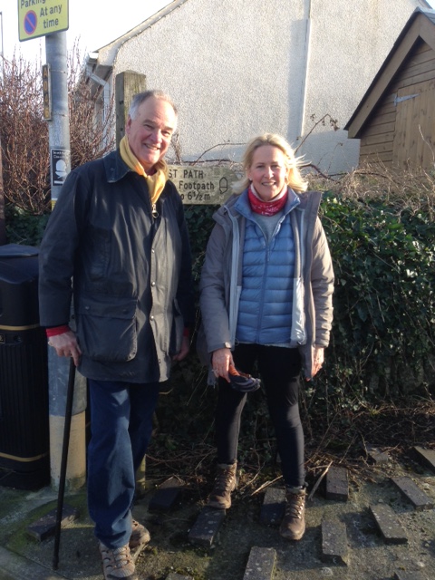
Two of the trio wanted to feature in the blog, but no mugshot of the third. If you’re reading this I got back safely and,  with a bit of route tweaking from the bus driver, just in darkness.


Day three, returning by car ferry with car to Dartmouth I quickly spotted the RNLI Shop. They have no local lifeboat but were very interested in my exploits and although no personalised local boat mug, Jo and Harold willingly gave me a mugshot. And also awarded me a RNLI Dartford Pin, which I wear with pride.


Leaving Dartmouth for Stoke Fleming via Dartmouth Castle to…

…Little Dartmouth and eventually Stoke Fleming where I caught the bus back to Dartmouth….

dsc_0609

…where I’d left the car. Noted that the 3 bus eventually connects with Plymouth – useful for the next trip. That cloud suggests it will be good to get away home.