Trick or treat. Jake and Maisie’s Halloween! And Bonfire night has flared up again.
The Worms turn Welsh.
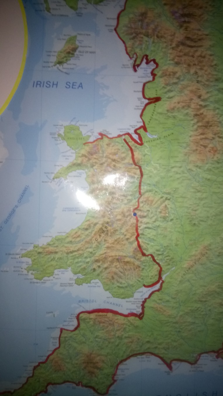
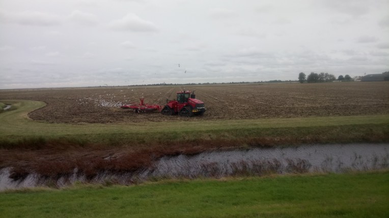
Sorry about the snow storm over the Cambrians, but at least you can plot the paths of the Crimson Worms. The full map will be available for viewing on Saturday.
Dear Rosie, Lauren, Stan, Jake, Rowan and Maisie!
Bobl’s back on the Welsh road after a six week layoff recovering in France from the excitement of almost completing England’s circumnavigation at Land’s End. Unfortunately I needed to recover from the recovery in France, so this last weekend I nervously returned to Chepstow to test my resolve, overweight and energy levels on The Southern Welsh Coast path .
The formal circumnavigation of England is due to be completed this Saturday with the Finale on Southend Pier, but now the race round The Wales Coast Path is well underway, from the North at Bangor and, as of yesterday, the South, at Newport. The finishing line will be at Aberystwyth . The North seems to have an advantage, but walking round Anglesey could be decisive.
The blog will continue seamlessly from ‘Round England’ to ‘Round England and Wales’ and so will the accumulative totals. After 18 miles and nearly walking to Newport yesterday, I have now clocked up 3,492 miles in 276 Walking Days in total. The circumnavigation of Wales is generally accepted as 1100 miles of which I have now done about 300 miles. So that means I’ve got about 800 miles to link Bangor to Newport.
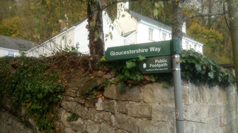
I spent some time in Chepstow making sure I properly connected up with the previous visits. In December 2012 I finished Offa’s Dyke Path at Sedbury Cliffs with Tim. We’d had a tortuous time with the weather and the trail was not the best; we were soaked and tired and Tim was forging the path way ahead of me. As we approached Sedbury Cliffs overlooking the River Severn Tim stood aside and let me be the first to arrive, as he said it was my walk and I should be first. We’ll raise a glass to you Tim, on Saturday.
I again visited Chepstow to link Offa’s Dyke to the South West Coast Path at the end of January 2014, initially following the Gloucester Way southwards..
On 6th November, 2017, this final walking visit tied up all the loose ends up as I started following the Wales Coast Path red, yellow and blue and way markers of a fossil motif from the River Wye.
The start of The Wales Coast Path and across the bridge in Chepstow where the Offa’s Dyke Path passes by near Chepstow Castle
Ancient and modern; past the church, through the town wall and out under the M48 motorway bridge.
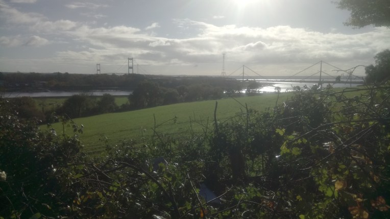
The older M48 Bridge first crosses the Wye and then the Severn…..our River Teme joins the Severn further upstream near Worcester. I walked East over this bridge in February 2014 heading for the South West Coast Path. This visit I went West following the low lying marshes alongside the Severn with extensive England views of Avonmouth and Portishead opposite.
The newer M4 bridge crosses the Severn further downstream from Caldicot to Redwick, roughly the same route as the Severn Railway Tunnel.
Pylons dominate the skyline as I leave the built up areas and head for the wide open Caldicot Level.
The Severn Tunnel Station at Rogiet provides express services to and from England. I just used their car park for Vera while I walked to Nash,.
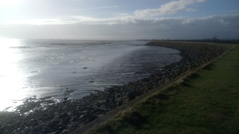
Approaching Sunset and Gold cliff in the distance.
I was fast running out of steam and found a café at Goldcliff. I wanted to finish but the coast path was miles from any built up areas. I headed inland resigned to walking a further 4 miles to Newport and attempted hitching a lift, but no takers. I was told I’d missed the local bus backto Newport where I was hoping to catch a bus to Vera at Rogiet Severn Tunnel Carpark.
I eventually got to Nash and heard a big vehicle behind me and moved into a layby to let it pass, suddenly realising it was a bus, so I changed my hitch hikers thumb for a signal for the bus to stop… and it did. I negotiated a fare to Newport and another bus back to Vera. Serendipity is alive and kicking in Wales.
Vera was still at the Severn Tunnel Carpark and soon I was heading homewards.
The National Trust Ferry across the River Ore to Orford Ness. I was the only passenger, the skipper was rehearsing his health & safety spiel which included emergency exit advice and, if at any time he was swimming, to try and keep up.
Dear Rosie, Lauren, Stan, Jake, Rowan and Maisie,
The first time I walked round England…c’mon there may be others!…. things did not always pan out as I thought, and two areas have been playing on my conscience that I did not truly follow the coast.
The first miscreant, at Orfordness, was deliberately led astray by following the Suffolk Coast Path. There’s a strong clue in the words used – ‘coast path’. One could be forgiven for thinking one could walk such a path and have one’s foot in the water and the other relatively dry on the sand. But no! From Aldeburgh the path deliberately diverts inland to The Snape trying to avoid the River Alde. This River is a tricky blighter too, meandering along, giving every nonchalant appearance of exiting into the North Sea at Aldeburgh before it abruptly turns 180 degrees back on itself as if scared what it might meet. It then teases the shoreline for several miles refusing to enter the sea until it meets the River Ore and is swallowed up, as is the Butley River doing similar strange about turns until all three rivers slip sideways into Hollesley Bay. All this diversionary flow sliced off a huge chunk of land, mainly shingle, in the form of Ordfordness-Havergate National Nature Reserve owned by the National Trust.
Prior to that, The Atomic Weapons Research Establishment tested bomb detonation devices and other weapons, while boffins developed over the horizon radar systems and other top secret activities. Visitors were previously forbidden and security was tight. Even now people are warned to keep to strictly marked trails for fear of unexploded ordnance. It is quite eerie, but every so often you come across National Trust Volunteers telling you their experiences, as many worked here when it was active.
The National Trust run a seasonal ferry from Orford across the River Ore. My previous attempts at capturing Orford Ness were thwarted by arriving out of season. This time I caught the ferry across from Orford to the island and wandered around for several hours following the various trails, visiting displays and talking to volunteers about the history. These are so secret that a map is issued on arrival and collected on departure, as you are counted on and off the island. Actually that is not so much secretive as parsimonious. But I do have my photos……
The landscape is bleak with several old structures betraying its recent former history as a weapons testing establishment. The lighthouse is redundant and under separate ownership from the National trust.
The tracks through the various redundant buildings were carefully signposted, and I didn’t like it whenever I hadn’t seen a trail marker for a while, particularly on the shingle beach, every stray object had the potential energy of an unexploded bomb!
Finally preparing to leave the island, I saw other forms of ferry – a landing craft adapted for bringing vehicles and heavy loads over from Orford, and the ramp to facilitate this, looking back towards Orford across the River Ore, or is it the River Alde?
So, now having at last, visited Orfordness, I can relax about the security and feel I have done my best to keep to the coastline by keeping to The Suffolk Coast Path which eventually regains the real coast at Hollesley. Most of Orfordness remains out of bounds and I suspect that when Natural England define The England Coast Path here they will do not much better than the County of Suffolk have done with their route.
And now the Islands of Essex, particularly Wallasea Island….
Wallasea has a unique relationship with Crossrail. Much of the spoil excavated during the construction of Crossrail has been shipped to Wallasea Island raising the Island by up to three metres and creating mudflats, saltmarshes, lagoons and islands in conjunction with RSPB and the Environment Agency
Now of all the counties to have the longest coast line, you wouldn’t pick Essex, would you? Well, you should. But then they include many Islands, which then demand a complete circuit. I wouldn’t have left Essex yet, unless I enforced a strict Island policy on my England and now Wales Coast Walk. If ownership, access, time, tide, weather and route permit then each Island can be visited and mileage added to the grand total at my discretion.
Taking Essex’s major Islands here’s how access panned out.
Canvey Island; visited and walked the length to Canvey Point.
Foulness, Havengore and Potten Islands; guarded by QinetiQ- a dyslexic security firm, nearly impossible to access; got to be born there; but did manage The Broomway guided tour on Maplin Sands. It is a moot point that Natural England consider all three circumnavigable. Looking forward to the invasion and the battle with Qinetiq
Wallasea Island; considered by Natural England circumnavigable until you get half way round and have to come back because it’s not. I have the mud on my boots to prove it.
Northey Island; accessible and circumnavigable, and the natives are welcoming.
Osea; private Island unresponsive to pleas. Slightly stand offish.
Mersea Island; Accessible by road and exited by ferry
Horsey Island and Pennyhole Bay; tricky!
I suspect Essex will end up reducing its total coastline when the realities of possessive owners hit home. But the tidal inlets, outlets, mudflats, saltmarshes, sandbanks, lagoons and islands have all been recently reformed to provide a National Nature Reserve which will be well worth the slight disruption.
If you detect a slight attention bias in favour of Essex, who recently won the County Cricket Championship, by a county mile, then you’re quite right about the County of my birth; more specifically Rochford, at the centre of all these islands taking up so much unnecessary attention. Donald was also born in Rochford. Which makes it extra special.
More Wallasea pictures
Essex Yacht Marina nestled alongside the River Crouch – been here before to cross the River to Burnham on Crouch – or was it vice versa. Vera was left in the carpark in the shadow of a café which provided good company and even better coffee on my return. Interesting chat with Dave about the meaning of life and enjoying it. By all accounts, at seventy five he was in his prime, avoiding unnecessary exercise, like walking(!) but mixing with youngsters, and taking medicaments advisedly. Good on yer, Dave !
Farming Wallasea style
The conveyor belt delivering spoil from Crossrail together with breaching the seawalls to landscape and resculpt the Island providing more habitat for wild life. I think the smaller notice is pointing out that the security fence has sharp edges.
The end of the line!. All the clues led me to believe I could circumnavigate Wallasea Island atop the seawall. I walked to the easternmost point opposite Foulness, where the River Roach joins the River Crouch, to discover this breach in the seawall. Even I wasn’t prepared to brave that mud, and so turned and retraced my steps halfway back to the marina, before branching off to Grapnells and returning to Vera and the coffee.
I feel I’ve done walking justice to these Essex wildlife sanctuaries that are still work in progress, and maintained my coastline trail as far as the Authorities will let me. I will watch with interest to see the final route of the England Coast Path provided by Natural England. The same applies to Potten, Havengore and Foulness Islands, except the O/S Maps clearly define them as “DANGER AREAS”.
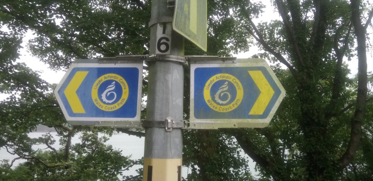
This is The Wales Coast Path emblem which I’ll be following for the next 800+ miles
Dear Rosie, Lauren, Stan, Jake, Rowan and Maisie,
Welcome back to a New School Year and a refreshed Walking Blog with added Wales. Only Maisie remains at home, Ro and Ro begin new schools and Lauren, Stan and Jake resume their old haunts. I begin a new path too! Having run out of England Coast Path, with still some fuel in the tank, I’ve taken on the 870 mile Wales Coast Path starting at Prestatyn and heading for Chepstow, by the Old Severn Crossing.
I already have some Wales Coast Path miles in the bag after completing Offa’s Dyke Path at Prestatyn in June, 2013, I carried on to the English Border around Queensferry heading for The Wirral. So, after this first outing , I “only” have less than 800 hundred miles to go. Plenty of time for all to join in, and those who managed to escape the Round England phase – beware – we have ways of making you walk!
My starting point for the Wales Coast Path, where Offa’s Dyke Path finishes at Prestatyn which I completed in June 2013.
The rules remain the same as before; refer early editions of the blog; the logistics should be easier because unlike 90 per cent of the England Coast Path, The Wales Coast Path is already in place. That doesn’t mean I won’t get lost – I still claim that right – but I have to get used to a different logo highlighted above. I’m also very much nearer the workface; in latter stages of the last walk I was travelling for days just to get to each start; now it’s almost in our back garden. Well, the River Teme is our back fence line and forms the English/Welsh Border. Once the River got too friendly and invited itself into our kitchen. It is an old watermill, so no real surprise. As a result we installed flood protection, shifted upstairs and now have a winter and summer kitchen. Curiously enough, although there has been no repeat of the amiable river intruding, the flash flooding threats are just as likely winter or summer.
The Crimson Worm, race to the bottom at Land’s End, a feature of the last English Walk proved so popular that a Mrs Trellis from Llanfairpwllgwyngyllgogerychwyrndrobwllllantysiliogogogoch wrote in demanding similar status for Wales. Since I arrived at Bangor Pier in sight of the above village across the Menai Strait, the race is almost over, and will be when I enter Anglesey, next trip. Therefore, in order that a North Wales Crimson Worm can do battle with a South Wales Crimson Worm, I shall select Aberystwyth as the Finish Line, an area I know like the back of my hand, having had my head examined and stitched up during an adventurous Sheffield University Surveying Course. Let battle commence.
It also enables me to be selective in choosing which prevailing wind to have at my tail when organising future walks. As did the North Crimson Worm start from Prestatyn, so the South Crimson Worm will start from Chepstow, possibly my next visit.
Preliminaries over – let’s get on with the pictures.
Big Andy joined me for this inaugural walk in Wales. When he’s in charge of logistics I can sit back and relax, no need to remember where I left the car or where I pitched the tent . I organised the Campsite. I realise now that it was cruel to subject such an ex-Military Man to the harsh environment of a tented holiday camp rife with screaming kids, barking dogs and raucous civilians – I fear it was down there amongst the lowest ebbs of his life under canvas.
The RNLI features large on any of my coastal visits and we’re always impressed by their latest equipment, although such benign, mill pond seas at this time deny the necessity. Just watch the latest RNLI TV to see real value under pressure. My favourite charity.
The dilapidated Pier at Colwyn Bay, such a contrast to Llandudno. End of first day this trip or the 269th of the whole journey round England and Wales.
Penrhyn Bay approaching Little Orme, early Saturday , no one around.
Llandudno RNLI Station were having a fundraising event with all equipment and new premises on display.
llandudno Pier, well
appointed and good coffee and
cake, a cut above Colwyn Bay Pier
Llandudno Pier, well worth the trip; a different league from Colwyn Bay Pier
Around Great Orme’s Head and the entrance to Conwy from Llandudno Junction, by road , rail and on foot; and the A55 tunnel is underfoot, or rather under water.
Conwy Lifeboat Station
The A55 tunnel from LLandudno Junction under the Afon Conwy emerges on the Conwy side and quickly joins forces with the railway and unfortunately the Wales Coast Path until Llanfairfechan, where they diverge and give each other more room into Bangor. At least it allows the footpath to be relatively level; whereas the railway and road duck and dive through tunnels cutting through the rock.
Looking back over the Conwy Sands at Great Orme and Conwy Bay.
The old Quarry towns of Penmaenmawr and Llanfairfechan exhibit resculptured landscape and scarred evidence of heavy rock industry served by a port long since abandoned. The pavilion tearooms are still there providing scrumptious cakes and pots of tea at old fashioned prices with excellent service. I’m afraid I filled my boots.
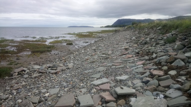
Leaving Llanfairfechan heading for Menai Strait, the Glan Y Mor Elias Nature Reserve occupies reclaimed mud and sand banks with the path becoming less formal – in places resorting to a form of crazy paving with old broken slabs levelled by incoming tides
And so to Bangor – I wish I could say it was uneventful – but on my own again I managed to enter by the most circuitous method and even joined the ever reducing spiral of Llandygai Industrial Estate, which promised an exit at Maesgeirchen but never delivered. I resorted to the old route of the A5, which delivered me to Bangor Pier, up there with Llandudno Pier for maintenance and fruit cake.
Middle dead centre is the Menai Bridge serving Anglesey and Llanfair P G, my target for this walk – I ended up about a mile short as I diverted through the leafy roads of Upper Bangor to the railway station, where my transport back to Llanfairfechan awaited to take me to VERA, who you’ll be pleased to hear has a stay of execution while the Walk around a Country the size of Wales continues.
Bangor Station – the end of the line for now – and Llanfairfechan Station (request stop!) where Vera stood guard at the Pavilion Tearooms.
Finally a dedication to my old school friend Dave Shipp, who died a year ago. All the area I have covered above, was his territory as a long standing resident of Llandudno Junction. He was an adventurous walker and covered many paths including passing alongside us on Offa’s Dyke on one occasion staying at The Mill, but sadly we never joined walking forces, even though he swore on one trip we did it together. I visited Gill at their house, Ty Craig, with not the slightest notion of how to get there, but drove unerringly through the tangled lanes and private drives ending up in their driveway. I think Dave must have been navigating.
something sinister is lurking in the mists which is refusing to let me edit the headless picture — any ideas?
These ABOVE poses were coaxed out of me; I am not normally given to such displays. You wouldn’t have thought I’d just walked round England – my way. That’s 264 miles further than New York
My walking circuit of England following the proposed route of English Nature’s England Coast Path is now complete .The Crimson worm has now completely circumnavigated England and short circuited the Welsh and Scottish borders via Offa’s Dyke Trail and Hadrian’s Wall Path respectively. The Northern Worm on the S W Coast Path won the race to the Bottom at Land’s End, beating the Southern Worm by three days.
Now for The Wales Coast Path…
Dear Rosie, Lauren, Stan, Jake, Rowan and Maisie,
This is the last time I shall be writing to you to tell you all about my walk around the coastline of England. That is because last Tuesday, 25th July, I finished walking from The Lizard to Land’s End along the South West Coast Path. I first started my walk in November 2013, so it has taken well under four years in total. Big Andy was with me taking care of all procedures and navigation necessary to keep me on the straight and narrow, and to allow me to savour my last days walking, without getting lost. Considering the mist that descended on us in the latter stages that was a considerable feat he performed. And very many thanks to everyone else who helped. You were wonderful.
No words needed! The last few days and hours were mobile navel gazing , contemplation and disbelief. I worked hard to restrain my enthusiasm and stop myself speeding up!
I am still speechless and slightly smug at what I have done. It was exhilarating. A mixture of inner turmoil and weariness.
The pictures that follow represent the journey from Kynance Cove to Land’s End. I will say again – no words needed. Irony or semantics. Very droll. Just shut up! The following pictures are courtesy of Big Andy, after my camera and phone succumbed to the seasonal cloud bursts. There will be therefore an unfortunate amount of my mugshots.
less than four miles to go to the finish
near the campsite at Mousehole on the South West Coast Path – still over eleven miles to go
memorial to seafarers……
…and lido at Penzance
Memorial to Seafarers and…..the delightfully refurbished lido at Penzance
surprised by a Kinnock Wave
Refreshments
Looking back at The Lizard – We’ve walked all that!
Breaks get longer – me to bathe, view, drink and attend feet – the ex- military to chin wag.
Mullion Cove
Kynance Cove – our start point on day three
After the walk and because my camera showed signs of life stopped off at Penzance to record previously neglected harbour views –
It is now over a week since finishing my walk around England, and I haven’t recovered. I realise I was running on empty for quite some time, and in the last three trips between June 24th and July 25th I had walked 223 miles in 16 walking days.
I suppose, fitness wise I must have peaked this summer. The Paunch clings on – it won’t let me go.
In the nearly four years of the walk, I don’t recall such an intense period of activity as this last month, but this was fuelled by the knowledge I was on the final run-in. I was pretty lucky with injuries and illness, I did take a few heavy falls and plenty of arthritic aches and pains and one twisted knee, but managed to walk through them. I never once even considered giving up and totally ignored any helpful advice that I might hold back. I was always conscious that I had to finish in the allotted timescale for fear of anno domini et tempus fugit. Carpe diem.
I feel this is a bit of a lame end to THE BLOG, but I’ve got nothing left – there is no more to say except I’m very pleased with myself, and The Walk around a Country the Size of Wales will now begin in the first weekend in September. Friday 1st,starting at Prestatyn heading for Anglesey. All welcome. Make your own arrangements. Let me know if you wish to join in. There will be no blog. Maybe some pictures. Just one foot in front of the other and you’ll eventually get there.
Moments; – my most fearful was just halting in time at the abrupt cliff face at Great Hangman; my enduring memory was the relentless beauty and walking severity of the South West Coast Path; my incredulity at the rapid natural regeneration of the North East Coast after the 80’s enforced mine closures; the contrast of summer sky and industrial pollution along the Teesdale Way; the plastic and metal can litter along the North bank of the Thames filling every nook cranny and inlet but relief appeared to be at hand with regeneration of the riverside pathways; and the Essex saltmarshes are particularly evocative because of childhood memories. Everything else was merely just fantastic!
By order, there will be a low key finale for The Walk on Southend Pier on November 11th, 2017, nearly coinciding with my 70th Birthday, leaving the shore end at 1-00pm heading for the Café, Toilets and RNLI Station one mile and a third away at the seaward end. I am promised by the authorities that facilities and trains will open even on a bleak autumnal November day, but no alcohol, and they weren’t too happy with a tape indicating the three thousand, four hundred and twelve and a third miles walked around the coast of England. Not too many people welcome just in case Health and Safety Regulations are breached….
…….definitely no running and ball games and DON’T THROW PEOPLE BELOW!….
LET ME KNOW YOU’RE COMING, SO AS I KNOW HOW MUCH BREAD PUDDING TO COOK – OR MAYBE BRING YOUR OWN!
YAKI DA!
Bob
…and now to tame the garden after four years neglect
I’m nearing completion of my walk round England’s Coastline with only a scheduled sixty six miles to complete as the Northern and Southern S W Coast Path Crimson Worms battle it out to reach the bottom at Land’s End first. This is the penultimate letter to you, our Grandchildren, hoping to inspire you to something likewise. You’ve all got it in you to achieve, if you want it enough. The final letter, or next Episode will reveal if I completed my target of completely walking around England – on the very edge! Sometimes over the edge..
I’m now staying at Mousehole AFC Campsite, near Paul, Cornwall at the stage of finishing off The Walk, at Land’s End, with about 26 Miles to complete from St Ives on the Northern S W Coast Path; and about 40 Miles from Kynance Cove, near the Lizard on the Southern S W Coast Path. Even now, I do not know who is going to win. The administration, tactics, navigation, strategy, participation, communications, and latterly the photography are all in the hands of Major Big Andy McIntyre. Only my preferences were required The intention being to release me from any significant role whilst in a state of heightened emotion and anticipation of what I was hoping to achieve, and left me free to concentrate and savour my surroundings.
Throughout this walk, whenever walking alone, I have obtained my own balance and feeling of wellbeing by my own peculiar method of favouring humour and positivity, and eliminating the opposites. Works for me; but I’m vulnerable when walking with guests who may not have similar views, and my feelings sometimes are aroused. To avoid this, I crave indulgence from guests and avoidance of issues – even hearing my self saying “it’s my walk and I don’t want to discuss that!”
That’s the background; now for the practicalities of actually Walking.
Good use out of season for the Mousehole AFC football ground as Big Andy, Donald, Stan and Bobl take up canvas residence for unspecified several weather dependant days, whilst The Walk heads for completion.The Church tower is a prominent feature in the neighbouring village of Paul, helping us navigate the peninsular. The second night we could be forgiven for thinking also our last as we suffered horrendous thunder and lightning, accompanied by sheets of rain – always exaggerated by fragile tent fabric. Stan and Mumbles slept through it all.
My entourage and body guard, Big Andy, Donald, and Stan holding Mumbles, all tasked with seeing me safely over the finish line at Land’s End, while I savoured the final few days of my epic walk
The Plan was to walk the Northern S W Coast Path as far as Cape Cornwall six mikes short of Land’s End, today, and tomorrow let circumstances dictate the next move
Donald and Stan weren’t scheduled to join us till the second day so Big Andy and I set off from St Ives Station in an enormous cloud burst, with water cascading over the steps, flooded drains, bursting manhole covers and dark grey surface water inundating the beach. This had echos of the recent flooding at Coverack. I ‘ve kept the negatives small. Just got to walk through it.
Not much for the coastguard to see here. Move on. Wetly. My camera and phone were slowly drowning and we were immediately drenched again, with no option but to continue walking.
Gradually, over a couple of hours, the rain relented and we could see the lovely colours in contrast..
..and we came across Jasmine just about giving up and turning back. We offered her company to continue with us, which she gladly accepted. A fortuitous meeting with a lady literary agent, who is going to read the blog and who knows – a blockbuster…. the wet ‘s getting to you, bobl.
Jasmine left us around Zennor to find her Airbnb and to dry out.
By late afternoon shadows even started to appear but the water was still very rough as we headed for Cape Cornwall
Pendeen Watch heading for Cape Cornwall
End of the first day – new arrivals join us tomorrow – who’d have thought the rain this morning would have given way to sunshine. But the water made a mess of my camera and phone – unable to re-charge I gave all photo responsibility to big Andrew, as well as him navigating, plus strategy, tactics and communications – I’m just here for the ride – relax!
No arguing! Positively.
The completed back up team ready to depart from Cape Cornwell on Day two, heading for Land’s End and hoping to be the first Crimson Worm to race to the bottom, on the South West Coast Path. In sunshine.
Half an hour out and we passed The Brisons and the neighbouring countryside is full of pit falls – literally; mine shafts and workings are everywhere. Stanley counted them and we kept to the straight and narrow track.
And there’s no accounting for adders
Mind the adders. Here we find one miner and a minor looking for pirate treasure…. later on we could have done with such welcome cover when we watched the squalls home in on us. Stan was ok – he could get into sheltered crevices – not us, we were too bulky. Wet ourselves again.
Passing Gwynver beach heading for Land’s End; Stan was nimble like a mountain goat, often leading the way
Passed Sennen Cove beach resort and Life Boat Station and on the Road to Land’s End with an inner glow.
Donald’s pictures take over where mine have now drowned in rainwater…..
Land’s End is getting nearer, and the finish post…. Stan is quite casual about it all!
And the winner of the get to the bottom race is the Northern Crimson Worm……it’s not over! There’s still 40 odd miles from Kynance Cove to Land’s End to cover on the Southern S W Coast Path. But as an interim reward Big Andy produces some Champagne to celebrate with. Now we have to nurse the Southern Crimson Worm home from the Lizard without Donald and Stan, who deliver us to our new Starting Point for Day Three , Sunday.
We will gloss over my only area of responsibility and how I managed to leave the car keys in Cape Cornwell, for the car at Land’s End. Stanley found a flying fox/zip wire; I would’ve walked; Donald would’ve hitched; Andy said he’d take the bus; he did but later transferred to a taxi…… result keys returned, and free to eat celebratory meal at LE restaurant
The only way to go to Land’s End – by zip wire… So what happened next?
Only 40 or so miles to go and I’ve walked round England. Did I do it? What went wrong? Reply and request the final instalment -Episode 93 – the only clue I’ll give – I’m recovering and soon be ready to have another go…
here’s Big Andy’s perspective – I can’t remember where they all fit in – I was too busy navel gazing but day two just about covers it.
Above; The end of the line for The Northumberland Coast Path, which I had religiously but unsuccessfully tried to follow all the way from North Shields, Newcastle. Part of my penance for straying from the pilgrims’ route was having to walk alongside the extremely busy A1 for several miles. There are quite a few heathen drivers out there, wishing you’d pass by on the other side.
TheBridges of Berwick upon Tweed taken from the bus route outa there; I only had 17 minutes to explore and make sure I caught the Sunday service X18 back to Vera abandoned near the A1 in Fenwick, pronounced Fennnick.
Haste ye back to Bonnie Scotland. I think I might just do that…..but Wales is next!
Below; The Crimson worm represents my progress around England’s coastline, and includes Hadrian’s Wall plus Offa’s Dyke…..
The end of the crimson line on the Scottish Border, at Berwick upon Tweed.
Only the S W Coast Path left to complete around Land’s End.
Map courtesy of Ordnance Survey with my Crimson overlay depicting my route around England’s coastline, plus Hadrian’s Wall and Offa’s Dyke National Trails.
Dear Rosie, Lauren, Stan, Jake, Rowan and Maisie,
Well. Well. Well! I did IT . I got to Scotland. Just by putting one foot in front of the other. Nothing special. But I do feel a tiny bit proud. Whatever you lot do – you don’t have to do it all at once – just put one foot in front of the other – keep going – and you’ll get there.
Rosie! Your winning the hundred metres was putting one foot in front of the other rather faster than I did and you have such a lovely action; Lauren, taking up the tennis racquet in response to Wimbledon, you are going to be good – keep practicing, small steps at first; Stan, the man with a plan, already three Welsh Peak climbs under his belt and your football control is very good for your age – use both feet ; Jake, tennis, cricket and football, Andy Murray, Jo Root and Harry Kane should be worried – you remind me of – er well – er , – me, but use the left foot more; Rowan , I’ve seen your Ballet clip, such grace – and attitude…practice those steps; and fearless Maisie perhaps smaller steps and less danger.
But The Walk goes on. Next is the final visit to the S W Coast Path on Thursday to complete everything at Land’s End. We still don’t know whether the Northern or the Southern Crimson Worm will get there first, but Major Andy, Captain Donald, Sgt Andy and Sapper Stan will all be there to witness it. We’re staying at Mousehole AFC Campsite for any late arrivals.
NUMBERS
I walked 109 miles in seven days, alone this time, on the pilgrims way along the Northumberland Coast Path, bringing the total to 3339 miles on 263 separate Walking Days.
Rav4 Vera has clocked over 150,000 miles, not all down to The Walk, but certainly, I couldn’t do it without her. Likewise the back up driver albeit 12,000 miles away with Omi, in Shaky New Zealand, where recently the ORBLAX amazingly didn’t beat the Lions. I find this incredible, since so many Kiwis were telling me until quite recently how poor the Lions were….. it is quite normal for New Zealand to go into collective depression when they realise the Orblax are only human. Just get in touch when you’re ready….
Walking alone, gave time for reflecting on the previous well over three thousand miles I’d walked around England’s Coast and all I can write is that my thoughts are completely scrambled. All those worthy comments, pithy sayings and clever conversations made up along the way for outpouring into the blog have deserted me. I’m very weary, but not in a bad way . The sort of weariness that leads to a deep and long night’s sleep. Very satisfying. It’s a sort of Euphoric malaise – is that possible? Or smug, as Henri would have it ( I make no apologies that only a very few will appreciate that).
Bottom Left Hand Corner -Only about 66 miles to go from The Lizard to St Ives via Land’s End. If you look at the English/Welsh Border, roughly on Offa’s Dyke Trail, about half way up, or half way down, there is a blue spot where The Mill can be found!
When I get to Land’s End I think I will be very proud of myself. I might even be tired and emotional, with the aid of a bottle or two of NZ bubbly. I don’t drink much – so it won’t take a lot of bubbles.
Excuse me a minute , the screen’s gone all blurry.. Wherever you are, on Sunday and Monday at Land’s End, I’ll drink a toast to you all. If you’re wondering why twice – well there’s a Northern Crimson Worm and a Southern Crimson Worm and they both have to pass the finish line. Major Big Andy is in command of navigation, tactics, strategy and logic, with a brief to get me there. I deliberately haven’t read any orders, so I can’t tell you who will win. We just put one foot in front of the other – and we get there…..
Enough of this blubbing – get on with the pictures, remember I was alone; I couldn’t even stick to the Holy Trail, I may have strayed off the straight and narrow coast path, so don’t blame me if some of the pictures aren’t what I thought they were!
And finally congratulations to Terry, who this week climbed 3260 metres up the Matterhorn as the lone male in a party of five – that’s some baggage handling El Tel. Well done! It was the practice you put in on the S W Coast Path what dunnit.
This day began from Baslow and headed North West to Manchester Airport when Marilyn was departing for Auckland and Omi. Leaving the airport, I sorted out the maze of the M60 and M62, heading for Leeds and eventually Widdrington, North of Newcastle, my base for several days, while I walked the Northumberland Coast Path to Berwick.
Near Widdrington but where’s the tent? I forgot to take my Campsite location picture until I was leaving. I originally booked three nights, but added two more nights because I was no where near Berwick. I stayed a sixth night, because the circuitous route added miles to the walk. Thank you Seddons Camp Site for being so accommodating, and good luck with the red squirrels.
My car location pictures at Whitley Bay! Eccentric? What’s more eccentric? Imagine going into a Police Station asking for help finding the car? It has been known!
As with so much of the East Coast, Whitley Bay is not immune from erosion problems as witnessed by the ongoing reconstruction of the promenade heading back towards North Pier of the Tynemouth Harbour passing the closed Life Boat House on the way. I was barred from the North Pier by an unwelcome notice saying open from 7am to 8pm. but It was firmly locked at 4pm. Inside the harbour it was as calm as a millpond .
Not very busy harbourside heading for the North Shields Metro Station. The Registered port for the dark blue and white boat was Kirkcudbright, whose name will evoke from Susan, John and Janet various amused memories of unnecessarily long name boards of our youthful homes. I talked to the crew, hoping to get in touch with my roots, only to find that what I first took as a broad Scottish accent talking Gaelic, was the other local dialect called Polish.
I eventually found the metro and tried to pay for a ticket back to Whitley Bay and was informed no one pays after six o’ clock; apparently a local custom built up on fortuitously inoperative ticket machines and knowledge that there are no inspectors after that hour. I shared the profits with a local sweet shop. Reward for six miles that day. Not a bad start.
Religiously sticking to the promenade out of Whitley Bay, where I had some previous, on to St Mary’s Island and lighthouse approached only by causeway – not at high tide!
Moving out of Whitely Bay Heading for delicately named Seaton Sluice and into sand dune territory – not the landscape I’d anticipated- heading for Hartley Links
Arriving at Blythe on an informal footpath – I’m free to choose my own route – which isn’t obvious. Following the south bank of the River Blythe after visiting the fishermen on the west pier, I’m corralled inland. There is no way over to the East Pier and he fishermen say it is dangerous anyway.
Blythe south harbour and lifeboat station
I head for the A189 along the River Blythe, to the nearest bridging point. But soon I am forced further inland to the A1147 to Stakeford and the B1334 to North Seaton.
.The inland route was uninspiring until I reached Newbiggin Bay, but the Bates Mine water treatment process to cleanse rising polluted minewater was interesting and indicative of the mess previous industry has left behind.
The coast at Newbiggin Point….
………Newbiggin by the Sea,- St Barts Church where ex Army Surveyor Chris was perfecting his drone Survey of the Church . It’s a far cry from the Theodolite and level surveys I trained with in 1966….. and subsequently worked with as a Site Engineer round the world. I still have a dumpy level and I’m not afraid to use it.
I just thought a plumber repairing a water pipe beneath 11,000 volt lines was shocking, as were the two sulkies happily amusing, following the coast road. Gettit?
The Power Station occupied the foreshore and forced me inland but back on the beach again by Lynmouth and Druridge Bay. I found a very popular home made ice cream shop at Cresswell – I know – my paunch. And the RNLI station told of many brave rescues, in particular dragging the boats several miles through the lanes because the seas prevented launching from the harbour.
Wild Life Photographers near Widdrington, had spotted a nest of White Barn owls and staked out these cottages. Chris with his tripod was not ashamed to be blogged but the others I respected their wish not to be photographed. Get in touch if you do read this and give me more accurate copy!
Playing in the sand at Druridge Bay – and a fishing boat comes very close to the beach dragging his nets in. They are my foot prints! But look at the direction of travel? How DID I do that?
Coquet Island – a Benedictine monastic cell and medieval tower appear about a mile offshore – zoom in and read the notice!
The South Jetty and North Pier of Warkworth Harbour at Amble with brightly painted boats and a new Amble lifeboat station. More souvenirs – the shop was open and they opened up more, for me to see the life boats.
The Elizabeth and Leonard moored in the harbour with the Rib under cover, but ready for action.
Lunch today is crab and crayfish salad with a beer at The Fat Mermaid, part of a modern harbour development at Amble on the River Coquet next to Warkworth Harbour. Delicious! If I’m careful, I can now eat seafood – as opposed to fish – which I ‘ve tried very hard with, but still can’t digest – even more so if the thing is still looking at me….
Following the River Coquet upstream to Warkworth and its Castle, we are now well into the Northumberland Coast Path heading for Berwick upon Tweed.
Leaving Warkworth via the bridges over the River Coquet, heading for Birling Links , the seashore and St Oswald’s way.
Approaching Alnmouth the circuitous way. A shorter route aong the seashore and fording the River Aln was denied me because the tide was too high.
The Alnmouth Golf Course shares the coast path until the seashore takes over. Spot the ducklings being taught how to surf…..
Boulmer Life boat house. The path has become very formal and well maintained.
World famous Craster kippers being smoked and the Jolly Fisherman where I had another crab lunch. At first I thought the building was on fire!
Craster Harbour and the IRB Station.
Dunstanburgh Castle appears ahead – the journey is gentle and rolling, the last of the Rolling English Road
For the most part so far, the weather has been kind; the odd wind in my face; not too hot; and the occasional drop of rain. The terrain is undulating and easy to walk as I pass NT’s Newton Point on my way to Beadnall Bay and Beadnall
Starting to move more swiftly along with the help of the coast path, road , footpath beach and dunes all being like minded, heading together in the general direction of my overall objective – Berwick upon Tweed. I’m making good progress……
Walking along Annstead Links, Seahouses Harbour appears in the early evening. I like the look of that breakwater jetty in the middle distance.
So much so that I sidestepped the gate and got very good views from the pierhead and extra specially rewarded with the 17-57pm fishing boat returning to harbour, with what looks like a huge catch of tourists!
Strolling round the harbour shops – all now closed, I spotted a print that I’m sure I might otherwise have purchased.
Starting again next morning – Saturday – returning to Seahouses – parking Vera in an all day carpark, I wandered around the Coastguard HQ, the Lifeboat Station and a monument – THE RESCUE – to seafarers guardians.
Now aware that my time was running out. Today was my last full day of walking and I had 32 miles left to complete. Tomorrow was Sunday and half a day’s walking’ and all that uncertainty of Sunday bus schedules. I checked that the best bus out of Berwick tomorrow left the Bridge -( which Bridge, there are three?) – at 14-17pm. There was another four hours later, which would mean I’d probably fall asleep driving home.
I still had to break camp at Widdrington as well – better get a shift in.
and returning to the pilgrims trail at St Aidan’s Dunes. Heading for Holy Island.
Now we come to the bit where it all falls apart. For no good reason ST Oswald took his way AND the Northumberland Coast Path inland leaving Seahouses. I have no higher authority to consult or disobey – Nanny’s in Auckland – not Bishop’s – its namesake – 12,000 miles downunder. So the beach route it is then. Oh Wicked! Next stop Bamburgh Castle
And that’s when it started raining. I headed for the castle, but it was guarded by shifting sand dunes behind that innocuous grassy mound lie many and varied tracks and trails through the overgrowth. The rain in itself wasn’t soaking. It was the accumulation of moisture on the vegetation at body height, that obligingly tipped itself on to me as I shoved my way anywhere. I was drenched.
I spied an unusual gathering of people in costume – they weren’t wet – they obviously knew the route through the sand dune maze and were aware of the soaking guardian, qualities of the ferns, reeds, gorse, brambles and heavy bladed sharp grass. I’m not moaning , but they were very inhospitable and wouldn’t let me pass. Photographed one footman putting his foot on – his colleague wasn’t too gracious – saying the ambience wasn’t right – I just found that a medieval character getting dressed in the back of a modern car to re – enact some worthy skirmish hundreds of years hence, was – er -interesting…. even though I was drowning inside.
Nothing would get me inside the locked gates to shelter and change into dry clothing, so I watched the battle. They weren’t holding back, and I think it was real blood. Better humour these guys; in so doing I turned tail and retraced my steps back through the soaking dunes, they reinvigorated and replenished with a fresh drop of rain.
When you’re really, really wet – you’d think another soaking is water off a duck’s back. Well! It is and it isn’t. I kept up a good pace to fend of any chill and didn’t stop till I got to Budle Bay and found a friendly, unoccupied WWII Pill Box .
Midday .
Lunch.
Very wet lunch. I now know why I carry a complete change of clothes in plastic bags in my rucksack. More than one family group of hikers visibly veered off course as I dried out and changed. I’d always assumed the worst any time I came across odd male – always male – behaviour in derelict structures; now I realise there might be quite plausible explanations.
There’s a bit of coast in the first picture below, but the rest is coastless terminating at the A1 with traffic thundering by and no footpath. Time to head off to Holy Island
WELL -I don’t know who set the course for the various trails from now on, but they should really go and get their theodolites sharpened. St Oswald and his advisers must have been at the mead and were taking the Rolling English road with them. Even though my map was a soggy mess, I could see a faster route to Holy Island. Unfortunately it required two miles alongside a very fast A1 clearway. I held out till I got to Fenwick, where the A1 intercepted St Oswald’s Way and the Northumberland Coast Path. Trades descriptions should be informed -there’s nil coastal to see here.
After crossing the main east coast railway line very quickly, I also very quickly came across the road to Holy Island. The tide’s in and the causeway clearly closed. , unable to part the seas, I left St Oswald to his way and carried on northwards along the Northumberland Coast Path, now firmly reinstated on the coast line.
That’s Holy Island over there! Retreat to the tent and hope for better tomorrow.
Upon returning very early Sunday after breaking camp and leaving Widdrington the tide had gone out but then came back in as it has done forever. It certainly wasn’t hanging around waiting for me. Maybe next time?
Now for a straightforward fast walk to the bus on Berwick Bridge; I followed the coast path all the way to the X18 Bus Stop. Here is the final half day in Pictures .
AVE ATQUE VALE BERWICKIUS!
Coffee at Goswick Golf Club – Walkers welcome! Alongside Lindisfarne National Nature Reserve
The coast path does exactly that – keeps alongside the coast unlike earlier. Eventually catch sight of the Pier marking where the Tweed enters the North Sea.
Lowry spent regular Summer holidays here and there are many such displays of his particular talent exhibited in Berwick, often exactly where he’d set up his easel.
And the last word goes to Berwick Life Boat Station
This blog about walking round England’s Coastline is dedicated to our six Grandchildren, now including our first teenager, with added attitude, Rosie. We do not discourage adults from also partaking of the sage travel advice contained herein, although for some it is too late to be childish again. When I grow up, there’s a lot of things I’ll do differently, particularly I won’t leave the S W Coast Path till last when I walk round England in the other direction. Perhaps the climbs aren’t so steep the other way round? And I’ll persuade more friends to join me.
In particular, Walking Guests Terry and Elizabeth added to the peculiar delight of this last walk, joining in for 35 and 21 miles respectively and I reproduce below their own responses while they are on their individual roads to recovery. Some of the best friendships you’ll ever have begin in the very early schooldays, I won’t labour it – it just happens! Look after those friendships! Marilyn, Elizabeth, Terry and I had a hilarious three or four days, despite a huge time span between being kids at school together and the present.
Terry emailed after he returned home;
“Dear Marilyn and Bob,
There is only one way to truly appreciate what you and Marilyn have achieved and that is to spend a couple of days walking with you. Fantastic team work; Marilyn you really ensured that you were always there at he end of each walk, and that was not just comforting but so satisfying, especially the ice cold Becks!!!!
Bob, what you have achieved is quite incredible. I was lucky enough to experience probably one of the most spectacular walks in the best of weather conditions, and have the luxury of a hotel and brilliant company at the end of each day.
You, of course, have experienced many days when the marvellous Marilyn was not with you, the weather was cold and wet, and your “hotel” was a tent , and your company was the iPhone, (if there was any signal!!!!) i.e. the complete opposite of what Elizabeth and I were so privileged to enjoy over the last three days.
I thoroughly enjoyed every minute of our walks, and the banter, whilst on the hoof, and again in the evenings was most amusing. One of the many highlights was seeing those two enormous adders yesterday.
Your photographs and the blog are a great legacy for your grandchildren and I am sure they will inspire them to stride out in determined fashion on their own “coastal walk” through life.
From your quick calculation, it sounds as if you only have 2/3 weeks to complete the English coast, so congratulations, I look forward to the Welsh coast next year!!!!
Finally, I guess I wouldn’t have been there at all had it not been for the many hours you, Marilyn and Elizabeth spent on the Earls Hall School story, so thanks to you all for that as well.
Well done.
Cheers Terry.
All of a sudden, the Round England Walk will be finished. There will be an enormous hole in my life, which I’ll have to fill, probably by walking a country the size of Wales
Nearly right! I have a list of Fifty important Domestic Chores neglected over the last four years, and a supplementary list of twenty five substitutes should I dare to finish any one of the Main List. I should never have retired really. It’s far too complicated. I won’t miss the blogging though!
A word about the sequencing of the Blog Episodes. I hope I’ve got rid of the gremlins messing around with the last few Episodes. It may be that you, Dear Reader , have missed some recent publications. This Episode is “90” and other recent interupted Episodes ” 89″,” 88″,” 87″ etc are now in both chronological and numerical order – I hope!
Lastly, about overloading. I could see from others’ pictures, where I’m the subject , now there was more than one photographer in the party, that there were plenty of unflattering views of my waistline., particularly compared to Terry’s well lived-in physique. Immediate action includes a ban of most of the goodies eaten in the last few days and starvation diet. If I don’t get rid of my unwelcome waistline in the next two weeks of walking then its mine forever. Back to berries, nuts and water.
Bobl (69 and two thirds).
THE CRIMSON WORM RACE to the bottom.
I keep an Ordnance Survey Map on the kitchen wall, recording my progress in crimson. Here is an extract…..
The Race to Land’s End is nearing its end. North Worm remains at St Ives, whereas South Worm has put on a spurt and rounded The Lizard to Kynance Cove. I think one more visit will settle it? The S W Coast Path distance calculator gives 66 miles as the distance between St Ives and Kynance. Map courtesy of Ordnance Survey.
PROGRESS
The England Coast Walk has taken 256 Walking Days so far, covering 3,230 miles, including 42 miles added by me this last trip. My guests this time were Elizabeth and Terry, who covered 21 and 35 miles respectively on the Falmouth to Kynance Stretch.
The map below, also courtesy of Ordnance Survey shows the remaining path left unwalked, 66 miles, due for completion by November 2017.
I have reached past St Ives on the North Coast, approximately 24 miles to go to Land’s End; and Kynance on the South Coast, by the figure “5”, after rounding The Lizard, with about 42 miles to go.
Finally, there remain about 66 miles neglected up on the North East Coast from Newcastle to Berwick. Stretches 8, 9 and 10, on the map below, also by courtesy of Ordnance Survey. Everything else is complete. Well – I’m not going back!
Dear Rosie, Lauren, Stan, Jake, Rowan and Maisie,
The last childish birthday of the year, no more till January, 2018, belongs to Rosie, who became a teenager last week. Hope it wasn’t too painful. Well done and Good Luck , Rosie. Lauren is getting stuck into the guitar, as is Stan with the Ukelele. We’ll soon have a family banned… whereas in the Peak District, Maisie is perfecting her ballet and Jake his cricket. Just a note to would-be talent scouts that Essex have first refusal, over Yorkshire; as do Spurs over Sheffield Wednesday. It’s a no – brainer – just look at the respective league tables – Essex top the County Championship and Spurs finish second in the Premiership, to a team full of posers and divas.
The recent heat wave saw Stanley and Rowan doing wet things with the garden sprinkler. I know because Nanny always returns home from StanRow guard duty, soaking. Flash has not worried anyone lately by running away, which is worrying in itself; but Cassie got uppity and ate her bedding, producing three days of insulated doggy-dos…..
Yet again, following her fifth, all time record guest walking appearance, we have been blessed with a poem from Elizabeth. You will have to wait because it is placed at the end to make you read all the blog. We hope you can contain your excitement. Plenty of grown ups can’t, witness its No 1 Position in the All Time Pick of The Cliffs Top Ten Walking Round England poems. Sadly, there were no other entrants. GKChesterton’s Rolling English Road and W W/W were disqualified for rolling and wandering off the subject coast path.
Elizabeth and Bobl were joined by Terry, another old schoolfriend. The three of us first met in 1952, when we all started at Infants School together. Here we are huddled around a Coastguard Search and Rescue vehicle. Well it pays to be prepared. Like the Coastguards below practicing Search and Rescue techniques. Nanny was also around to stop the squabbling.
The three of us were transported from hotel to walking territory by Nanny in Vera, complete with new Shock Absorbers and Brake Pipes; ie Vera – not Nanny. We will have a completely new RAV4 by the end of this trip despite the mileage tripping over 150,000.
The previous outing had finished at the Ferry crossing at St Mawes with Kida, Cornish for “Ice Princess Ferryboatdog” showing us Atlantis, but being Saturday this time it was closed for repairs. Instead we took the much larger Pirate Boat, Tamar Belle, from Falmouth to St Mawes and return, to marry up the missing link on the S W Coast Path Water Bit. Vera released Nanny and she was allowed a rare day off to join Terry and me for a pleasant tour of Falmouth Harbour, recorded below in pictures. Elizabeth was still on her way from London.
The tour of Falmouth Harbour took an unexpected turn in the bottom picture when the skipper hit the submerge button and off we went unexpectedly to Atlantis. Only the periscope, wrapped in an Ensign, indicated our position. We dried off quite quickly in the sunshine and returned to Falmouth, where Terry and I set off for Pendennis Point on the S W Coast Path.
Terry (hands aloft) celebrating his escape from city dwelling, as we hugged the path on cliff edge and followed the changing urban, resort, harbour features until we arrived at Mawnan, which was properly rural, eight miles along the coast path.
On the road again.
Having warmed Terry up and got his joints moving, we decided to try to book in again at the hotel in Helston and meet up with Elizabeth. We each had our confusion and unpleasant experiences with the Rottweilers behind the reception desk but the chain shall remain nameless. Basil Fawlty would have been more welcoming.
The next day, Sunday we set off from Mawnan, towards the Helston River, and were welcomed by Nanny walking towards us, guiding us into the ferry terminal.
A short journey from Helford Passage, leaving Nanny on the beach, across the Helford River to Helford and the Ferryman dropped us carefuly, particularly the city dwellers, on the jetty at low tide and went back to look for the ten pound note he had earlier sacrificed overboard to Neptune.
A domestic boat house; Elizabeth aka Princess didn’t want to get her boots muddy; the ex-church now fish restaurant Holy Mackerel; and finally our first refreshment break. Terry seems to be feeling the load.
Looking back over the Helford River – this morning, we have walked most of that opposite….
………with this still to come.
After we had forded the very slippery Gillan Creek. Nanny had been waiting with supplies, because it would be a while before we rendezvous again.
Nore Point
Porthallow Cove Rendezvous – Time for the Princess to have a rest. The track goes inland to avoid industrial quarries and MOD territory.
Giant Weed! Without the Princesses pink fluorescence we feel vulnerable to traffic on the lanes which now represent the Coastal Path and Nann y made Terry and Bobl dress up in hi-viz. Thus ensued terrible consternation in the local communities thinking we were Customs or Fisheries Officials come to arrest someone!
Terry’s premature 70th Birthday Party at The Talcarne Inn, New Lynn. The first of many such events – Happy Birthday – El Tel!
The following day, fully relaxed, Princess and B’Day Boy start playing in the road
Old Quarry and derelict Port, moving inland again and then on the coast to Coverack.
Surveyor Terry selling holiday homes off the plan, while we stopped for coffee; in his excitement of achieving a sale he accidentally applied Deap Heat to his nose instead of sunblock cream. The screams were audible for miles. Fortunately there was an ornamental pool just below. No gold fish were harmed in this unfortunate incident….
Coverack Harbour – Compare and contrast with a photo from Nanny’s archives
Tide in – tide out – nothing much else has changed?
Still at Coverack – The Lifeboat House. RNLI. and leaving by the back door after some unexpected guidance from a Canadian…. which we didn’t quite follow and got lost, leading to the loss of equanimity of The Fairy Princess.
Fishing boats at Coverack Harbour near Dolor Point
Leaving Coverack – looking back and looking ahead to Chynalls Point. we made our point and stopped for a rest or a pose below at the ancient fort..
National Trust lookout near Beagles Point and views looking in the direction of The Lizard and looking back again
Cadgwith Cove – finish for the day and off to Porthleven for evening nosebag.
Next morning, leaving Cadgwith Port and passing The Devil’s Frying Pan.
RNLI The Lizard, Nigel on volunteer shop duty and Rose The Lifeboat
Bumble Rock, The lizard Light house
From The Lizard looking back towards Black Head; forward to Lizard Lighthouse; and at Bass Point
Housel Bay, Polpepper Cove, The lizard Lighthouse as I head round The Lizard Point, the most southerly part of the English Mainland Coast.
Finally, I made it to Kynance Cove, the same scene of 56 years ago when Nanny visited with Omi and Gordon. Nanny (MIDDLE) hasn’t changed much but the scenery has weathered a lot.
Elizabeth, The Poem – TALES OF EARLS HALL
All along the paths of Helston,
Through the lush ferns tall,
Go Terry, Bob and Elizabeth,
Earls Hall old friends – All.
Gannets, seagulls, adders,
Ponies by the river,
Wading through the muddy creeks,
iphones all aquiver
Black rocks, sandy beaches,
Where the seals swim,
Here we catch the Ferry Boat,
To rest poor Terry’s limb (his knee!)
Vehicular support was commended,
Although a taxi to New Lynn,
For Terry’s Birthday Celebration was
Also enjoyed by Marilyn.
Everyone for pasties,
Dining out on fish – what a spread,
Heads down, poles up,
The Lizard is far ahead.
Clouds form in the blue above,
The friends went at a canter,
But the days were fun for all of us,
Thanks to Terry’s banter.
Elizabeth Abbot Wordsworth.
Next Trip Hadrian’s Wall to Berwick – July 10th ….. running out of miles.
This is a blog recording my progress walking round the coastline of England by way of a letter to our six grandchildren, Rosie, Lauren, Stan, Jake, Rowan and Maisie .
There are 3.188 completed miles, with about 170 miles uncompleted, left to walk. By the time The Walk finishes in November, it will have taken four years, with over 252 actual walking days so far, reaching St Mawes, near Falmouth, on the Southern South West Coast Path; and reaching St Ives on the Northern S W Coast Path below. Not forgetting Newcastle to Berwick on Tweed. . I need to travel at just over one mile per day……..
Unfortunately, The Blog isn’t going as well as The Walk and Gremlins have got in and re-arranged the Episode numbers. This is Episode 89 – if you are looking for Episode 88 then scroll through 89 and 87 until you get to the misplaced Episode 88. I can’t think of any other way to correct this; if you can, let me know, please!
{Now ALL fortunately corrected with advice from WordPress – something about a STATIC FRONT PAGE?}
I also need to publish a sacrificial Blog Episode, to see exactly what happens in the Episode Sequencing, without risking a full blown Episode.
Another reason for this non-walk reporting Episode is to announce provisional details of the Walk Finale taking place on Saturday, November 11th around 1-00pm at Southend on Sea Pier. I have been in touch with Southend Pier and asked if I can borrow it for my Walk Completion Ceremony and what facilities would be available? Toilets? Café? Bar? Is it open? As yet I haven’t had any confirmation, but they did ask how many people were involved.
Therefore, in an attempt to best guess spectator interest can you, dear reader, let me know if you will be attending?
And finally, Terry is joining Elizabeth, Marilyn and The Writer on the next journey from St Mawes to The Lizard and Beyond. Anyone else care to witness this?
CAUTION – I am having internet issues – some may say operator error; this latest blog is in draft form only. In particular Guest Content has been compromised and is incomplete.
Keep returning to this Episode 88 and eventually you may get the full two fat ladies…
The Harbour at Mevagissey
PROGRESS
Map courtesy of English Nature with my Crimson Worms stretching to get to Land’s End first; the Northern Worm at St Ives; the Southern Worm at St Mawes (Falmouth).
Dear Rosie, Lauren, Stan, Jakie, Rowan and Maisie,
Today is Uncle Donald’s Birthday – we won’t say HOW old because that makes Nanny and Bobl uncomfortable. For his birthday, amongst other things he got a new office. Before his birthday we all celebrated with an intellectual visit to Hay on Wye Book Festival. The first to suffer from your collective artificial intelligence was the HAY sign below
Rosie and Maisie, oldest and youngest share an ‘H’; Stanley is an ‘A’ Student; Why Rowan?; and Lauren and Jakie are thirty between them.
We learnt that security were mainly checking to see if everyone had read the books purchased last year. Consequently our party was not complete…
Maybe if Elizabeth keeps improving her Poetry she’ll be in line for Children’s Laureate next year, sadly Lauren Child beat her to it this year. But kids , you’re in for a treat later with another rhyming effort, and maybe you might find a shaggy dog story from the Cornish Ferryman embellished by Bobl..
Let’s start as we finished with the ferry boat ride into St Mawes from St Anthony’s Head
Kida – Cornish for Ferryboatdog Ice Princess, plying her trade across the St Mawes Harbour. Originally teams of up to six larger outboard Ferryboatdogs used to swim in harness pulling the ferryboat to Atlantis, but mutinied because crabs kept nipping them. Then they bred a smaller inboard inbred dog like Kida who powered the ferry boats purely on flatulence and tail wagging. It was never advisable to sit downwind in a Sou-Westerly.
Kida can operate with only one crew, similar to that above, usually fed sufficient to coerce passengers to tie lines and put out fenders. Sometimes, when berthing, they train their crew to throw mooring hooks into eyelets, for which they are rewarded with biscuits. Obviously Kida has a crew with a good eye and accurate throw, and a penchant for choc digestives.. and we saw Atlantis at low tide.
Resting with Cornish Pasty, awaiting embarkation at the wrong jetty, they needed extra draught to board overweight passengers such as Bobl; other passengers found the right queue; and mid-cruise approaching St Mawes. We enjoyed it so much that we stayed aboard to return to St Anthony’s Head. We were boarded later by irate crabs looking for dogs to nip, but Kida had cunningly disguised herself as a dogfish. Fortunately crabs can’t smell. Like Bobl. Bobl’s got no nose. How does he smell?
Terrible!
Sorry.
And now back to the beginning…. at Charlestown Harbour
I started with a Cornish pasty at the Tallships café also selling Cornish ice cream and clotted cream and reflected why, after all this exercise I still had a paunch.
Despite the weight handicap, and leaving the Back up Nanny, I strode out of Charlestown around St Austell Bay passing Lower and Higher Porthpean to delightfully named Blackhead
Porthpean Beach and St Austell Bay
and looking north and south from Black Head
Arriving at Megavissey, some might say Mevagissey.
Awaiting rendezvous with Elizabeth at Mevagissey, she joined in for 14 miles, punctuated by rest in Marilyn’s back up Vera.
Rendezvous accomplished – next stop Gorran Haven. Notice the fluorescent gear, just in case RNLI are called out to search for us in overcast conditions.
Leaving Gorran Haven and progressing to Bow or Vault Beach
Meeting Jurgen and Angelica from Heidelberg at Stone Cross, Dodman Point. Many Germans have visited this area highlighted by a German TV show at weekends. We must have met over fifty in all. We later met Jurgen and Angelica again in Mevagissey eating fish and chips from the same chippie and again as we adjourned to a local bar, where they fully approved of the local brews. Hope you enjoyed the Cotswolds J and A !
Portloe rendezvous with Marilyn and resting guest missed by minutes – maybe hours – so changed to re-rendezvous at Gwendra and or Carne Beach, whichever hale well met first
Approaching Nare Head and Gull Rock off shore not forgetting to look back at where I have been walking. Enlarging the RHS photo would bring into view the Stone Cross on Dodman Point
And now it’s head down, best foot forward for Portscathoe and St Anthony Head before meeting the ferry at Place
We know our Place, where we ended up before taking the ferry to St Mawes and the lawn is more expensive to hire as a venue than the House. According to the intelligencia aboard the ferry, in between mouthsful of biscuits.
We now come to the guest content, which is causing me compatibility issues as in Beta Max/ VHS or, my era, Triang/Hornby .
I did have a rant about Brexit and England – but I just can’t be bothered any more.
Stay with me and we’ll have the Guest issues resolved before you can say ‘Elizabeth’
Here we go…..
I was forced to watch an Episode of Poldark. I really can’t see what all the fuss is about. Reminded me of Chelsea F C – All posturing, posing, poor acting and prostration (- can’t use ‘diving’ as it’s had the ‘p’ taken out of it).
‘Deepest Poldark Country Again’
It’s June along the Coastal Path,
The gorse and ferns are tall.
Kestrels and Buzzards swirling above,
Bob stillO’England and it’s up tails all.
Pasties and juicy apples,
Coffee, Flakes and Nuts,
Contribute to his daily fuel,
And guide him through the ruts!
Slushy green undergrowth,
And fields full of lambs,
Bob and Elizabeth make their way
Slowly over sands.
Marilyn has a brand new skill,
(Not just providing driving and sustenance)
It’s counselling for walkers!
Provides encouragement and care,
For very tired talkers.
Cornwall looked at its best this week,
Blue skies, on layers of green,
Elizabeth looked for her Poldark again –
But he was nowhere to be seen!
High above the narrow paths,
The coastguard chopper whirrs,
Bob completed another 30 miles,
Of the coastline he prefers.
It is back to Cornwall once again(June 24th),
But Bob is on a roll,
Will any of you be able to join us?
To contribute to his goal?
ELIZABETH ABBOT WATKINS. Erratum – it was 33 miles actually – Ed!
And now more pictures from the Abbot-Watkins collection……..
At Gorran Haven; then Caerhays Castle; Rosevine where Elizabeth’s son Hugh got married recently; Elizabeth at Portscatho posing and Bobl eating another Pasty.
And below – a rare moment where Nanny rests from Back-up driver duties in Vera; or Pasty Provision; or mobile restroom for weary poets.
There were more but I’m having real problems with the editing, so here endeth the Episode.
Anyone with experience of WordPress get in touch – URGENT!


 Middle dead centre is the Menai Bridge serving Anglesey and Llanfair P G, my target for this walk – I ended up about a mile short as I diverted through the leafy roads of Upper Bangor to the railway station, where my transport back to Llanfairfechan awaited to take me to VERA, who you’ll be pleased to hear has a stay of execution while the Walk around a Country the size of Wales continues.


![P1050759[2335]bob signpost](https://i0.wp.com/still0england.com/wp-content/uploads/2017/07/p10507592335bob-signpost1.jpg?w=272&h=363&ssl=1 "P1050759[2335]bob signpost")
![P1050721[2345]swcp lamorna](https://i0.wp.com/still0england.com/wp-content/uploads/2017/07/p10507212345swcp-lamorna.jpg?w=484&h=363&ssl=1 "P1050721[2345]swcp lamorna")
![P1050755[2333]bob andy signpost](https://still0england.com/wp-content/uploads/2017/07/p10507552333bob-andy-signpost.jpg?w=764)
![P1050738[2341]approaching lands end](https://i0.wp.com/still0england.com/wp-content/uploads/2017/07/p10507382341approaching-lands-end.jpg?w=354&h=266&ssl=1 "P1050738[2341]approaching lands end")
![P1050744[2339]diagonal mist](https://i0.wp.com/still0england.com/wp-content/uploads/2017/07/p10507442339diagonal-mist.jpg?w=354&h=266&ssl=1 "P1050744[2339]diagonal mist")
![P1050745[2337]heather](https://i0.wp.com/still0england.com/wp-content/uploads/2017/07/p10507452337heather.jpg?w=402&h=536&ssl=1 "P1050745[2337]heather")
![P1050731[2343]land's end fingerpost leaning post too](https://still0england.com/wp-content/uploads/2017/07/p10507312343lands-end-fingerpost-leaning-post-too.jpg?w=764)
![P1050721[2345]swcp lamorna](https://still0england.com/wp-content/uploads/2017/07/p10507212345swcp-lamorna.jpg?w=764)
![P1050714[2349]eleven and half miles to lands end](https://still0england.com/wp-content/uploads/2017/07/p10507142349eleven-and-half-miles-to-lands-end.jpg?w=764)
![P1050718[2347]mousehole harbour tide in](https://still0england.com/wp-content/uploads/2017/07/p10507182347mousehole-harbour-tide-in.jpg?w=764)


![P1050674[2365]Porthleven](https://still0england.com/wp-content/uploads/2017/07/p10506742365porthleven.jpg?w=764)
![P1050644[2375]looking back at the lizard](https://still0england.com/wp-content/uploads/2017/07/p10506442375looking-back-at-the-lizard.jpg?w=764)
![P1050626[2381]military notes comparison](https://i0.wp.com/still0england.com/wp-content/uploads/2017/07/p10506262381military-notes-comparison.jpg?w=485&h=364&ssl=1 "P1050626[2381]military notes comparison")
![P1050654[2367]day 3](https://i0.wp.com/still0england.com/wp-content/uploads/2017/07/p10506542367day-3.jpg?w=271&h=364&ssl=1 "P1050654[2367]day 3")
![P1050628[2377]mullion cove](https://still0england.com/wp-content/uploads/2017/07/p10506282377mullion-cove.jpg?w=764)

![DSC_2281[2556]pen](https://i0.wp.com/still0england.com/wp-content/uploads/2017/08/dsc_22812556pen.jpg?w=378&h=213&ssl=1 "DSC_2281[2556]pen")
![DSC_2285[2559]](https://i0.wp.com/still0england.com/wp-content/uploads/2017/08/dsc_22852559.jpg?w=378&h=213&ssl=1 "DSC_2285[2559]")
![DSC_2278[2562]penlee lifeboathouse](https://i0.wp.com/still0england.com/wp-content/uploads/2017/08/dsc_22782562penlee-lifeboathouse.jpg?w=378&h=213&ssl=1 "DSC_2278[2562]penlee lifeboathouse")
![DSC_2282[2554]](https://i0.wp.com/still0england.com/wp-content/uploads/2017/08/dsc_22822554.jpg?w=378&h=213&ssl=1 "DSC_2282[2554]")
![DSC_2279[2561]penzance harbour 4](https://i0.wp.com/still0england.com/wp-content/uploads/2017/08/dsc_22792561penzance-harbour-41.jpg?w=760&h=428&ssl=1 "DSC_2279[2561]penzance harbour 4")
![DSC_2214[2316]mousehole campsite4](https://i0.wp.com/still0england.com/wp-content/uploads/2017/07/dsc_22142316mousehole-campsite4.jpg?w=378&h=213&ssl=1 "DSC_2214[2316]mousehole campsite4")

![DSC_2215[963236]](https://i0.wp.com/still0england.com/wp-content/uploads/2017/07/dsc_2215963236.jpg?w=760&h=428&ssl=1 "DSC_2215[963236]")


![DSC_2217[2328]stairs from st ives station flooded](https://i0.wp.com/still0england.com/wp-content/uploads/2017/07/dsc_22172328stairs-from-st-ives-station-flooded.jpg?w=77&h=137&ssl=1 "DSC_2217[2328]stairs from st ives station flooded")
![DSC_2218[2329]more water running off the land than from incoming tide at St Ives](https://i0.wp.com/still0england.com/wp-content/uploads/2017/07/dsc_22182329more-water-running-off-the-land-than-from-incoming-tide-at-st-ives.jpg?w=244&h=137&ssl=1 "DSC_2218[2329]more water running off the land than from incoming tide at St Ives")
![DSC_2219[2332]not much for the st ives coastguard to see here](https://i0.wp.com/still0england.com/wp-content/uploads/2017/07/dsc_22192332not-much-for-the-st-ives-coastguard-to-see-here.jpg?w=244&h=137&ssl=1 "DSC_2219[2332]not much for the st ives coastguard to see here")

![DSC_2222_1[2411]Andy with OUR Agent Jasmine](https://i0.wp.com/still0england.com/wp-content/uploads/2017/07/dsc_2222_12411andy-with-our-agent-jasmine.jpg?w=378&h=378&crop=1&ssl=1 "DSC_2222_1[2411]Andy with OUR Agent Jasmine")

![DSC_2224_2[2417]andy on a bridge](https://still0england.com/wp-content/uploads/2017/07/dsc_2224_22417andy-on-a-bridge.jpg?w=764)


![DSC_2226[2430]day 2](https://i0.wp.com/still0england.com/wp-content/uploads/2017/07/dsc_22262430day-2.jpg?w=378&h=378&crop=1&ssl=1 "DSC_2226[2430]day 2")

![DSC_2230_1[2437]day2](https://still0england.com/wp-content/uploads/2017/07/dsc_2230_12437day2.jpg?w=764)
![P1050551[2401]cape Cornwall](https://still0england.com/wp-content/uploads/2017/07/p10505512401cape-cornwall.jpg?w=764)
![DSC_2231[2442]](https://still0england.com/wp-content/uploads/2017/07/dsc_22312442.jpg?w=764)
![DSC_2233[2441]day2](https://i0.wp.com/still0england.com/wp-content/uploads/2017/07/dsc_22332441day2.jpg?w=378&h=213&ssl=1 "DSC_2233[2441]day2")
![DSC_2234[2444]](https://i0.wp.com/still0england.com/wp-content/uploads/2017/07/dsc_22342444.jpg?w=378&h=213&ssl=1 "DSC_2234[2444]")
![DSC_2235[2446]](https://i0.wp.com/still0england.com/wp-content/uploads/2017/07/dsc_22352446.jpg?w=760&h=428&ssl=1 "DSC_2235[2446]")
![P1050575[2389]Adders](https://still0england.com/wp-content/uploads/2017/07/p10505752389adders.jpg?w=764)
![DSC_2237_2[2454]](https://still0england.com/wp-content/uploads/2017/07/dsc_2237_224541-e1501334632135.jpg?w=764)
![P1050566[2399]miners minor](https://still0england.com/wp-content/uploads/2017/07/p10505662399miners-minor.jpg?w=764)
![DSC_2238[2452]](https://i0.wp.com/still0england.com/wp-content/uploads/2017/07/dsc_22382452.jpg?w=378&h=213&ssl=1 "DSC_2238[2452]")
![DSC_2242[2461]](https://i0.wp.com/still0england.com/wp-content/uploads/2017/07/dsc_22422461.jpg?w=378&h=213&ssl=1 "DSC_2242[2461]")
![DSC_2247[2460]](https://i0.wp.com/still0england.com/wp-content/uploads/2017/07/dsc_22472460.jpg?w=378&h=213&ssl=1 "DSC_2247[2460]")
![DSC_2248[2462]](https://i0.wp.com/still0england.com/wp-content/uploads/2017/07/dsc_22482462.jpg?w=378&h=213&ssl=1 "DSC_2248[2462]")

![DSC_2250[2464]](https://i0.wp.com/still0england.com/wp-content/uploads/2017/07/dsc_22502464.jpg?w=378&h=213&ssl=1 "DSC_2250[2464]")
![DSC_2264[2472]](https://i0.wp.com/still0england.com/wp-content/uploads/2017/07/dsc_22642472.jpg?w=760&h=428&ssl=1 "DSC_2264[2472]")


![P1050603[2373]the northern worm wins reaching lands end for the first time](https://still0england.com/wp-content/uploads/2017/07/p10506032373the-northern-worm-wins-reaching-lands-end-for-the-first-time.jpg?w=764)
![DSC_2269[2497]zipwire.JPG](https://still0england.com/wp-content/uploads/2017/07/dsc_22692497zipwire.jpg?w=764)
![P1050614[2385]feet up](https://still0england.com/wp-content/uploads/2017/07/p10506142385feet-up.jpg?w=764)
![P1050596[2387]donald approaching Land's End](https://still0england.com/wp-content/uploads/2017/07/p10505962387donald-approaching-lands-end.jpg?w=764)
![P1050594[2391]playing on the seawall](https://still0england.com/wp-content/uploads/2017/07/p10505942391playing-on-the-seawall.jpg?w=764)
![P1050586[2393] senner cove](https://i0.wp.com/still0england.com/wp-content/uploads/2017/07/p10505862393-senner-cove.jpg?w=484&h=363&ssl=1 "P1050586[2393] senner cove")
![P1050553[2397]day2 better weather](https://i0.wp.com/still0england.com/wp-content/uploads/2017/07/p10505532397day2-better-weather.jpg?w=272&h=363&ssl=1 "P1050553[2397]day2 better weather")


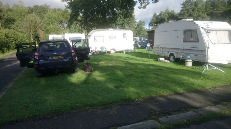


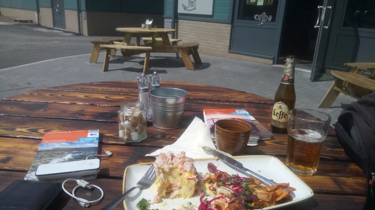


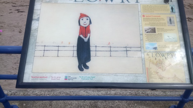
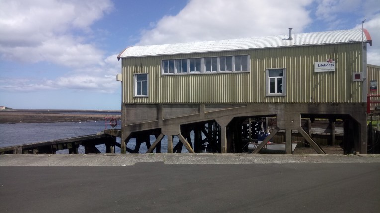

![IMG_3659[2111]](https://i0.wp.com/still0england.com/wp-content/uploads/2017/06/img_36592111.jpg?w=250&h=250&crop=1&ssl=1 "IMG_3659[2111]")


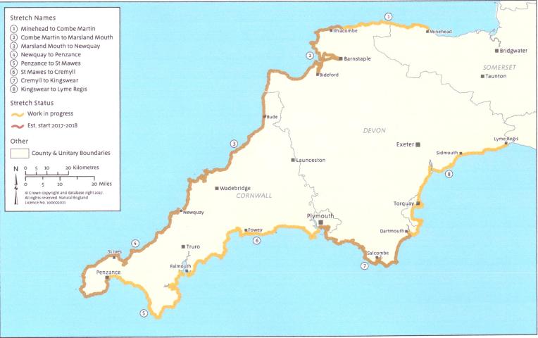 I have reached past St Ives on the North Coast, approximately 24 miles to go to Land’s End; and Kynance on the South Coast, by the figure “5”, after rounding The Lizard, with about 42 miles to go.
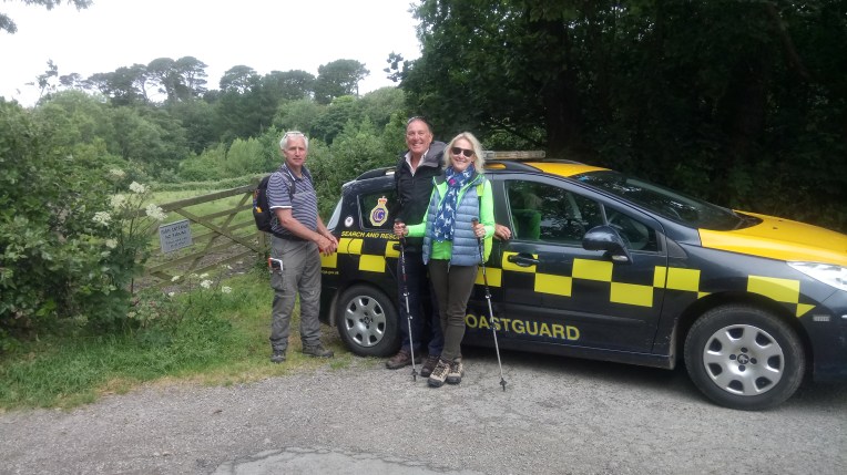
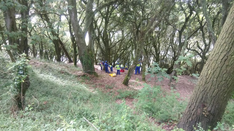


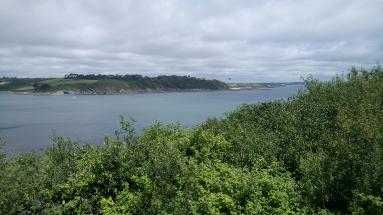


![IMG_3659[2111]](https://still0england.com/wp-content/uploads/2017/06/img_36592111.jpg?w=764)
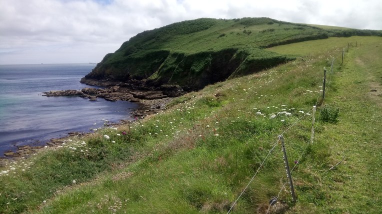


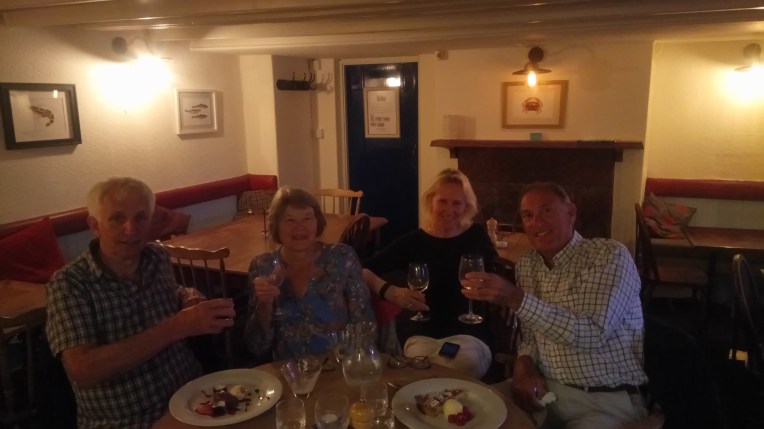


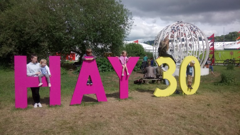 Rosie and Maisie, oldest and youngest share an ‘H’; Stanley is an ‘A’ Student; Why Rowan?; and Lauren and Jakie are thirty between them.


![IMG_3647[1886]](https://i0.wp.com/still0england.com/wp-content/uploads/2017/06/img_36471886.jpg?w=760&h=1013&ssl=1 "IMG_3647[1886]")
![IMG_3651[1760]](https://still0england.com/wp-content/uploads/2017/06/img_36511760.jpg?w=764)
