STILLOENGLAND/69, 193 Days, 30 Miles on the S W COAST PATH, DAWLISH WARREN to TORBAY MARINA. GRAND TOTAL 2601 with 475 to go.


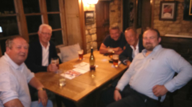
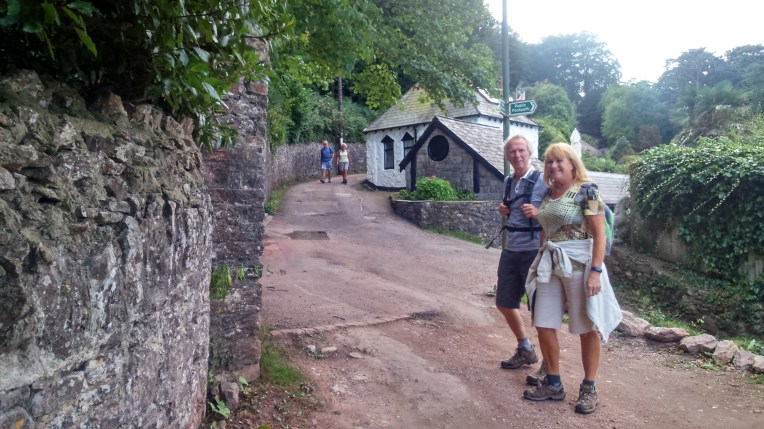
                          Longmeadow Farm Campsite, Shaldon and fellow campers.
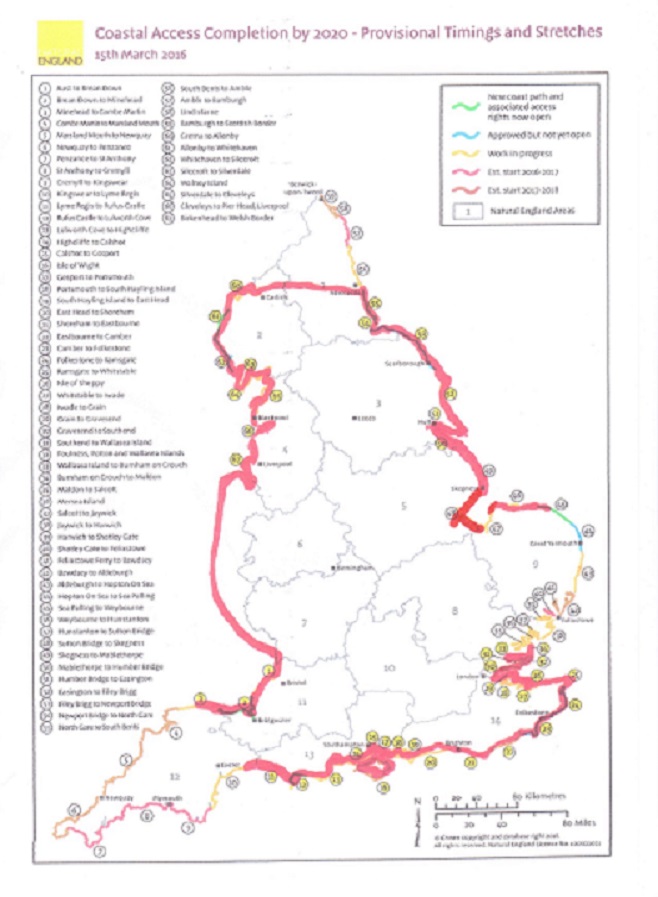
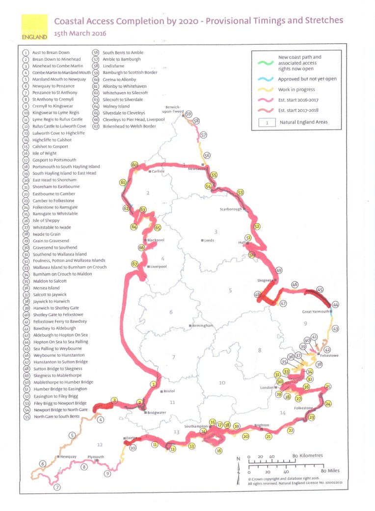
MAPS

coastal-access-map-16-september-2016

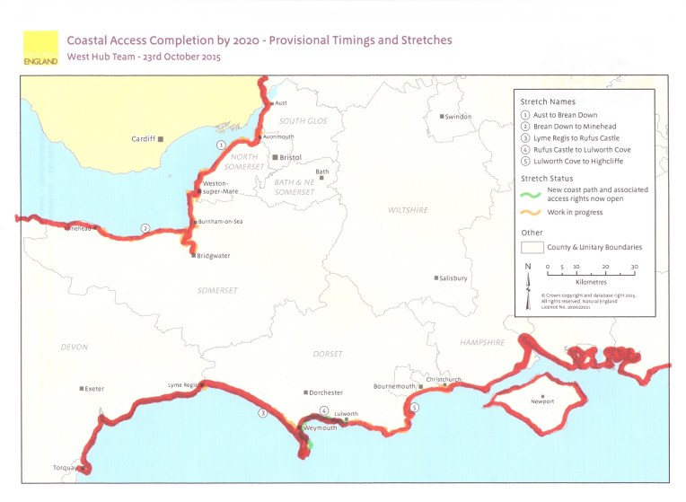
       The Crimson Worms are slowly wriggling their way to Land’s End, I think the Southern one will win. This trip’s 30 mile haul is barely perceptible on the England Map;  so to make it feel I’ve achieved, I’ve added the West Hub’s Map,  below. Now it looks like  looks like I’m getting there

swcp-16-september-2016


This is Episode 69 in a series of letters to our Grandchildren who are following my walking the proposed England Coast Path, which is due to be fully in place by 2020. Meanwhile I am joining up the dots of existing well known coastal walks, plus Hadrian’s Wall and Offa’s Dyke to complete the England circumnavigation, often getting very lost in the (aging)process, but hope to be finished by November, 2017


Dear Rosie, Lauren, Stan, Jake, Rowan and Maisie,

Extra holiday activities for Rosie and Lauren involves packing up and moving house; for Stan and Jake, they have learnt how to ride a bike, with Rosie on her balance bike and Maisie attempting to dance on one leg. She is much better than Nanny and Bobl, who are learning to  Jive on all four legs. Strictly chaos. Don’t forget the Conga practice!

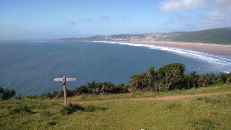
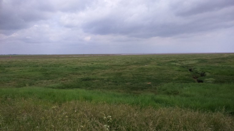
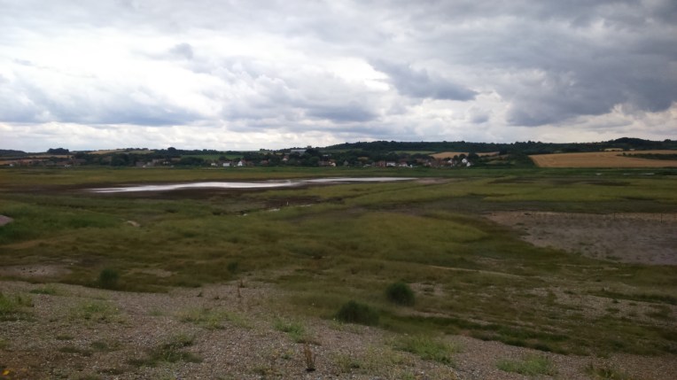
Now the School Holidays are over, the S W Coast path has emptied  and the Summer temperatures are reducing, I returned to Dawlish Warren to tackle more of the fragile,  undulating South Coast heading towards Torquay.

I stayed at Longmeadow Farm Campsite, Shaldon,  on the West bank of the River Teign opposite Teignmouth. Eexcellent facilities , plus a pet farm with a variety of small farmyard animals. I got on with the pigs best and their constant snuffling. Farm produce was for sale. I didn’t buy any bacon.


Some useful numbers. On Thursday, September 15th, Walking Day 191, I pitched up at Longmeadow Farm Campsite in Shaldon, opposite Teignmouth, Devon for 2  nights.  A charming site overlooking the River Teign and mainline railway, with added pet zoo to entertain the children , adults and me. I  qualify for either category. The pigs were excellent company. The site was also excellent. The animals were very tame,  and the electric hook-up, the two free fridge – freezers were a boon  in the late summer heatwave.

Open brackets: The electrics are now a requirement on my camp site selection procedure; ‘fraid I’m getting a bit soft as I immature; the cell phone, battery back ups, laptop, kettle, sandwich maker and inspection light all require power. Previously, the car coped but draining the battery and jump starting the RAV4 laden with gear, not my idea of a gentle walk round the coast. Even so, I still always park facing downhill.  Close brackets!

Get back to the numbers!

This trip lasted to walking day 193, Saturday ,  17th September and covered 30 miles, bringing the Grand Total miles walked round England’s Coast to 2601, with about 475 miles left to go. I wonder if I’ve got enough left in the tank?  After Day 191, I was beginning to doubt it, the constantly undulating cliff edge and numerous diversions and alternatives were major obstacles to staying found , as opposed to getting lost. And the recent 5 week lay off was  throwing gremlins in my stamina. Not to mention the recent bout of forgetfulness. I was without essential equipment, having mislaid my bag of navigation and recharging equipment before  setting off from home. I then managed to leave my sticks somewhere before even starting the walk in Teignmouth. I probably have now reached the stage where I need a minder. Henry – take note. Hopefully, if things work out, Henry will be joining me, later,  for a day, from Torquay onwards and beyond – or till something gives! Please don’t expect too much, Henry. In fact expect anything. There is little or no regulation in the Walking Industry.

Viz:- Recent clause about to be added to terms and conditions

In the event of flagging energy, inclement weather, adverse wind, (flatulence or any inconvenience ) I have deemed it perfectly acceptable  to seek refuge in any suitable hostelry or similar for as long as it takes. I have actually given up alcohol, except emergencies and special occasions. It is surprising how many emergencies and special  occasions six grandchildren can create, Maisie?

And a corollary: Any  form of transport, other than feet or ferry, is perfectly in order to get to said hostery/home/or place of safety, providing no account is taken of mileage accrued during  rescue.                                                                                                                                                    I have in mind   piggyback/wheelchair/wheelbarrow/bus/taxi/ambulance/fire truck/ RNLI/ Air/Sea Rescue. Some of this has actually happened…..

ps my mislaid bag of navigational  etc essentials turned up at Auntie Annie’s, Rosie’s and Lauren’s  new house where I had mistaken it for a removal item to be transferred from the old house. It is generally agreed Bobl is better off walking rather than helping house moving. Carry on!

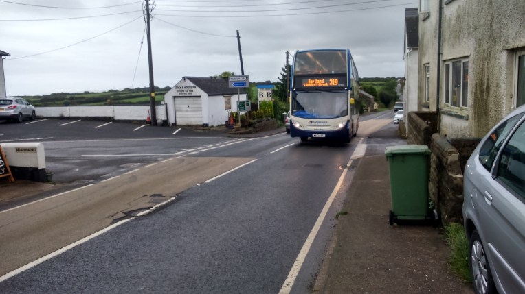
I was doing the numbers – other useful numbers were 22 and 32, which were the go-to  Stagecoach buses shadowing my route.  The drivers deserve accolades; diversions were in operation in Torquay while the authorities vandalised the streets by completely ripping them up in a most haphazard manner. Lack of direction, overhanging trees and parked vehicles added to the chaos and travelling on the top deck was better than Alton Towers.

Modes of transport – top left Teignmouth Station Platforms 1 and 2  ; the ubiquitous Stagecoach 22 – If you wait 10 minutes the 32 comes along too; the Cliff railway looked hairy to me – viewed from a distance you could see the cliff collapse nearby;   all aboard via the gangplank for the Teignmouth to Shaldon Passenger Ferry; and the train service from Teignmouth to Dawlish Warren was swift but a bit pricey – they don’t take the oldies bus  pass.


Got to finish the numbers…Platform 1 and 2 at Teignmouth and also Dawlish Warren can be added in to the equation; very useful in studying the Dawlish coastal railway route so recently destroyed in storms and so impressively reinstated by Network Rail.

Aside; The tale of  O/S Explorer Map OL/20 -South Devon. My trip this time was mostly on OS Explorer map 110, but I usually carry the preceding map and the subsequent maps, just in case I’m ‘really lost’. I did a deal with Dash-4-it and then Millets and eventually got all the English Explorer Maps with blue on them ie Coastal Maps,  except for some reason OL 20 was lost. Bad omen? I realised I was short and rapidly got Millets to courier the missing item which arrived just in time. I popped it in the Navigational/Electrical hook up bag, which as we all now know I left at A-A’S, R’s and L’s.  Realising I would be lost without map continuity, I needed to get  a third version.

I use the M5 on my way to Devon, and am at the stage of life where stopping at every services is mandatory. Serendipity dictated that on my way to the facilities I passed a WHSmith posing under the banner of Roadchef, all brand spanking new having been recently refurbished. Worth a go – the Map section wasn’t comprehensive, but the one I needed was there waiting – new issue too, containing the mobile download – unlike others . I could now not be ‘ totally lost’ – but  don’t rule out just ‘lost’.

The twist in the tale was having now purchased three versions of OL 20 and mobile downloads, I never covered enough ground to actually make use of its contents. I’m still on Explorer Map 110 ! But they do overlap a little bit.

I wonder if Millets/ Dash4 It/ WHSmith do refunds? Albeit the only receipt I have is from Roadchef?


At last we have come to the end of preliminaries; so to the journey;

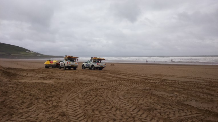
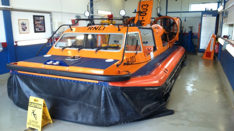
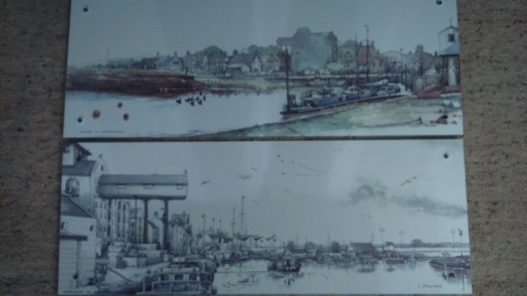
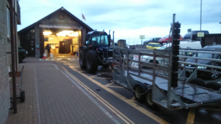
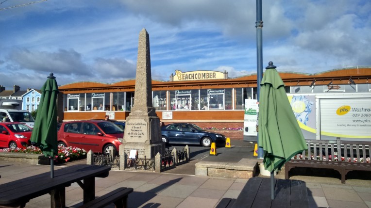
Day one I left camp by car to Teignmouth Station and took the train to Dawlish Warren, returning via the SWCP and Dawlish, Holcombe and a tour of Teignmouth. It was late and all usual facilities were closed ; Pier, Beachcomber, RNLI Shop but the Two Annes – the lifeboat was deployed on an exercise and the Harbour was busy and interesting.

dsc_0323

The Two Annes Lifeboat had gone AWOL from the RNLI Station when I arrived – maybe it’s out on a rescue

Next day, I returned this time by ferry from Shaldon and visited the same venues and purchased usual souvenirs of RNLI but lost my sticks. Back across the very fierce River Teign by ferry and onto the SWCP again and steeply up to The Ness and along the fragile cliff edge.

Passing by Smugglers Cove and Labrador Bay, Maidencombe, Watcombe, Torquay Golf Club, to Babbacombe all the time climbing and descending in very short order. At the Golf club I was overtaken by a couple of couples doing the same route as me but faster – well there were four of them. As a group we found our way up more hills, they were due to take the busroute back to Shaldon. I quickly executively decided to take the bus back too. The hills had found my Achilles heel, and every other vulnerable spot in my anatomy.

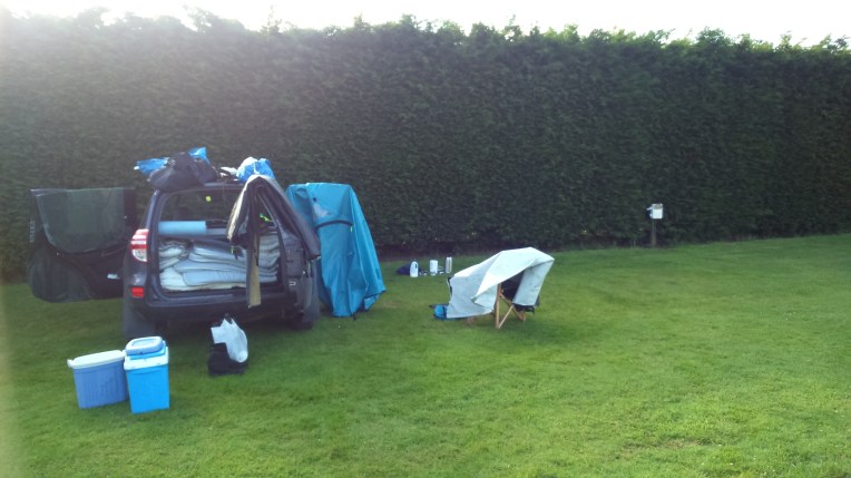
The final day I broke camp. And learnt a valuable lesson.  When I first arrived and set up camp, hooked up the electrics and boiled the first kettle, I began to notice a burning smell. Smelling is not my strong point, actively or passively. I kept checking the electrics. Nothing obvious, but I disconnected overnight. The next day was the same , as was the final day, but I couldn’t find a culprit.

Until I packed the groundsheet. Beneath it was the remnants of a buried camp fire! Not alight, but the dampness was sufficient to create the smell of burning and accordingly an associated whiff of fumes. And I had pitched right on top of it unknowingly. And possible silent suffocation.  Most sites do not allow open fires for obvious reasons and there are strong fire and fume  warnings about lighting  camping  gas cylinders in tents and awnings. This is another good reason for not allowing it.

Eventually,like a Phoenix from the Ashes, I packed the car, and set off early back to the restart point in Torquay. Out of the fire into the frying pan, I left the car somewhere in the morass of roadworks, I struck out on foot to cover as many miles as I could whilst leaving enough energy to complete the drive back to Shropshire.

I succeeded in negotiating Black Head, Hope’s Nose, Thatcher Point, Daddyhole Cove and the descent into Torbay New Harbour and Marina. I found a bus stop at the bowls club where I caught the 32 back to the road works and found the car first time, overheating in the heat wave. I’ll get out of the kitchen for a while.

And so to Shropshire.   Where the lush green grass is growing too fast for me to keep up…

Next Start point –

The bus stop at Torbay Bowls Club.

The same again in pictures;


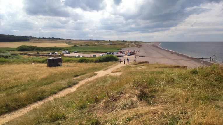
Top left; I had the pick of sites so I pitched on top of a previous camp fire – and no that is not my TV Aerial; Dawlish Warren re-start of the S W Coast Path heading for Torquay; it wasn’t quite high tide so I could get on the path alongside the sea- views looking back to Starcross and ahead to Dawlish; Brunels failed Atmospheric Railway almost ran along here, enlargen to read why it failed.


The new mainline resurrected after the washout at Dawlish; showing the centre, the railway station and  Coryton Cove as I head for the hills again.


Looking back at Dawlish and heading for Teignmouth – you cannot miss that sign….


Below

Looking for fishing boats on Shaldon beach ; nothing suitable but I found the ferry to Teignmouth


dsc_0338

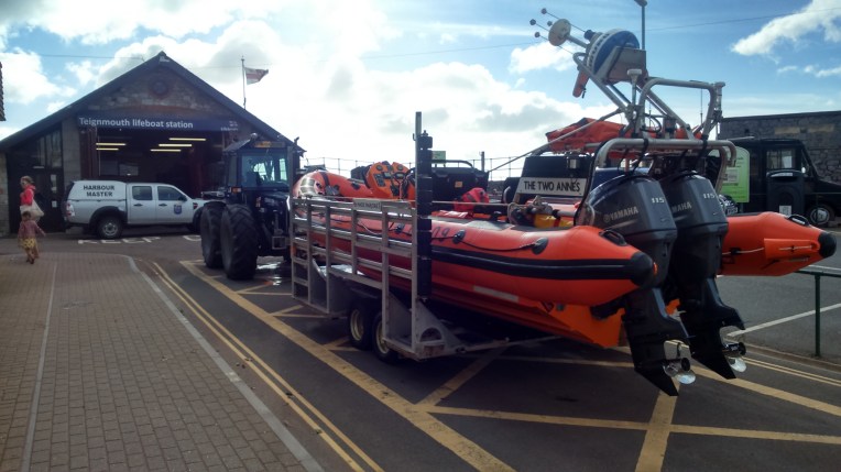
The Two Annes back in her cradle after an exercise


dsc_0339

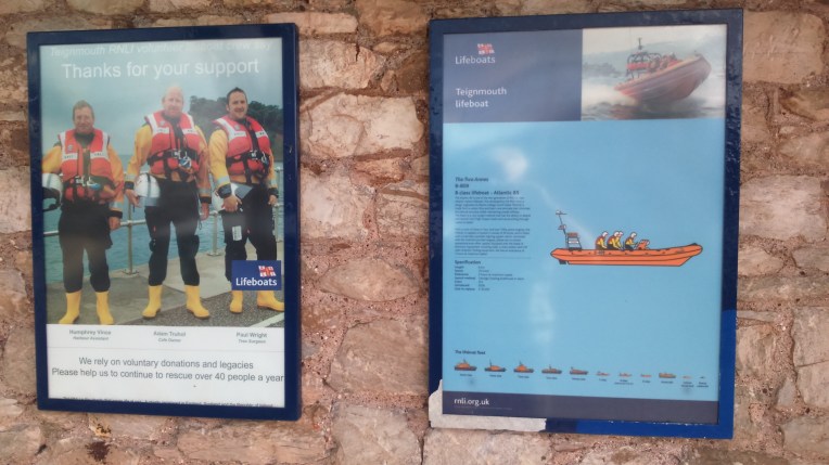
The caption says the crew is Humphrey Vince, Adam Truhol and Paul Wright and the star of the show is ‘Two Annes’, the Teignmouth Lifeboat


The Pier at Teignmouth with views of the town and up and down the coast. The end is in sight but not open to visitors as it is in  a dilapidated state.


dsc_0342

My favourite Coffee house in Teignmouth, where I left my sticks all day and came back  to find they had looked after them all day. The latte wasn’t bad either….


dsc_0350

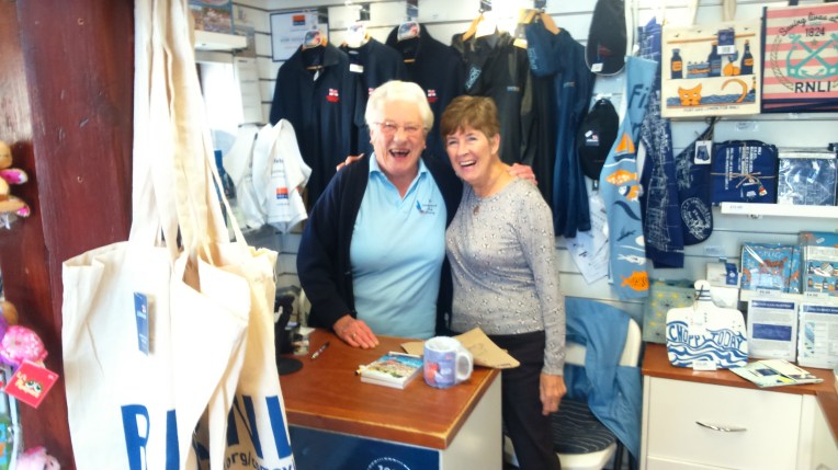
Babs and Penny were perfectly happy and enjoying their voluntary work at the Teignmouth RNLI Shop until I suggested adding making coffee to their repertoire…. those are my purchases on the counter..

The ferry back to Shaldon from Teignmouth crosses a vigorous stretch of the River Teign


Still very hilly and fragile , the SWC Path takes me through Maidencombe, Watcombe and St Marychurch  past the Cliff Railway to Babbacombe. Looking back the Railway appears to be quite close to a recent slip.


dsc_0378

I met Nigel, Val, Derrick and Roz, after they caught up and overtook me alongside the Torquay Golf Club. I managed to keep pace for a while; I think we were all suffering from the switchback. I think the final stretch at Anstey ‘s Cove  heading for the Palace Hotel decided everyone to start finding a bus stop and attached bus taking us back to Shaldon.


dsc_0382

And here is that bus – eventually.

The final day took me from The Palace around the coast by Black Head towards Hope’s Nose


Hope’s Nose was busy with itinerant fishermen in many of the nooks and crannies, it was rugged and difficult to access without a bit of climbing. I took my time, and aroused the curiosity of the anglers , who wanted to know who I worked for. They appeared happy that I was retired and chatted about their not so good fishing today. I retreated from Hope’s Nose and  I moved on  further round the SW Coast Path along the cliff edge again.

Thatcher Point, Thatcher House and Thatcher Rock hove into view and I followed the path as it descended into Meadfoot Beach


Thatcher House recedes and a Devon  ice cream van appears; so too did Christine Hammond in the final strides of her South West Coast Path Walk as we passed going in opposite directions. How does one long distance walker recognise another? Well it helps if you are both following a known trail in opposite directions; and then the equipment is generally well used and reduced to minimum necessities – no frills; and something in the eye by way of steely determination and certain efficient  way of walking; and guesswork . Often loner but in Christine’s case two Sherpa/handmaidens were tending her equipment in the background. She gave details of her S W Coast Path trip as 60 miles to go. That’s a great effort. The total is about 630 miles. She looked as if she didn’t get as lost as I do.  I have her blog details of   birthdaywalk2015.blogspot.co.uk  and I will compare notes when I’ve written this up. God luck Christine ! I hope you finish in style.

It’s always nice to meet someone likeminded – we agreed that we had got our territory back now the tourists had departed. Another attribute – very possessive! And no BMI issues.

Two quirky photos – you can always tell when I’m tired and emotional and stop concentrating on the walk  – I get artistic with the photos – it uses up time! It took ages to balance that toy boat…… and the SW Coast Path actually goes through someone’s turret


Top Left; Torbay Marina entrance and the other two show the East Pier from the west Pier  and vice versa – just to prove I don’t miss anything out…


……AND FINALLY…..


Grid ref  SX 907 634

My restart bus shelter at Corbyn’s beach just opposite the Torre Abbey Bowls Club.


I’m going home…. Maybe back next week?


STILLOENGLAND/68, 190 Days, 27Miles on the SOUTH WEST COAST PATH . From VELATOR QUAY To HORN’S CROSS Passing Through BARNSTAPLE


Read on to discover my progress on walking round England’s Coastline, with added Offa’s Dyke and Hadrian’s Wall  making a complete circuit

Here’s a map of where I’m at, the description is by way of a letter to our Grandchildren and photos highlight the notable points along the way

coastal-access-map-12-september-2016


Dear Rosie, Lauren, Stan, Jake, Rowan and Maisie,

Before reporting the latest walk, let us wish Maisie all the best for her recovery from the injury to her poor bad leg. I hear she has been very brave and  so far is a perfect patient. I cannot believe that she will not find an ingenious way to get around somehow and terrorise Jake with her plaster cast. Speedy recover Maise! And you’ll soon be joining me on the Coastal Walk. I think I could probably carry you……

dsc_0194

Velator Quay Start point on the South West Coast Path this trip.

My circumnavigation of England on foot, following the South West Coast Path stretches, was approaching Barnstaple in  Devon. The specific task this visit was to pick up the walk from my previous visit to  Velator Quay near Braunton, and negotiate the Rivers Caen, Taw and Torridge, and traverse Barnstaple, Instow, Appledore and Westward Ho! finishing up 27 miles later at Horn’s Cross. The accumulated total walked at the end of this stretch, is now 2571 miles, leaving about 500 miles to go to the finish. I have achieved this on 190 non- consecutive days since November 2013. All this latest walk was recorded in pink highlighter on O/S Explorer Map139, making the sheet look like a bowl of spaghetti had been spilt over it.

I was based at Marshford Camp Site near Diddywell, Northam and I relied on buses 19, 21 and 319, and the Appledore/Instow ferry to position myself in between Coast Path walks.

dsc_0270

Stagecoach 319 delivered me to Horn’s Cross


The Instow/Appledore Ferry across the River Torridge – acceptable alternative for the Coast Path but only for an hour or so either side of high tide.


Signage of the South West Coastal Path was not the best and once I found my self the wrong side of a thick  bramble, which extracted an armful of blood from thorn scratches, as toll for letting me through from a housing site which unfortunately seemed to have obliterated the footpath – or my interpretation of the map was in error….


Alongside the A361 and the River Taw, I followed the Coastal path  inland heading for Barnstaple


The Taw Bridge, midspan,  completed a few years ago, has simplified the route of the Coast Path into Barnstaple and I headed for The Railway Station and Bus Interchange for buses back to the Campsite, and Instow and Westward Ho!


The South West Coast Path is also the Tarka Trail from Barnstaple to Instow and follows an old railway line. All the paraphernalia of the railway is still in evidence including Fremington Station – except for traintracks. But the Yelland Power Station has gone, fed from coal from South Wales, that dried up on the demise of the Coalmines and the raison d’etre for the railway line in the eighties.


The ex-railway track feeds into Instow Harbour  and the passenger Ferry carries the Tarka Trail  across the River Torridge from Instow                              ……………..to Appledore Quay.


Housing in Appledore is tight and the lifeboat is permanently moored in the Harbour ready for a quick getaway. But the LifeBoat Station was closed , so no souvenirs – perhaps next time round?


The Taw/Torridge Estuary, Nature Reserve a Country Park and Golf course. Salt Marshes, Pebble Ridge and Sand Dunes. A dynamic and sustainable combination and a gentle, level stroll back to the coastline.


But sand dunes appear and the walk becomes more of an ordeal through the undulating soft dry sand and the wind picks up and moves the sand around.


So a different tactic involved walking the sands which were firm but wet, and consequently my walking boots filled up. Not the first time. The nights under canvas were damp and not surprisingly the tent  attracted other creatures in search of shelter. One morning putting my boots on, I judged that one of my  arch supports had shifted. Quick investigation revealed not an arch support but a distinctly shaken, slightly flattened, fat slug, who had made his/her home for the night in my boot. 


Tally Ho! Lo and behold; and so Westward Ho! hoved into view – the wide bay; and the hotels and big church built into the hills giving them a wonderful panorama.

Originally Charles Kingsley’s novel Westward Ho! was written about Bideford nearby. It was a best seller and developers saw the advantage of a Hotel called Westward Ho! on the prominent part of the seafront; it multiplied and the settlement grew and took the same name; The only destination in England with an exclamation mark!


dsc_0250

Panorama of WESTWARD HO! See my footprints.


dsc_0247

Looking north, from Westward Ho! towards Braunton Burrows 


I had the choice of walking the cliff edge which was quite difficult with the constant rise and fall , not to mention the instability. So I won’t mention it. Or the seashore which was littered with boulders all shapes and size, except those of a size convenient to walk on. There was the occasional shower of debris from the eroding cliff face, a stern reminder that the whole lot could come tumbling down in a moment. The National Trust’s Greencliff looked daunting from a distance and so I chose the seashore route; I was rewarded with steeply inclined and very eroded strata above, and then another likewise but also folded in on itself. I suspect a geologist’s fantasy. The tide was high and I kept an eye on the width of beach available to walk without getting cut off. There was no formal way off the beach when I decided my allotted time on the beach was up, so I chose the lowest cliff around and scrambled to the top. Several earlier footprints suggested others were of the same mind. Incidentally , now the school holidays are finished it is a relief that the congestion  of walkers has subsided and I’ve got the walk back to myself. I’m not totally antisocial, but when the walk turns into follow-my-leader and dodge the traffic coming the other way, it’s not so inspiring. Although at times , when alone, you miss the opportunity of sharing something unexpected – the rock formations, or seals, with someone else. And doubts sometimes descend; someone kindly pointed out what if you turned your ankle? Or worse – ran out of food – or –  ..I just don’t go there, but keep subscribing to the RNLI and the Air Ambulance. 


dsc_0281

Not too many people would see this as the route goes along the cliff top.


dsc_0280

You can just see wooden steps ascending Greencliff behind the green debris; I chose the seashore since the climb was a steep 60 metre or so. But could I get round that bluff in the distance? Only one way to find out!


The S W Coast Path carries on  but I turn inland at Peppercombe Castle heading for Horn’s Cross, where be public transport – or taxis for the three lads ahead of me.

This is where I’ll begin again next time out. 

This stretch from Horn’s Cross to Westward Ho! was actually done South to North, but I have written it up as if  it were vice versa, for reasons of continuity. I got caught out by being too descriptive of my avoiding Greencliff climb…I’ll walk backwards next time..


STILLOENGLAND/67, Day 187, 34 Miles Along NORFOLK/SUFFOLK COAST PATH – WINTERTON ON SEA TO CRAZY MARY’S HOLE

I’ve been away for a while, having a rest from walking, camping and  blogging – but I’m back  now, slightly overweight and struggling to get back into the swim of things, but the tide will turn and when I find my seal egs it will be all plain sailing….DSC_0076


You have unluckily found your way onto my report back to our Grandchildren, Rosie, Lauren, Stan, Jake, Rowan and Maisie, about the continuing ramblings of an intrepid England coastal circumnavigator as I meander  my way  around the proposed England Coast Path after the fashion of G K Chesterton’s  “Rolling English Road”. You know the one where he says…”The night I went to Birmingham by way of Beachy Head”…. or “the Day   I  went to Glastonbury by way of Goodwin Sands”  – or my version this last week – the time I went to Crazy Mary’s by way of Caister -on-Sea – nearly works! Read on to learn all about Crazy Mary……. Spooky?


Adding in the 34 miles this trip, I have stumbled 2544 miles in 187 walking days, spread over about 33 months. ‘About’ because there is doubt about when I  decided I was really doing it; now I have estimated I have about 530 miles to complete, I think I can claim to be  underway. It’s all downhill from now, except most of the remaining trek is on the South West Coast Path which I have found so far to be very uphill as well. And of course, I do go off course , a lot,  so the numbers are merely academic.

I’m resuming on the Norfolk/ Suffolk Coast Path walk after our summer break, brought about to avoid walking in the heat and copious tourists getting in the way and trampled underfoot. Back on the road again I noticed things have changed. Analogous to my phone and broadband, I’m slower, lack energy and I’ve lost more memory, and bits of me that haven’t already fallen off seem to hurt more. Also, I’m now reporting in  on Nanny’s borrowed laptop since mine Brexited early following La Summer break in France. On returning to blighty, we appeared to forfeit our right to the Internet; not only that – we had 15 litres of English diesel, and the can, confiscated by the Gendarmerie despite our protestations that the French Oil Refineries were likely to strike at any time. On principle, I never argue with any female  gendarmes wearing side arms. That is not sexist, but just entente cordiale.

Without fear or favour, and to show I’m not racist either, this trip, I have had a walk- in with the Suffolk Constabulary over their right to park a mobile speed detector van on the footpath. He did not wear a side arm, so I was a little more opinionated…. for the purposes of this blog  I am predominately a pedestrian, but at other times, also a driver too, and  occasional dog walker, child minder, bus passenger, cyclist and future mobility scooter operator… roads are for vehicles, paths are for the  others, and I’m concerned about the increasing intrusion of one over the other.   I think I offered a sustainable case until he responded ” and your point is…..?” I detected this was another way of saying you are wasting Police time.

But I have learnt that the most dangerous parts of all my rural walking adventures  are when I’m directed onto the highways and byways and footpaths disappear or are blocked and overgrown and pedestrians are forced into the roadway vying  with traffic entitled to travel at sixty mph. In urban situations, cyclists seem to be permitted to seek refuge on the footpaths, all-terrain four wheel drive pushchairs and mobility scooters run amok and dog leads get longer by the hour, and other traffic appears entitled to park and manoeuvre on paths if the road is not wide enough. Rant over.

As usual I have wandered off piste. Back to the Coast Path.Arriving in Scratby near California, I took up my pitch at the Scratby Hall Campsite, who are recovering from the seasonal load, with plenty of space and generous facilities (heated swimming pool) and very helpful staff. Beyond their control was the hacking smoker’s cough of an occupant(e) of the nearest tent and the farmer’s bird scarer in the next field. But I was off walking at Sparrowfart, so neither intrusion got to me.


Inside and outside the tent at Scratby Hall Farm; not a lot of room either way.

The weather and buses were excellent; Scratby Hall Campsite gave me a comprehensive bus leaflet with routes, maps and times, and I flashed my elderly  bus pass with great effect over all three walking days on the 1, 8 and 99 routes which maximised my walking time and ferried me to and fro from walk starts to finishes. The drivers were good too; one time on the 99 a passenger pointed out an elderly lady in the distance who he knew wanted to catch this bus. The driver patiently waited several minutes on  until she boarded.

DSC_1500      The Coast watch Station at  Winterton-on- Sea,   finish for Episode 66 and  starting point of this Stretch. 

As I was saying! I resumed the Walk from Winterton on Sea , halfway down O/S Explorer Map OL 40 The Broads – this took a battering as it is a double sided map – not a good idea – I can imagine it as pulp if the weather had been inclement. Fortunately it becomes  Explorer Map Number 231 at Crazy Mary’s Hole.

Walking South and keeping to the coast, except where forced inland by cliff collapses, I soon regained my stride passing through Caister-on-Sea to Great Yarmouth. Crossing the River Yare involved a huge U-turn and detour of about six miles to end up in Gorleston-on-Sea. Back on the coast, I headed for Lowestoft promenade via Hopton-on-Sea, Corton and Gunton. After traversing Lowestoft Docks I found the start of the Suffolk Coast Path and followed it along the coast to Pakefield where the path turned inland to join the A12. I found a bus stop level with Crazy Mary’s Hole, and didn’t wait long for the Number 99 to pick me up and return me to the car. And the tent and off home very early next morning.


Now for the pictures…..

Back on the coast again, my old friends from the previous trip were swimming along with me


DSC_0030

….and the Hemsby Lifeboat being tucked up for the night….


Caister Life Boat Station

Records go back to  1281 outlining many disasters on the treacherous sandbanks and Caister men have been pledged to saving lives for centuries – their motto “Caister men never turn back”

DSC_0039

…..and Caister Lifeboat Shed was not open for business, so no souvenirs, only their information plaque. It  is an independent station funded locally and by Jim Davidson after whom two boats were named.        Donner und Blitzen?


Scroby Sands Wind Farm is the longest established offshore array in the British Isles. I spent some time with their Engineers discussing  facts and myths about wind turbines.  In an earlier Episode I described being waylaid by a couple very opposed to offshore wind farms . I recalled most of their arguments and played devil’s advocate only to be comprehensively swatted away. The future’s bright – the future’s e-on  (if it’s windy)


Postcards from Great Yarmouth – oh I do love to be beside the seaside….  I went out as far as allowed on Brittania Pier and Wellington Pier…. not very far compared to Southend Pier!


Further down the coast towards the docks I was also denied access to the North Pier at South Denes despite grovelling in the reception of the Harbour Master – H and S – I have an address to write to but life’s too short.


Departing from the coast again and walking back along the River Yare and the berths servicing the offshore industry. Then doubling back on the West Bank towards Gorlestone-on-Sea and the South Pier which I could access.


Gorlestone and South Pier, home of RNLI Lifeboats and  giftshop with volunteer Jane, and lifeboats old and new.


Leaving Great Yarmouth and Gorlestone for Lowestoft, the coastline is  more fragile and comprehensively propped up, baffled and protected by rip rap rocks.


And then the path disappeared and took the signage with it, forcing me onto the coast road with no footpath but plenty of drivers who wanted to wipe me out.


Richard the most Easterly lobster fisherman at the  time!  Ness point is the most easterly point of Mainland Britain and for a while I was the most easterly person as I perfected the half-pie selfie on the man made extension to the mainland.

Richard had numerous tall lobsterman tales to tell and knew every nook and cranny of the groyne, and every fish caught and nearby disaster and drowning. I spent an interesting hour or so re-charging my batteries. I wonder if he lives there? I forgot to ask about Crazy Mary.


The Euroscope at Ness Point, the most Easterly bit of natural mainland, identifying all the compass points and destinations round Britain and the World. From there I could have set off in the right direction for Land’s End or John O’Groats.  But I’d soon get lost.

DSC_0114

Hamilton Dock. Yet again I was stopped going into docklands by security, but this time Guard Kevin made up for it and I lost yet another hour to stories of a memory challenged little old lady trying to break in to meet her boyfriends in the hidden caves beneath the piers; the diver who was chased off his job by a guard lobster that severed his finger and slashed at his legs – he needed an ambulance; and the illicit early morning setting-off of an emergency repeater flare that attracted the police and the press; and the pet dog given an industrial fluorescent warning gizmo so his owner could see him in the dark, off the lead – unfortunately others mistook it for an UFO  – much to the delight of the local papers. Still no sightings of Crazy Mary.

The A12 and the coast footpath share the lift bridge over Oulton Broad. Traffic chaos ensues whenever  a boat requires the bridge to be lifted, much to the consternation of the local wine group, who ,when upright have a reserved view of proceedings. Is Crazy Mary there?

RNLI at Lowestoft South Pier, lady volunteers June and Ann served me my lifeboat mug. I think I must have collected about half the fleet’s mugs on my journey round England. I’ll have to go around again to pick up those I missed .


DSC_0132

Lowestoft South Pier, about 90% open.

Lowestoft Claremont Pier, I tried hard to get to the end but couldn’t get permission.

Digging more holes looking for Crazy Mary.     Doug was buried up to his head. I wonder if they ever dug him out? And the fishing fleet beneath Pakefield Cliffs looks distinctly tired.


DSC_0147 
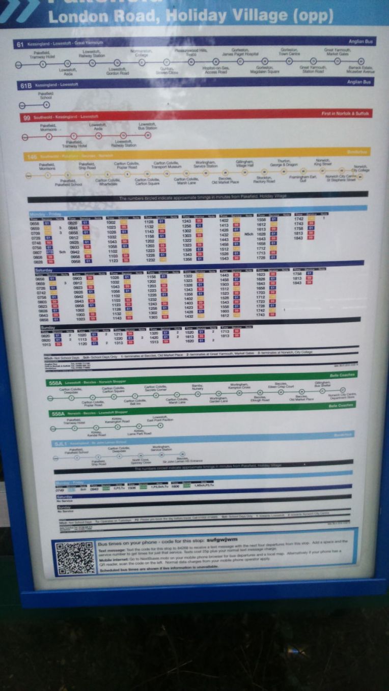
And the bus timetable for future reference – The buses run to Southwold – Kevin’s home town, about which he told many stories.

The trip finished here –  34 miles – level with Crazy Mary’s Hole – my start point next visit.

Crazy Mary is the ghost of a fisherman’s wife. The Fisherman died tragically and she is left wandering and wondering about his return. She is often seen in the area around nine in the evening looking for her husbands sails hoping he is safe and well, but in vain. She died of starvation…….. I start my next walk from Crazy May’s Hole – anyone care to join me…… appropriately there is a Look Out Station nearby.

Very Spooky!

Should I pitch up there?

Answers on a postcard please.

Sleep tight.


STILLOENGLAND/66, Day 184, 41 MILES on NORFOLK COAST PATH From CLEY NEXT THE SEA To WINTERTON ON SEA. The Grand Total passes 2,500 miles with about 560 miles to go.

DSC_1492

Seal of Approval

Continuing my letter to our six Grandchildren and anyone else foolhardy enough to follow  my circumnavigation of England’s diminishing  coastline made into a complete circuit by including Offa’s Dyke Path and Hadrian’s Wall Path.

Coincidentally, Episode 66 published today on the 50th Anniversary of England winning the World Cup  at Wembley in 1966, Saturday, July 30th.


SPOT THE LATEST WALK ON STRETCH MAP (45) , BELOW

Coastal Access 28 July 2016


Dear Rosie,Lauren, Stan, Jake, Rowan and Maisie,

NUMBERS.

30th July 2016.

Fifty years since England won the World Cup, in 1966, at Wembley. I went with three schoolmates, Dave, Pip and Dick. We had tickets for all England’s matches, and we drove to Wembley in Nanny Tab’s Ford  Anglia, or Dave’s Hillman Minx, and parked in the Wembley side streets  outside Dick’s Uncle and Auntie’s house and walked to the stadium. After a cup of tea and much fussing from Auntie…. we won the cup and drove home! Simple?

Dave also sent some souvenirs – and a picture of Southend Boys when I was Rosie’s age; see if you can spot me and  Dave?

David Lloyd, Trevor Rhodes, Greg Hatt and Nigel Chapman were from Southend High School as well. Old Southendians might spot them?

The accompanying write up said I scored a goal from Dave’s ‘gentle’ free kick and I thought I shinned another ,but the report gave it to someone else! The goal post broke when Greg Hatt ran into it; he was a big lad! Some Old Earls Hallians may remember Greg too. He  and Trevor were later scouted by Arsenal, and David and his less well educated , bandy left foot, abandoned me on the left wing, and  representative soccer, in favour of tennis and winning Junior Wimbledon,   and had a string of Tennis, Fitness and Leisure Centres named after him….  whereas Dave, Nigel and I carried on educating the rest of our bodies, brains and minds in the sixth form


Those were the days my friend(s)  I think…..

Last Monday we celebrated Great Aunt Janet’s 70th Birthday in Leicestershire, we couldn’t be much further from any coastline. Tuesday morning saw us hurtling Eastwards to resume my confrontation with the rolling Norfolk coast.

So Great Aunt Susan, Great Uncle John and now Great Aunt Janet have all exceeded the seventy limit – that only leaves me, and before I do it I must have walked round England…… derestricted.

Back to Walking Days 182 to 184, Tuesday to Thursday,26th to 28th July, 2016, accompanied by Nanny as Back up driver, and therefore not camping but this time staying at the Very Best Exotic Mount Lavinia B & B, in Sheringham. Highly recommended.

This latest journey, trying to follow the Norfolk Coast Path, which irritatingly , irregularly and irrationally, but normal for Norfolk,  disappears or turns into The Paston Way.  I  restarted on that first day at Cley Windmill, after squeezing between two houses and heading due North along the River Glaven until meeting the North Sea. After which I turned sharp right and  followed a fairly level easterly course mostly  along the seashore, sometimes atop a fragile cliff edge, in places eroding at alarming pace. I passed through Salthouse Marshes to Kelling Hard and left O/S Explorer Map 251 for Map Number 252 and onto Weybourne and Sheringham.  Eleven miles and enough for the day, we retired to the B & B, after an  F & C supper.

The following day everything  was expected to be in place for an epic record day’s hike; early start, prevailing wind at my back, level coastline; clearly defined route and regular back up from Nanny. We made the re-start  at Sheringham at the same time as the first storm clouds  and waited while they emptied themselves as we sheltered in the car.

Eventually the rain relented and I set a South East course for Happisburgh, via Cromer Pier, Overstrand, Mundesley, Bacton and Ostend.  After nineteen miles, I relented on achieving a record day’s walk at Happisburgh when the route got somewhat irregular. Not surprisingly since the  cliff edge and village are disappearing rapidly. Back to a Crab Salad at the superb No 1 Cromer Fish and Chippery.


The final Day’s walk got me off Map 252 and onto OL 40 Explorer Map named self importantly The Broads. I kept very near the coast all the way to Winterton on Sea, only losing the sea view when the sand dunes got too high to look over.

But what a surprise when I regained the shoreline……. look at the pictures!  Very carefully….DSC_1484


For all three days walking I managed a respectable 41 miles; making the Grand Total 2510 with an estimated 566 to the finish line. For most of  the last day and  over four miles I was escorted by many seals who appeared friendly, playful and communicative. But photo shy. They kept me company when no one else was around. Very uplifting.


Pictures

Leaving Cley Marshes Nature Reserve and following the Norfolk Coast Path along the shoreline with the tide going out.


DSC_1409

Salthouse and Salthouse Marshes three miles or so into the walk.


Rendezvous at Weybourne for refreshments while a bulldozer hauled a fishing boat from the tide and the fishermen unloaded their catch

DSC_1415

Looking back, ascending the shallow cliffs in late afternoon  with the tide receding and the sun struggling to break through the threatening cloud, and the fishermen’s catch ready for sale elswhere


The fragile nature of the cliffs approaching National Trust’s Sheringham Park ,  and  the cornfields turn into a golf course


Top; Sheringham approaches and the I R B Station and slipway; and bottom, the railway station for North Norfolk Railway. This is the terminus for this service, but it is linked in line, across the Sheringham level crossing with the National Rail Service , heading for Cromer and beyond.  I finished my walk here today.


Resuming the next day from Sheringham seafront, the glow from the brightly coloured fishing boats dimmed as the the clouds gathered , the rains came and the walk was delayed – despite full wet weather gear


Everything is a bit fragile, the erosion is relentless…


Early morning, Lifeguards keeping an eye on us even as the tide recedes and the weather is foul and very few people around.


Cromer Pier in the distance and when I got there a Chinook flew low overhead clinging to the coastline? I visited the Lifeboat House whilst on the pier.


Life inside the Lifeboathouse.  Maureen in the Gift shop tried everything to find a souvenir mug with the local boat’s name on it, to add to my collection. Even visiting the mess room to see if there were a used version in the washing up! But no luck – it seems RNLI are no longer selling them.

So I purchased the Cromer teatowel instead!


Cromer Pier and RNLI Station from the outside


RNLI Museum at Cromer, a short walk from the pier. Volunteers Angela and Pat serving and very helpful. Views of boats inside and outside taken from the upper levels of  the museum


Moving on,  a mile along the beach looking back and forwards, tide incoming , careful not to be cut off when it reaches full strength and comes in with a bit of surge


Retreating inland to find the rain had left the clifftop very muddy, but I eventually  followed the lane


DSC_1467

Came across this heavily protected ball along the way – can’t identify it nor give away its position just in case I shouldn’t….


Back to the shoreline and the sun’s back and tide going out, heading for Happisburgh and then to Mount Lavinia. for B and B.


DSC_1471

Sadly Happisburgh is rapidly disappearing into the sea, a victim of the constant erosion. The story is told above and it seems nothing can be done to significantly affect it.

Even the lighthouse is vulnerable – its predecessor has already disappeared. But happily just about here, one mile out of Happisburgh, I travelled my 2,500th  mile of this walk; its downhill all the way now


Approaching Sea Palling the vast open expanse of beach and flats  are empty. The sea defences have recently been reinforced by eight artificial reefs  formed off shore providing habitat for sea birds nesting on the sands.  Security guards stand by should any wayward holiday maker intrude beyond the markers….


Boards explaining the flood defences and note the siren which goes off as a flood warning if the defences are breeched.


DSC_1482

You are being watched……


DSC_1484

….I can see you…


DSC_1485

…at first there was only one seal…..  butDSC_1488

a lone elderly swimmer got a bit of a surprise and as I progressed along the beach  the seals left  to go their own way and I went mine, or so I thought…….


DSC_1489
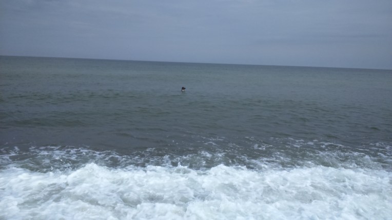
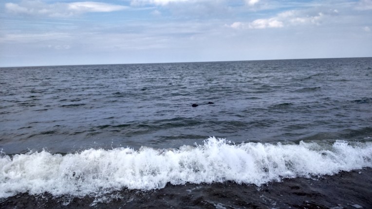
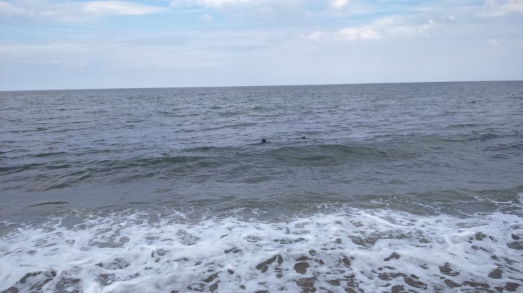
……….but they  returned and called to me when I had not immediately noticed them….DSC_1490……and soon there were more . Every time I moved to a new bay formed by the breakwaters they appeared; this time there were several but it was difficult to capture them surfacing altogether. They swam just below the surface and accompanied me to  the end of the groynes. It was difficult to move on and leave them behind when they seemed to want to communicate. There were few other people around and they seemed to have adopted me as I walked along their beach while they swam alongside for several miles.


DSC_1489

DSC_1492

Instructions for operating the seals. They were good company and it was sad to say goodbye before I reached Winterton on Sea.DSC_1495

DSC_1496

Byeeee….

DSC_1497

….and all gone; only the wide expanse of Winterton Dunes National Nature Reserve….


DSC_1499

until Nanny came striding towards me, to see what had been keeping me.DSC_1500

We returned to Winterton on Sea Car Park having completed eleven miles today and made many new seal friends. This is the Volunteer Coastwatch tower. Starting place for the next walk…


STILLOENGLAND/65, Day 181, 35 Miles on the S W COAST PATH – BRANSCOMBE AIRFIELD TO DAWLISH WARREN – GRAND TOTAL 2469 MILES – 607 TO GO, maybe…..


Background.

This is a record of my walk around the coastline of England  in the form of a letter to our six grandchildren.

By November 2013, I had completed the 180 odd miles of Offa’s Dyke Trail and decided to extend the route northwards from Prestatyn, and Southwards from  Chepstow. For variety, I occasionally completed stretches of both banks of the Thames below Woolwich, and when the weather permitted , I joined the North East and North West coasts by following Hadrian’s Wall.

I am trying to keep to the proposed route of the England Coast Path, which English Nature hope to have fully operational  by 2020. Hopefully my journey will end before then and before my 70th birthday in November, 2017 when I should have made the complete circuit of England.

The Grand Total Mileage above represents the distance I have actually walked so far, including getting lost and making circuitous journeys when I have no other means of returning to where I started. It represents a very accurate total of  miles walked by me, but a not very accurate measurement of England’s perimeter.


Dear Rosie, Lauren, Stanley, Jake, Rowan and Maisie,


The Crimson Worms are  neck and neck heading for Land’s End on the South West Coast Path, and the third is  curled up and dormant on the Isle of Wight. The one at Dawlish, Devon, has its tail at Maldon, Essex; and the other at Braunton, Devon stretches back to  Cley next the Sea, in Norfolk. We’re going to visit that next…..

Coastal access 21 July 2016

I stayed at Branscombe Airfield and Camping Site for the second time, I enjoyed it so much on the first visit in May this year . But this time they actually had aircraft activity. It was a bit of a surprise to see a light plane in amongst the tents and caravans. This one in the top left picture is due to be delivered to a collector in Eastern Europe, after being restored on the site. Bottom right is my Walking Card (courtesy of  markbuck) with the link to this blog; which I distribute on my travels to anyone unfortunate enough to engage me in conversation. In return I distribute hopeful fishing boat scenes back to Mark for him to capture in water colour; go to         https://www.flickr.com/photos/markbuck/       

See if you can recognize some of the scenes amongst this very talented collection


Numbers and Summary

Walking Days 179 to 181, Monday to Wednesday,  18th to 20th July, 2016. Starting at Branscombe, and following the South West Coast Path westwards through Sidmouth,  up Peak Hill to High Peak, over the River Otter to Budleigh Salterton, quickly past Straight Point live Firing Range,  to Orcombe Point and the River Exe at Exmouth.  I walked off the edge of O/S Explorer Map Number 115 at Exmouth and on to Number 110 across the River Exe to Starcross,  by way of The Passenger Ferry, Orcombe.  a four mile return trip, which I claim for my tally. My westward journey ended at Dawlish Warren and I returned to Exmouth, and found the RAV4 and so to home, very overheated. I used Buses from Stagecoach and First Buses, the 157 and 9A, for positioning and cooling down.   Numbers for the temperature during all three days, reached unbelievable heights and one of them was the hottest day of the year.

I moderated my pace, and started early in the day for coolness and managed to accumulate 35 miles, with no actual getting lost included. This brings the Grand Total to 2469 miles and reduces the outstanding mileage to about 609. High points were at Weston Cliff Trig Station, 162m;  Higher Dunscombe Cliff, 156m;  167m at Peak Hill and 157 at High Peak Trig Station. I ascended those very slowly.  


Pictures.

My apologies for some of the shots. I think it got so hot at times that condensation formed in the camera. Some pictures appear as if in a heat haze, but since  I’m not going to be repeating the walk any time soon,  please treat the effect as artistic, and we’ll say no more about it.

A short stroll from the campsite at the Branscombe Airfield took me back onto the South West Coast Path and National Trust Property at Weston Cliff, and the sea. The land mass on the horizon does disappear in sea mist or heat haze – nothing to do with the camera. Back on unstable cliff edges, some of the earth slips were quite recent and more were due,  judging by the fresh cracks opening up.

In little over half a mile the path took me on a switch back from Weston Cliff, 162m,to Weston Mouth, approaching sea level, back up to Higher Dunscombe Cliff at 156m. I struggled in the mid-afternoon heat.

=


The heated rollercoaster ride continued down  through Salcombe Mouth back up  to Salcombe Hill Cliff, more National Trust Territory, then descended into Sidmouth, where, just off the Promenade, I found the Bus back to Branscombe Cross. Well, nearly.  The bus driver said it was too dangerous to drop me off at those crossroads and he let me off at the Donkey Sanctuary instead, where I could walk the back lanes to the Airfield. Judging by the continual braying , it must have been feeding time. Sorry no pictures – it was also closed!  But it did put me in mind of our new Foreign Secretary….


Next morning, I hid the car in shade,  bright and early to walk in the cool of the morning with very few people around.  I found Jacob’s Ladder on the way out of Sidmouth; maybe I would have been tempted to have a dip later on. It was a steep descent to the beach  with  no way out other than returning up the zig-zag path which carried  on to Peak Hill and High Peak 157m  in  about a mile. That set the pace for the rest of the day. Slow.


Part of the  S W CP route up Peak Hill combines with a busy lane , which has a six foot width restriction and no footpath. Survivors are encouraged to take the steep staircase hidden in the undergrowth to continue the long slow climb to High Peak


         .                  High Peak , the trig station  and the Ladram Bay view from the top


Ladram Bay used to have two arches but in the last century they have eroded to isolated lumps, as depicted in the moisture affected picture belowDSC_1310


Maximum use of the land – the farmers bring in the harvest of silage right up to the cliff edge,next year the field might have slipped seawards


The River Otter comes between me and Budleigh Salterton. I could have forded it at the U-Bend but at waist deep and slippery and slimey, I couldn’t risk the collateral damage should I slip. I was carrying too much technology, so the two mile diversion  inland was acceptable. It was a nature reserve and had its own charm.


Especially for Mark – Budleigh Salterton beach with failed fishing boats – I’ll keep looking.


DSC_1322

And the path out of Budleigh – uphill of course


DSC_1326

From near West Down Beacon, the view over Straight Point Rifle Range to the left. The shooting can be heard for miles – pity the caravan site?


DSC_1327

Littleham Cove fromStraight Point – rapidly eroding cliffs turn the water red – looking back to Budleigh Salterton.


The Geoneedle at Orcombe Point celebrating Earth’s structure along the Jurassic Coast and the view of the River Exe emerging  into the English Channel.


The Lifeboats at the RNLI Station ; my souvenir mug tells me the main vessel is a Shannon Class lifeboat ‘R and J Welburn’ 13-03.


Now at Exmouth Ferryboat Terminus at The Point with a hostelry  to slake my thirst and chatting to Gordon prior to catching my bus to Sidmouth. 


I forget all the names – I said I would – but I did promise Mr and Mrs John, Dave, Tim and Phil an appearance in the Blog. They invited me two nights running into their banter tent, and cross examined me on the Walk. Between them , and probably not in their imagination, they had climbed , run , cycled, spieled, fished and walked most challenges worth a go in Britain and Europe. Have I missed anything?

 They were surprisingly agreeable too, especially as I was the sole Southerner amongst  a melange of Cheshire, Lancashire and Yorkshire.  Also surprisingly I kept mostly sober, not all the inmates could claim likewise. I wasn’t going to jeopardise my walk with a hangover. Good to meet you all and hope your golf , cricket, walking drinking camping  holiday is memorable. And you manage to shake off the after effects of the bloody nose, snoring, smoking and flatulence. We shouldn’t go into detail. And finally I really did not know that about Billy Connelly, and the slur to the family name about  Michael McIntyre will best be forgotten….  maybe…  .


And so I left the Campsite just as the above party was waking from its slumbers, I was about to make my way home via  Exmouth , the Ferry to Starcoss and a quick ten mile walk to Dawlish Warren and back, four miles attributable to the boat journey.


I will be back to Dawlish Warren only when it is very much cooler….

Top – Exmouth Harbour new and old;

Middle  – one end of the jetty at Starcross is the River Exe Ferry and the other end is the  Dawlish main railway line,  so heroically and rapidly reinstated after the storms of two winters ago;

Bottom – the inlet at Cockwood, tidal and muddy at low tide as I found when I tried a short cut, on the way to Dawlish Warren. On the return journey, I was forced into it because I could see the ferry approaching the jetty and it wouldn’t wait! I also saved precious minutes crossing the beach to access the  jetty via the ladder, rather than the circuitous journey through the Railway Station. But don’t try that when the tide’s in.


The Ferry journey across the River Exe, to and fro, two miles each way, very relaxing on a hot summer’s day…. byeeeee… see you next in Norfolk?


STILLOENGLAND/64, Day178, 30 Miles on the S W COAST PATH – COMBE MARTIN TO VELATOR QUAY, BRAUNTON – GRAND TOTAL 2434 MILES – 642 TO GO.


Start point this trip, The South West Coast Path, near Combe Martin , follow the trail of acorns………but  watch the speed limit. Many of the posts and stiles have a grid reference inscribed on the white disc. Very helpful.

And also very helpful was Mark with his Walking Card for me to offer in response to queries about my walk and blog. In return, I am continuing my search for the perfect fishing boat setting for him to reproduce in water colour. At present I am trawling my photo library for suitable pictures – this may take a little while, since I believe there are about 10,000 pictures….. filed randomly….


Taking the form of a letter to our Granchildren, various ages two to twelve, this is the latest in a series of blogs entitled “Still O England” recording my walk round England’s Coastline with added  Hadrian’s Wall and Offa’s Dyke included to complete the circuit, as it were. I operate on several walking fronts and can choose where to renew the walk, but usually only when I have recovered from the last Episode; that is  walking and writing it up; both take their toll; one physically and the other mentally.

“StillOEngland”  took over from  “OEngland”  at Episode 59 – refer https://rdmaccord.wordpress.com  for previous Episodes. Also containing the rules and The Anthem and reasons for doing this.

My route blue print  for the walk is Natural England’s  Pr0posed  England Coast Path, anticipated ready for strolling in 2020. In the meantime, I am ploughing my own furrow, using their provisional route, shown below. The crimson worms indicate my progress to date, which I estimate to be about 80% complete.

The map  can be supplemented by English Natures Regional Maps eg

ECP-south-west-map July 11 2016A      Click here to show the Natural England’s intended route for the England Coast Path in the  South West. I have nearly reached Barnstable to the North and beyond Lyme Regis on the South Coast. Only about 600 miles  to go on the  original South West Coast Path.

Coastal access 11 July 2016

Dear Rosie, Lauren, Stan, Jake, Rowan and Maisie,

When I am suitably rested and ready to walk again, I can select where to start again from five active fronts on the English Coast; namely Newcastle,Norfolk, North Essex and either of the South or  North  Coasts of the South West Coast Path.

Weather forecasts, prevailing winds, tide times and availability of Nanny as full time back up, and therefore use of hotels, all came into the selection process.

I  chose, this time,  to continue my walk around England on the very last front mentioned, the Northern section of the South West Coast Path from Combe Martin  on the North Western tip of Exmoor. I  headed for Ilfracombe, Bull Point Lighthouse, Morte Point, Woolacombe, Baggy Point, Croyde, Braunton Burrows, Crow Point finishing short of Braunton at Velator Quay.

No buses or trains this time – Nanny is taxi-ing me everywhere – even Porlock Hill.

My previous Grand Total Miles walked was 2404 with assessed 672 miles to the finish.

In three days, 176 to 178, Saturday July 11th to Monday 13th I aggregated 30 miles horizontally and struggled several miles vertically and longed to be back on Norfolk’s flat terrain. It’s all recorded on O.S. Explorer Maps OL9  and 139 in pink, and further etched and  enscribed in Cyberspace by courtesy of   Nikes GPS Sportwatch, which records every detail, provided I switch it on , or off, as the case may be. This acts as hard evidence that someone is out there walking the English coast wearing my watch, while I sit in the nearest pub writing the blog. You’ll never know! Get in touch   rdmaccord@outlook.com if you want details of The Nikeplus Site. I can’t believe some of the places I’ve been.

So, the new Grand Total is 2434 miles, with 642 miles left.

Now for a touch of drama – I’m not sure I’m going to finish this .Brexit, Arthur Ritus and other recent family interaction with The NHS has thrown up timing difficulties with completion of the challenge. Why didn’t I start ten years ago?

Nevermind – I’m  certainly not giving up – but you cousins might have to entertain the possibility of pushing me round the remainder of the course in a bathchair….. so get training!

Footnote – A Bathchair was the forerunner to the Sinclair C5…..


Now the pictures…

Signs of the times – the universal acorn; No Dumping – really?; National Trust Golden Cove; and last known view of my O/S Explorer Map 139, which may still be hanging there. Fortunately, I found a replacement


The South West Coast Path or Tarka Trail clings to the cliff edge or follows the A399 via Sandy Bay, Golden Cove, Small Mouth, Watermouth Harbour, Watermouth Castle Theme Park and Samson’s Bay through the foliage, back on the trail again……..

 ……………….and looking back on  Watermouth Harbour from the path around Widmouth Head.


Top left -Ilfracombe in the distance; top right the A399 is protected from walkers by Armco barriers , walkers get what’s left –  but the views are worth it;  firstly Hele comes into view and then Ilfracombe  outer harbour; and finally the inner harbour with the tide out.

Time for a beer and fish and chips from the harbour shops and a good look at Verity by Damien Hirst.

Next Day, following a night not under canvas or goretex, purchase of a new map 139 complete with mobile download, Nanny dropped me off a the Museum to pick up the trail out of Ifracombe. The curator, even at that early hour on a Sunday, managed to put me on the correct trail out of town.


Leaving Ilfracombe; the kilns of the Museum;  the notice says it is Ilfracombe and names the church Emmanuel and the gardens Runnymede; one of the occupants wasn’t going anywhere; and The National Trust owns Torrs Walk which is my route out of town; and looking back proving it is me behind the camera.


Steady climb. Leaving Ilfracombe at near sea level, on the South West Coast Path/Tarka Trail via Flat Point heading for Lee Bay passing trig point spot level 206 meters.  20mph speed limit is unnecessary.


Back at sea level, Lee village was the designated coffee stop but  nowhere to park for the back up vehicle, so up the steps to Damage Cliffs, clinging to the cliff edge again until reaching……..


…the lighthouse at Bull Point, the graveyard of hundreds of vessels. It was built in 1879 but rebuilt in1972 inland after a rockfall


Access to the beach at Rockham Bay and later I met  61 year old Malcolm in the middle, always on the fiddle. He said he’d been on route from Brighton via the South West Coast Path for ten weeks, heading for Bristol. He said he had only eaten water in the last week! He seems quite happy holding my trip rations, sliced meat, cheese, figs and nuts. 


On the way to the very rugged Morte Point and round the corner, at the aptly named Windy Cove,  heading for Woolacombe where I can replenish my stomach having missed my coffee break and lost my grazing rations to Malcolm.

DSC_1211

The Cavalry arrives with food rations.


DSC_1215

Woolacombe Sands  from the Putsborough end of Morte Bay


DSC_1218

Morte Bay and Woolacombe Sand  from Napps Cliff heading towards  Baggy Point.


Baggy Point was particularly windy and quite high with  general levels around 100 meters above sea level


Leaving Baggy Point and making my way to Croyde Bay where Nanny was waiting to escort me back to the hotel after walking  15 miles, up and down and into the wind. 


DSC_1238

Next  morning, back to Croyde Bay, with the RNLI setting up their Lifeguard patrols for the day.


Three miles from Croyde to Hannaburrow Lane and next back up rendezvous was characterised by the trail sharing the B3231 with traffic. I preferred the wind and rock climbing of the previous walk.


The next few miles alongside a golf course and then a military range took me to the River Taw and Crow Point in relative safety.


Leaving the Military Danger Area behind and walking along the River Taw sea defences until the Caen River and finish at Velator Quay , where Nanny was waiting with more rations. Nine miles completed this morning

After our picnic lunch we set off for home, via Rosie and Lauren’s home.   To rest and recuperate in time for Stanley’s next performance as the Owl in ‘ Alice – The Musical’


STILLOENGLAND – EPISODE 63 – INFILLING THE WASH – 21 MILES FROM KING’S LYNN TO HUNSTANTON – 2404 MILES COMPLETED – 672 TO GO.

Warning – This is targeted at Two to Twelve Year olds. Teenagers and Adults may read but watch your attitude and behaviour. There may be stuff that’s beyond older comprehension; if so, consult your nearest child. Or me,   Thank you!

Are you sitting comfortably?


Then I’ll begin……


The Crimson Worm Count – down to three – stretch 47 swallowed up 46, as I passed  2400 miles in  total at approximately Heacham.  The longest reaches from Combe Martin, (3) towards the   the northern end of the South West Coast Path, up the west coast to Hadrian’s Wall, across to Newcastle and down the east coast as far as  Cley next the Sea in Norfolk (45). The second wriggles from Maldon in Essex (34), around the Thames Estuary, via Woolwich Tunnel to the south coast as far as Branscombe (10). The Third is content chasing its own tail around The Isle of Wight, (16). The numbers in brackets refer to the Natural England Stretches on the map below.

For me to complete, and hang up my walking sticks, I have  Newcastle to Berwick on Tweed, (56 to 59), Maldon to Cley , (34 to 45) and the rest of the South West Peninsular, (3 to 10).Anyone wishing to join in, I suggest the Norfolk, Suffolk and Essex leg is easiest, and leave the other two for the more adventurous! I reckon about 672 miles left to complete.

Coastal access July 1

Dear Rosie, Lauren,  Stan, Jake, Rowan and Maisie,

We’re now getting into the end of school year tests, concerts and sports days. It’s the only reason we know it’s summer, ‘cos the weather isn’t giving much away. Anyway I’ve seen some of your various performances and my end of term report is – I’m impressed with everything you are all doing. Maybe the water pistols were a test too far for parents, but then that’s Grandparents prerogative.


SUMMARY AND NUMBERS

This is Episode 63 of my walk round the Coast of England, which I started in November,2013, shortly after completing Offa’s Dyke Trail.

[ASIDE For earlier editions of the blog  REFER  https://rdmaccord.wordpress.com ]

Over this last extended weekend I managed  to meet all of you, Jake and Maisie in Derbyshire,  Stan and Rowan  in Norfolk and Rosie and Lauren  in Worcestershire. That’s a lot of travelling.

By glorious coincidence, which some have previously called serendipity, I discovered Stan and Rowan were going to be in the same Norfolk corner of England, with their parents, so , on the hoof, as they say I amended my plan to walk forever, and allowed myself a busman’s holiday day off – I would go and watch Donald torture himself on a triathlon at Holkham, Norfolk.  Formally known as The Outlaw Holkham Middle Distance Triathlon involving a gentle swim in the lake; a breezy bike ride on the open road and a three circuit  run around Holkham Hall grounds. Now add in the numbers; 1.2 miles for the swim; 56 miles for the bikes; and unlucky 13.1 miles for the run; and two transitions.   After all, this is really good blogging material and shows the tortuous obsession to swim/cycle/run/walk oneself into the ground has touched at least two  generations of our family. Uncle Andy and Auntie Ann are also guilty. I don’t think any of you cousins will escape either..

And so, just a one day 21 mile  walk this time out, to  reconnect to The Norfolk Coast Path; Day number  175; Saturday 2nd July 2016;  walking alongside The Wash from The Great Ouse at King’s Lynn  to The RNLI Station at Old Hunstanton via King’s Lynn Docks,  North Wooten, Castle Rising,  Sandringham, Wolferton, Shepherd’s Point,   and Heacham. Aided and abetted by The Coasthopper Bus and the 505; Ordnance Survey Explorer Maps 249 and 250 and camping two nights at King’s Lynn Caravan and Camping Site on the A47, near Middleton. Copious apologies due for any inconvenience  – more later!

The crimson worms have reduced to three, now the Wash has engulfed  the Norfolk Coast Path.

Top Row , The Campsite near Middleton  – very good facilities and  calm and peaceful until 5-30am Sunday morning when my car alarm took off as I was breaking camp! I think I got away with it?

Middle Row; my aide memoire to help me find the car after a day’s walking; and the Great Ouse approaching King’s Lynn, and finally  the quay at the town centre.


The journey proceeds towards Old Hunstanton, with photos taken at about one mile intervals – or more frequently if  warranted.


DSC_1099

The Fire Station, North of King’s Lynn on the A1078, warrants it because I collect Fire Stations. Donald, Annie  and Andy used to live in one, much older than this in The Heart of Brum, it used to  house horse drawn fire engines…in the good old days. Subsequently, it became famous for its parties, which only ever seemed to happen when Nanny and Bobl were away…. strange that? And visitors  occasionally let me know they’d already been to my home, beforehand.


Leaving King’s Lynn heading  the north, I had to divert to the A1078, away from the coast line, inland, because after asking directions at the Docks, the security guard said I could go through  , but no one ever did because the path led nowhere, and after that there were no footpaths or signposts. I heeded his advice and spent the rest of the morning trying to get back to the riverside. In vain.


DSC_1101

Looking to get off the trunk road and away from the congestion, there was supposed to be a footpath here heading to the old east seabank, but it was all very  recently planted with corn and therefore a self imposed no go area. Farmers win again. A good case for the Local Authority R O W Department. 


I carried on along the heavily trafficked main route out of King’s Lynn, fortunately there was a parallel cycle track to North Wooten, through suburbia, so I was insulated from white van man for a while. There is a game going on for them to see how close they can get without actually running me over.

The cycleway route 1, was very pleasant to follow; someone had given plenty of thought to separating the traffic, but unfortunately it all ran out before I reached Castle  Rising.


Back on the road again; pedestrians , bikes, cars, lorries and public transport all share one narrow strip of tarmac maximum speed sixty miles per hour. But the view would have been worth it at Castle Rising, (second and third pictures), had not a small car with large occupants  intruded on my chocolate box shot just  as I was taking it.

Never mind , every black lining has a silver cloud, and they were lost, asking me where was the castle , in a North American accent. I consulted the map and might just have sent them off in quite the wrong direction…. 

DSC_1112

Swan and Cygnets on the Babingly River taken from the A149 at Babingley Bridge, past Castle Rising.

Occasional cycleways but generally lanes with no footpath led me towards Wolferton, with a big surprise waiting.


A complete Royal Railway Station, without the trains, at Wolferton. It is preserved just as it was I the sixties, when it served Sandringham and royal visits.


But I’m still well off the coastline. With no direct roads or footpaths. Good luck English Nature when you come to plot the England Coast Path in this region. I  headed directly for the Wash National Nature Reserve alongside The Ingol. It is defined as Access Land on the OS Explorer Map, more notably a bird sanctuary. Other areas were signed as Wild Fowler’s territory – two extremes alongside eachother. One nurtures the other doesn’t.. both are very possessive.


Now back on the coastline that started to change dramatically. Squalls were coming across the Wash and hitting the shore, sometimes unloading their contents on me. Despite the July date , the heavy  rain was extremely cold and soaking ; there was no shelter. After passing over, the sun reappeared and I dried out fairly quickly.  Quite a contrast.


As I progress, alongside The Wash, mile by mile up the coast towards Hunstanton, the tide was coming in covering the vast mudflats…….

..and cutting off my progress along the beach, which halted abruplty at Old Hunstanton .


DSC_1134

So back to the cliff top promenade heading for the Lifeboat Station.


DSC_1161

One of very the few Hovercraft operated  by RNLI  at Hunstanton. Ideal for rescues over the extensive mudflats. I visited the RNLI Shop and added to my collection of souvenirs. Most RNLI Stations have a  gift shop with many useful objects for birthday presents or the like.. The volunteer staff are always willing to show you around and tell of daring heroics they have pulled off.  One of my favourite Charities, together with Help for Heroes and Shropshire Air Ambulance. 


By the end of the day, after taking the CoastHopper Bus back to King’s Lynn and the 505 back to the carpark; and the car back to Holkham Hall,where  Stan and Rowan were waiting patiently for World famous French’s Fish and Chips from Wells Next The Sea. Extra patience was needed after Donald joined the World famous queue, but it was well worth it.

And so to my tent in King’s Lynn, to await my early morning call, which I shared with other campers….


DSC_1140

Next morning I dried out the tent and packed up – and made an executive decision to watch someone else torturing himself rather than continue my walk. Uncle Donald was nearby at Holkham Hall doing a half Triathlon and Stan Rowan and Auntie Sarah were there too , to support him. So I joined in…. supporting , not competing.  I don’t do swimming, cycling and running. Certainly not all in one day.  


Holkham Hall near Wells next the Sea, is transformed into a swimming, cycling and running centre for the Outlaw Half Tri -Athlon, complete with campsite and childrens’ entertainment.


Donald’s finishing time of 5 hours, 50 minutes  and 17 seconds, outside the medical tent and with family and medal


And so  to stay with Jake and Maisie.And then to Rosie and Lauren. It’s all go!


STILLOENGLAND-EPISODE 62- FOSDYKE TO KING’S LYNN VIA SUTTON BRIDGE – 37 MILES- TOTAL 2383 MILES -693 TO GO.

I’m walking the coastline of England before my 70th Birthday in November 2017 and reporting back to our six grandchildren via this blog. The headline banner shows how far I’ve been and approximately how much is left to do…….


DISCLAIMER – This Episode was written in the early hours, under duress, whilst listening to the referendum results, and without benefit of my proof reader who is due to return to work from NZ  tomorrow; please correct typos and spellings yourself?


Below, the Crimson Worms are slowly closing in;  next time out I’ll join King’s Lynn to Hunstanton. but meanwhile I’m getting some rest.

Coastal access June


Fosdyke to Kings Lynn    Click  here for the Natural England East Hub Provisional  Stretch Map showing my walk from Fosdyke , below Boston, to King’s Lynn, via Sutton Bridge. In terms of Natural England  Stretches, I have completed  ‘9’,  and part of ‘8’ to, quite specifically,  Clenchwarton Road, King’s Lynn.


SUMMARY AND NUMBERS

Walking the sea bank  round The Wash from Fosdyke to King’s Lynn, crossing the Welland, Nene and Great Ouse, using Ordnance Survey Explorer Maps 249 and 250.

Walking days 173 and 174,  20 miles and 17 miles, 18th and 19th June 2016, respectively.  Total this trip 37 miles. Grand total 2383 miles with 693 miles to complete the trip.

Camped two nights at the Rose and Crown, Holbeach Hurn, and a third night at Peter and Lorraine Thompson’s home at Market Deeping Lincolnshire; and a visit to our old family home at Deeping St James, from where four of us emigrated to New Zealand nearly forty years ago,.and five of us returned 30 years ago. Strictly speaking, in total we were, and still are, a family of six.  Whenever Nanny and I get the chance we visit Baby John at  rest in Peterborough Cemetery and bring him up to date on the latest goings on. But not this time, on my own,  without Nanny; there will be many more opportunities for both of us , of  passing by, whilst walking the coast of East Anglia. We could introduce you all, too , if you’re comfortable?.

DSC_1017

Our home in Deeping St James; it wasn’t Gardenia, or is it magnolia, when we lived there?

Bus service 505 and The Ship Inn provided transport and refreshments; as did Peter and Lorraine to a very high and entertaining standard that I mustn’t get used to.  But suitably lowered by revellers Martin, Peter (again), Harvey, John and Matt at The Five Horseshoes at Barholm, below, mine is the empty seat, and half full glass. They ensured that my glass was never empty. I’ll be back….DSC_1082

And the conversation lingered on subjects familiar to me; Shoeburyness; Southend United ;Local Authorities; walking round England and Spain, Serendipity and Spiritualism, in that order and with intensity proportionate to liquid consumption. Thank you gentlemen. I wish I could be greeted by such a welcoming committee at the end of every stretch, although I think progress on the route march would  eventually suffer, but totally in the spirit of G K Chesterton’s Rolling English Road. My Anthem. That night I went to Barholm by way of Chestnut Close. Harvey, you’re inspirational, but I don’t think I’ll have a Comino Pilgrimage left in me after circumnavigating  England, then Wales. Laurie Lee never did say what the Spanish was for ‘Can I please have a drink of water’.

Back to the small kids….


Dear Rosie, Lauren, Stan, Jake, Rowan and Maisie,


That’s all for the adults above – now for the important stuff. Rosie’s Birthday on Thursday – something else happening that day but the Euro-in-out vote is not as important as Rosie ‘s big day. Everyone now should have their water pistol, I know Rowan has because my knees are very wet. And Donald’s drone birthday Present is armed with a camera, and not a water gun. And guess who is returning home after three weeks in Auckland  with her Mum? Notice even Maisie refers to Mum, not Mummy!

The route I took from Fosdyke to King’s Lynn was fairly level , keeping to the top of the Sea Bank most of the time. The scenery only changed as I approached the rivers cutting into  The Wash, The Welland, The Nene and The Great Ouse. The weather was good to me and serendipity played no small part in the Bus Service eventually  carrying me back to the car on a Sunday; Peter Thompson kindly provided the taxi service on the Saturday, where no amount of Serendipity would have substituted for a non-existent transport service. Having used the Ship’s car park all day, it was only fair to partake of their food and drink , also. Reccomended.


And now for the pictures

Camp site at The Rose and Crown in Holbeach Hurn at dusk; The Ship Inn at Fosdyke where this walk started; and the start of the sea bank walk alongside the River Welland; all looks delightful but the hardly used track was knee high in damp wild flowers and sodden grasses and my lower legs were soaked in minutes!

Keeping on the sea bank, views out to sea and and inland were notable for lack of water, except the sodden undergrowth. These pictures were taken at mile intervals.


A brief flurry of things other than wild flowers and grasses as I approach the  Military danger area. The usual warnings not to pick up any metal objects and not to wander into the bombing range. And the occasional pump house provides alternative buildings to the Military Observation Towers .


The S E corner of the Wash is a National Nature Reserve, and supports huge numbers of wintering and passage waterfowl.. The saltmarshes are important  for breeding waders and seabirds.


DSC_1045

The twin lighthouses either side of the river, guard the entry to Port Sutton two miles further upstream.


And I happen upon the River Nene, with a rush hour of river Traffic as the walk nears  Port Sutton.

.

Port Sutton cranes and Sutton Bridge crossing the Nene; and the signpost for overnight halt and restart next morning, Sunday, on the Peter Scott Walk.


Suburban Sutton Bridge; breaking camp at the Rose and Crown; and heading for the Peter Scott Walk.


Alongside the River Nene heading for the Wash on the  Peter Scott Walk


On the East bank of the Nene, The Sir Peter Scott lighthouse, his home from 1933, was built with its twin on the West Bank, in 1830. Paul Gallico Wrote The Snow goose here in 1941, although for artistic licence the lighthouse was situated 80 miles south! Sir Peter Scott, in 1947, illustrated the book.


DSC_1067

The normal seascape where the saltmarsh dominates the foreground with mudflats beyond is soon to be disturbed…….

……..Civil Engineering activity off shore with dredgers  providing for a cable for the Race Bank Wind farm and on shore the sea bank is being breached  to bring the cable ashore and temporarily interrupt the the walk with a half mile detour. And not everyone is happy about it


After the Civil Engineering interruption the walk  reverts to open grassed saltmarsh


DSC_1075

The River Great Ouse introduces itself into the Wash National Nature Reserve.


The path alongside the river heading for King’s Lynn hit an unexpected Sewage Works.

Temporary loss of concentration caused a deviation from the path and I was divorced from the River and around the Works. It became an immediate problem because I was on time for the pick up bus 505 to take me back to the car. Any delay and I miss my connection. I made a decision to not retrace my steps , time loss would be too great. The alternative  was to charge directly across a field, round the sewage settling pond, across a deep ditch and through a bramble hedge, under a barbed wire fence. And back on the path. Easy to write, but I felt like Brer Rabbit stuck in the Briar Patch when halfway through the bramble.


I suffered serrated limbs from the close up of the brambles and barbed wire, and also the long view now back on track. The leather hat was invaluable in bulldozing through the prickles.


Approaching Kings Lynn, now well behind time to catch the last 505  Sunday Bus back to my car at Sutton Bridge. I changed plan to intercept the bus route at Clenchwarton Road, rather than in the centre of King’s Lynn. Even so I wouldn’t have made it unless the serendipity cut in and altered the timing by some 40 minutes. Harvey reckons there’s more to this than pure happenstance…….. I say spooky!


On the bus, back to Sutton Bridge and pick up the car.  Drive to Peter and Lorraine’s house for  a really welcome shower, a  slap up meal with wine, and entertainment with the lads , Martin, Peter, Matt, Harvey and John  at the Five Horsehoes, Barholm.  And so to bed in a proper bed. Farewell to Peter and Lorraine, drive to Maisie and Jake’s, in the morning to give them their water pistols…

This Episode is dedicated to Peter and Lorraine; your famous hospitality didn’t desert you when you gave up the hostelry. Thank you very much.


Next Episode – Uncharted territory, who knows where Brexit will take me……….


STILLOENGLAND – EPISODE 61 – ADDENDUM- OLD HUNSTANTON TO THORNHAM via THE NORFOLK COAST PATH -7 MILES -GRAND TOTAL 2346 MILES WALKED – STILL 730 MILES TO GO


DSC_0997

The lighthouse near St Edmunds Point, between Hunstanton and Old Hunstanton. from where I started the correct route back to Thornham.  It is situated on a very easily identifiable part of Norfolk and  England’s coastline, at the point where the East/ West coastline turns almost ninety degrees South into The Wash. That rectangle of sea intruding diagonally into the Lincolnshire  EastCoast, just above the pregnant  bump that is Suffolk and Norfolk.  Highly recognisable, but once you venture far from towns such as Boston, Hunstanton and King’s Lynn, very isolated and sparsely populated. The maze of inlets, sea banks and salt marshes, plus the not easily discernable coastline and the need to do a full days walk to get any where, mean the coast path is not overused.


Dear Rosie, Lauren, Stan, Jake, Rowan and Maisie,

I have to correct an error on one of my walks  from Thornham to Old Hunstanton  on April 20th 2016.  Instead of taking the Norfolk Coast Path which I could not find , I walked into Old Hunstanton via the A149. The correct route is a National Trail through bird sanctuaries and along the Shoreline.

When I returned to Hunstanton  last Wednesday (walking  Day 172), I managed to find the correct start to the Norfolk Coast Path and decided the proper   thing to do was walk back to Thornham along the path to the point where I had deviated. My conscience would then be clear; where I can walk the coast and it is a signposted National Trail, I should use it.I would not have bothered if this was not a National Trail. It all counts towards the overall mileage. It was seven miles and brings the grand total to  2346 miles. The  remaining miles to complete  hasn’t changed, and remains at 730 .

It was not without its problems , for the most part it is a bird sanctuary and being the nesting season various areas were roped off. Unfortunately this confused my ability to follow the proper path and I found myself  heading inland and had to retrace my steps. Fortunately the tide was out and there was room to skirt the nesting areas on the sea side.

I was alone for the most part and unsure exactly where I was,and whether the roped off areas contained the exit to my route.  Fortunately in the distance I could spy some walkers coming towards me, and as long as they hadn’t turned back there must be a way out ahead.

I was glad that turned out to be correct, and I headed off the beach through another sanctuary – NWT Holme Dunes.


The walk back from the beach was in parts duckboarded, and otherwise, a well constructed footpath threading its way through the tidal creeks and inlets

I  hit Thornham and the serendipity button to make a coasthopper Bus appear to take me back to the car. Before leaving,  I needed to visit the Old Hunstanton RNLI Shop for my Lifeboat  souvenir.

RNLI Station at Old Hunstanton containing a conventional B Class Atlantic 85 craft and an Inshore Rescue Hovercraft, Hunstanton Flyer.. I think I’m becoming a Lifeboat nerd! Well, they are generally crewed by such lovely people and they are all volunteers, it is a worthwhile charity to support. Any way who knows when it might be me they are rescuing from some inadvertent battle with the tide .

Sadly the RNLI facility  was closed but I will return for my Lifeboat mug. Happily, next door,  a café was still open and I went in for a coffee and came out with two souvenir pictures of Wells next The sea by local artist Ian Hallows,

Morning Mist – Wells next the Sea  and Morning Tide – Wells next the Sea    both featuring the very recognisable  Granary Building in the Harbour

DSC_1016 morning mist and tide wells