Episode 133 – Resuming the Wales Coast Path walking 36 miles from Moylgrove/Trewyddel to Llangrannog reducing the north/south divide to Borth, to about 30 miles….or maybe more?- or is it less – confused? Read on!

087AC17D-30F5-406E-BDB6-CC5F5B78A4D6
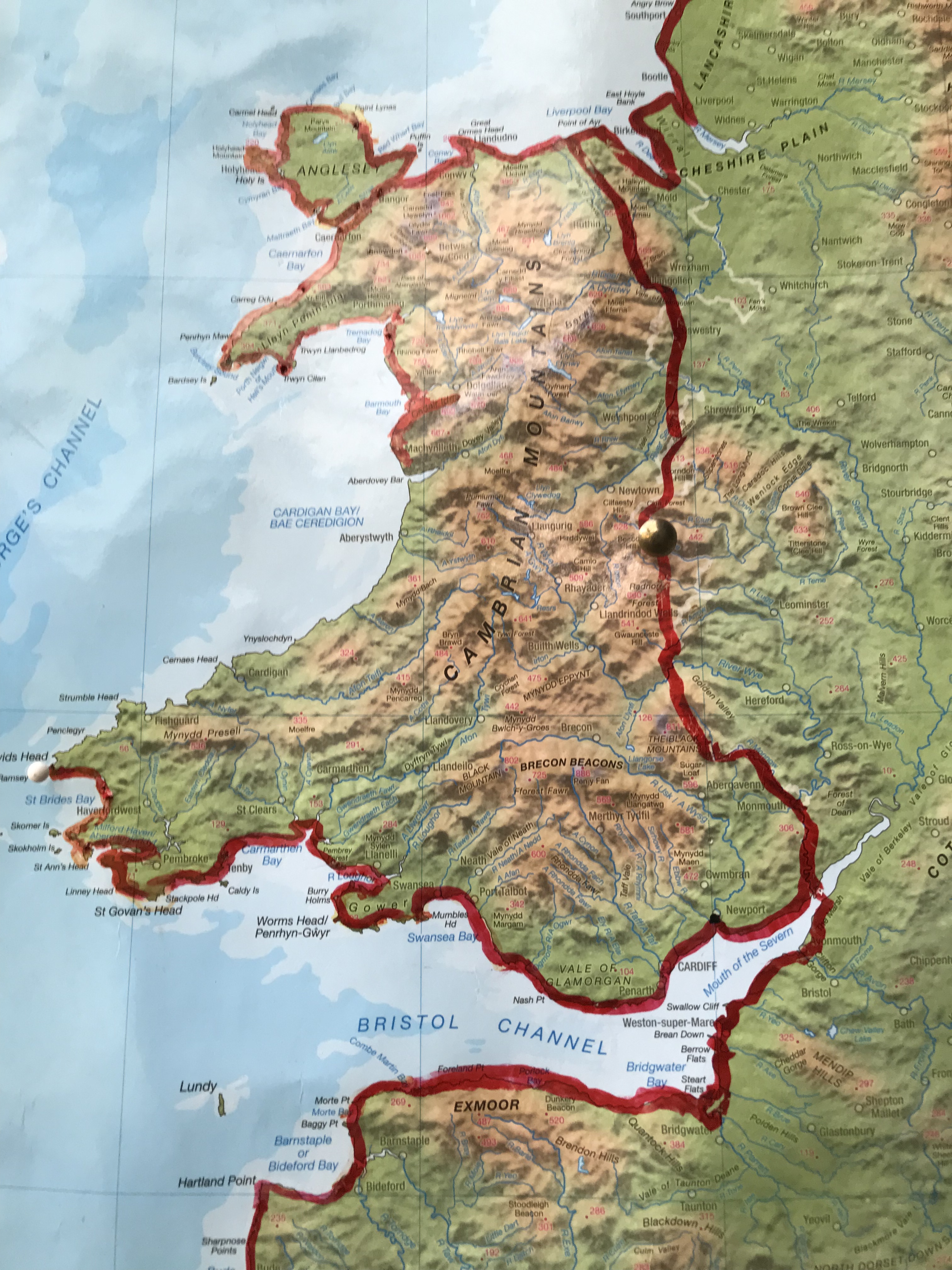
Progress Map by courtesy of Ordnance Survey. The southern crimson worm has turned up the heat and reached Llangrannog 25 miles south of Aberystwyth. Whereas his slippery northern pal remains holed up at Borth 6 miles north of Aberystwyth – use two fingers to enlarge the map!!

Dear Rosie, Lauren, Stan, Jake, Rowan and Maisie,

I’m running out of miles to walk and there is a realisation that another chapter in my walk around Britain’s Coastline is coming to an end as I approach Aberystwyth.

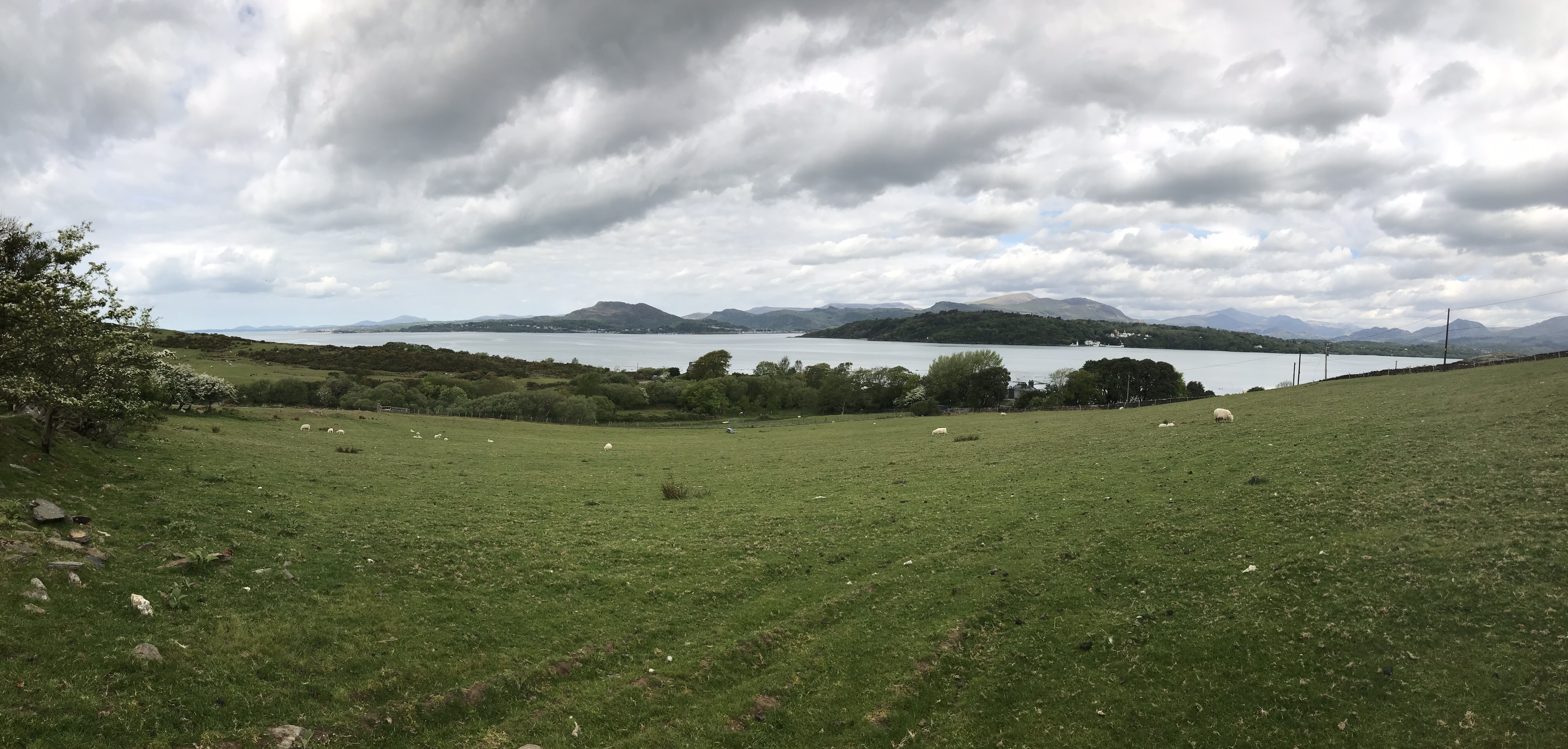
I’m beginning to think that the area I’m now walking is by far the most scenic and I want to photograph everything in sight which creates a selection problem further down the line.

The sequence is also questionable since enforced walking there and back creates double the opportunities and also twice the confusion in putting things in the right order. I think I can safely leave that to my dear reader – if the reader notices at all. Let random prevail…


Grand total miles  walked so far round England and Wales is 4,449 in 355 days but not all in one lump! In fact spread over several years.

If you think the total appears to be exaggerated- well it is- I include lost miles when I have gone out of my way unintentionally (unkind people call it lost) and I include duplicated miles where I have gone there and back on foot, plus any extra walking needed to actually access the Wales Coast Path (WCP)

Please  feel free to check my figures, you can borrow my marked up route maps and see you in about six years, unless you walk faster than I do.

Anyway, a rough guide would be that walking round England and Wales including Offa’s Dyke and Hadrians Wall is gonna end up being about four and a half thousand miles, give or take….

This latest several day walk starts at Moylgrove/Trewyddel where I lost and found my wallet last episode.

The next big town was Cardigan which I used as a bus hub as I walked the Coast via Cemaes Head and Poppit Sands.


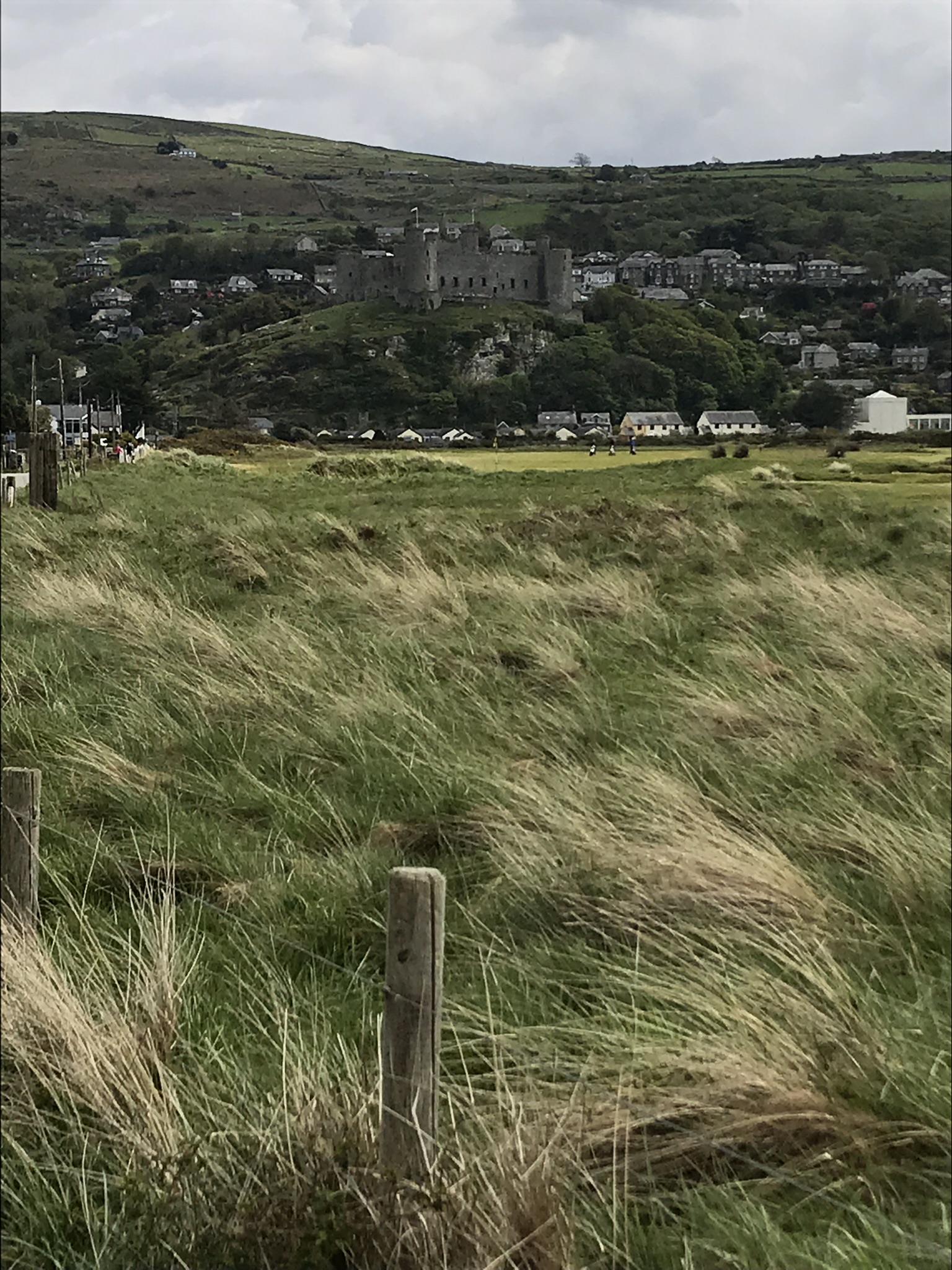
Cardigan is well inland on the Afon Teifi with nowhere to Ford the river until the first bridge – Bridgend!

1B4AA30E-22DA-4BEF-BCC2-DF7C27ADB0C4

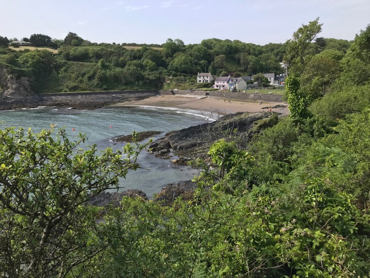
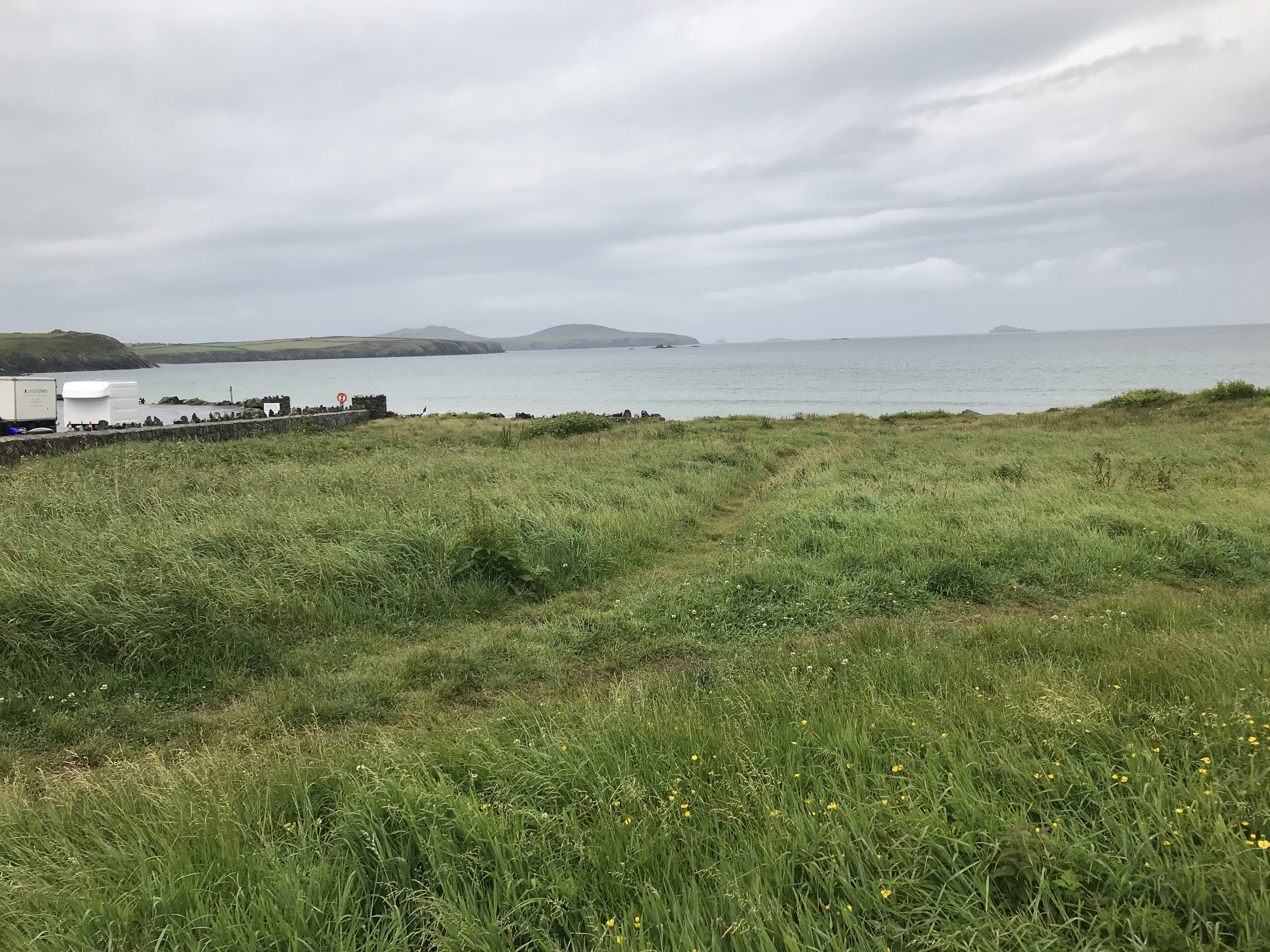
Above/ Bridgend Cardigan/the castle was being done up and not so photogenic. After that came Gwbert, Parcllyn, Aberporth,  Penbryn, Tresaith and Llangrannog

Penbryn  was picturesque beyond belief. I lingered longer here, maybe realising the WCP journey was coming to an end with heightened emotions; caused maybe by the superb natural surroundings; or could be the coffee, cake and ice cream at the Plwmp Tart?

Penbryn.,.


Domestic issues – below-  camping at Llety and inside my personal public transport – for a while I was the only bus passenger

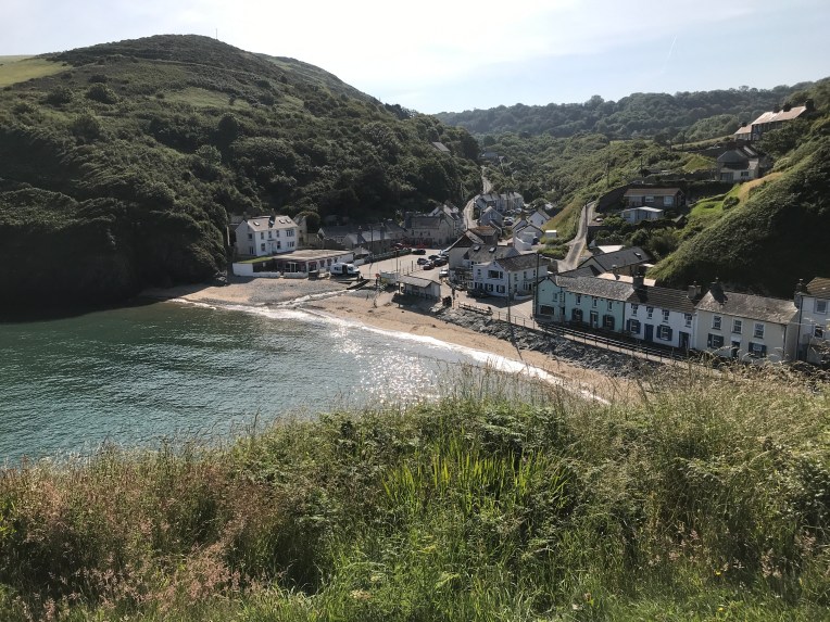
Above and below Llangrannog where this walk started and ended


B22D3060-E6DA-40A5-9A83-7948C3853416.jpeg

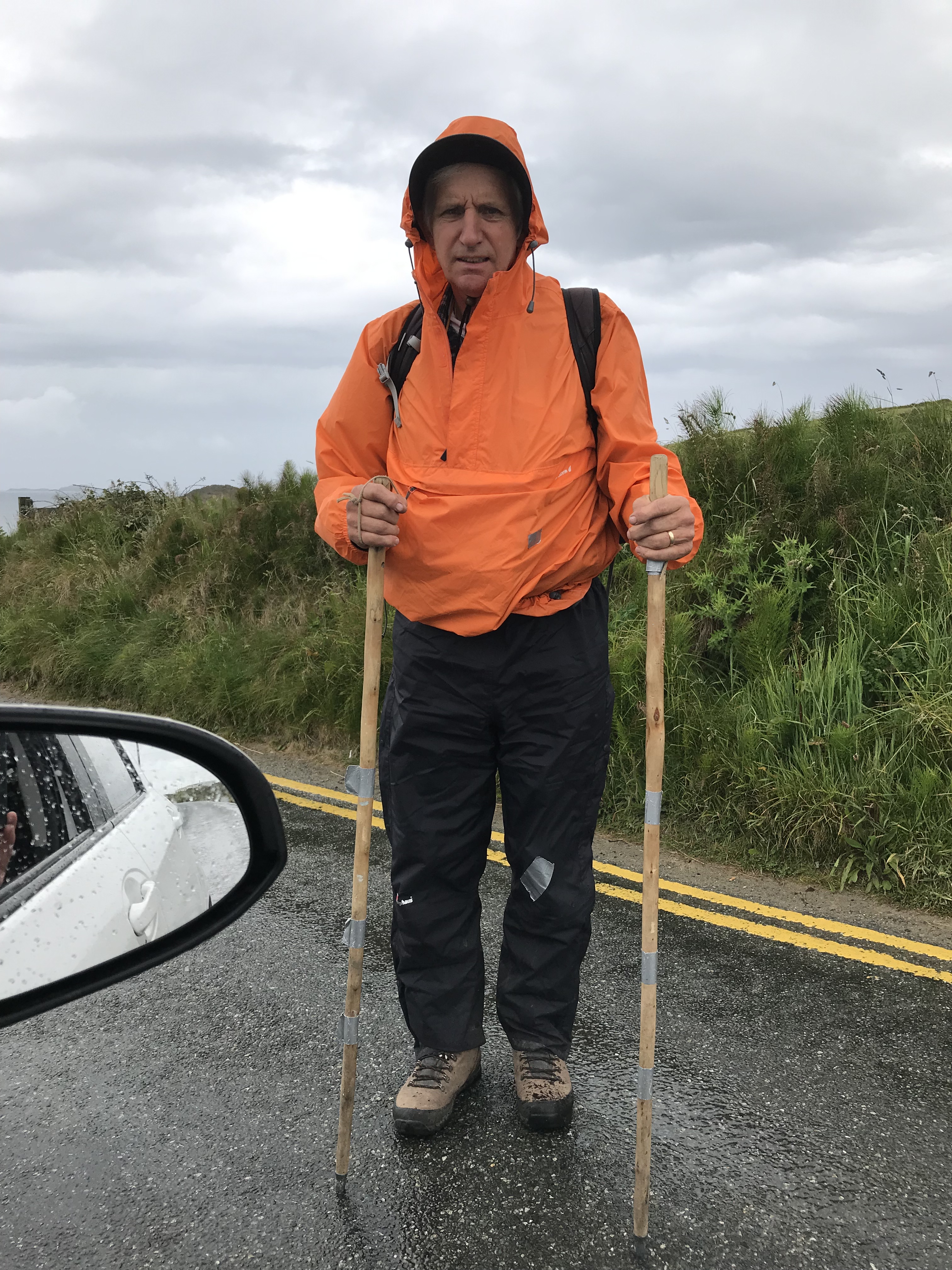
A very early start, caused by a fox raiding the bins at my campsite. He came and sniffed at my tent and screeched at 3am; I got up and cleared the mess because next the gulls would come to investigate followed by rats. My trusty multi purpose steel tipped sticks were by my side. Needless to say I didn’t get much sleep and started my walk much earlier than usual.

I was desperate for a hot beverage it being very early and nowhere open. The Gilbert family came to my rescue and gave me early morning sustenance and Essex nostalgia. They had been coming here for summer holidays for years as a greater family and occupied a wonderfully positioned letting just by the boat slipway. As family continued to arrive I made my excuses and headed off refreshed looking back and down on their idyll -above – bottom right

Next was filling in a shortfall heading for Tresiath and back , running on empty and no buses to suit my timetable. I hate there and backs except this one was well worth doing twice .Refer the Plwmp Tart!

I returned to Llangrannog tired overheated but exhilarated.

Time to go home!

Hang on?

But what’s all this about ?


An updated Progress Map??02B1D472-EB86-4F72-A404-C79998AD9286

it seems the northern crimson worm didn’t go home straight away on Thursday, but instead slipped out and slithered into Aberystwyth unnoticed


There’s crafty for you boyo!

Heres the story in pictures very low key but the southern worm still has to complete the course in the finale on July 27 walking into Aberystwyth from Llangrannog


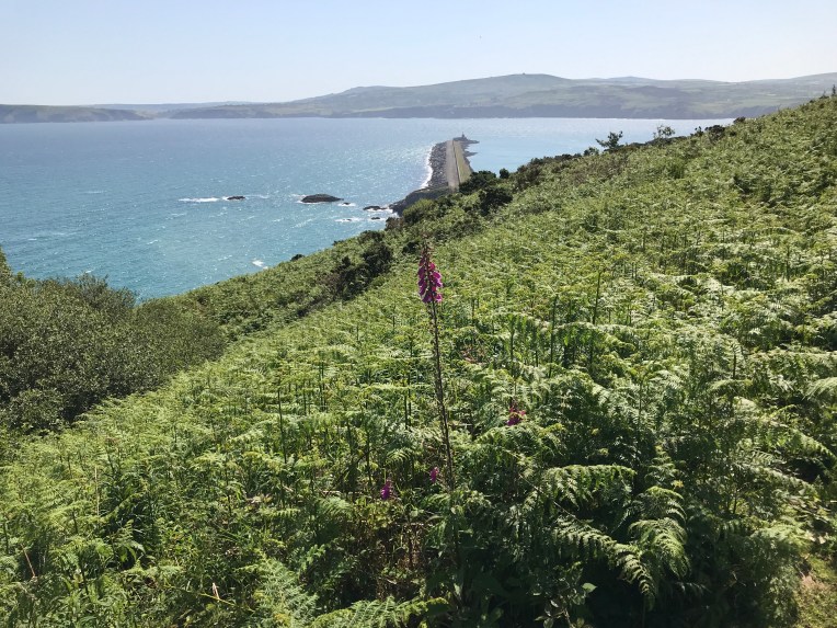
The plan was to walk 6 miles from Borth into Aberystwyth and catch the train back

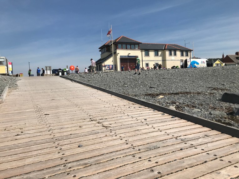
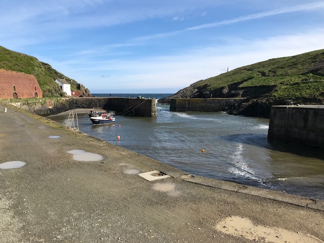
Leaving Borth beach and the IRB Station

B36B4027-A8BF-44F3-8786-196D38D457E8


Looking back at Borth – below

CB9F07FB-F767-48EB-A62D-E3E7D7DE4E64


Aberystwyth laid out ahead of me as I crest the next hill — another mile to go

A1975256-6DE6-47B5-B475-912F8F68EC5A


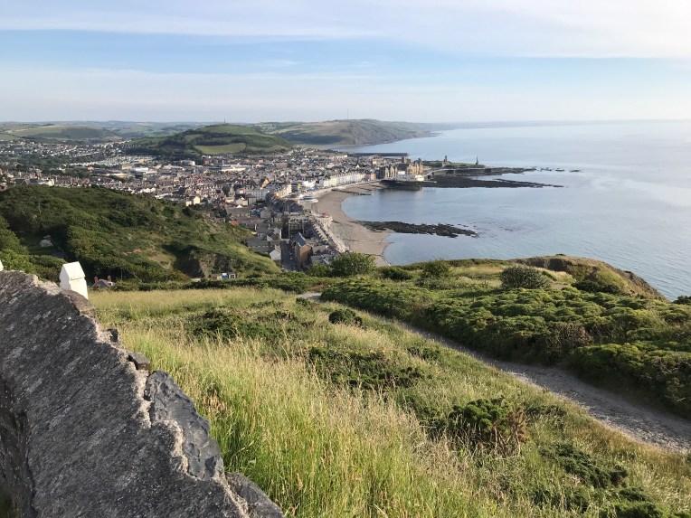
End of the cliffs at Aberystwyth Cliff Railway

AB25A50D-7F3C-4E90-A634-D6EDCF02324F

Followed by a walk into Aber to find the railway station out of here.

Below – Leaving the train at Borth from Aberystwyth where Nobby was waiting to take me back home, but not before we had negotiated an enormous might time diversion in the heart of mid-Wales where they seemed to be resurfacing every road I needed to use.

5384F47D-7716-4735-B90D-8108C49BA6DB

I got home at midnight. Otherwise a very successful journey making a mess of my arithmetic but I believe I have now completed 4,455 miles in 354 walking days!


The northern crimson worm had deviously got to Aberystwyth first.

All that remains is to complete the circuit by walking thirty odd miles from Llangrannog to Aberystwyth and celebrate with the Finale- with fish and chips and lime and lemonade at Aber  Baravan -full details available from Marilyn- dress code walking gear.


Episode 132 – Return to Newport Sands and walking 12 miles on the Wales Coast Path to Moylgrove/Trewyddel The Principal Walker showing signs of fatigue and has to be rescued by Geoff and Marlene from Bolton; Lily and Sam from RNLI: and Richards buses not forgetting Trenewydd Farm Holiday Cottages….

N

My rescuers; Richards Buses disappearing with my wallet; Geoff and Marlene who found it; Lily and Sam who replenished my water supply; things go wrong when Bobl’s in a hurry and Nanny had been loaned to Rosie and Lauren. Not forgetting Linda and Tony At Trenewydd Holiday Farm my B and B for the night

Below- Cliff edge scenery from Newport Sands to Cwm  Trewyddel. Today’s walk was pretty strenuous with plenty of ascents and descents in the heat of the day; I was glad of the company of Geoff and Marlene. With all the chaos I still managed twelve miles bringing the total to 4,413 miles in 351 walking days.


Dear Rosie, Lauren, Stan, Jake, Rowan and Maisie,

Nanny took a risk and allowed me to play on the Wales Coast Path resuming at Newport Sands on my own whilst she looked after Rosie and Lauren.

With my independence, my plan was to arise st 5am and leave home with Nobby, driving to Moylgrove/Trewyddel and intercept the 9-24am Poppit Rocket Coast hopper bus alighting at Newport Sands and walk the coastal path back to Poppit Sands increasing my southern crimson worm tally by miles. Simple. What could go wrong? All in the right direction too!

It all started to unravel when I stopped for breakfast  refreshments along the way and miscalculated the time to get to  the bus at Moylgrove/Trewyddel. In the end, was relying on the car clock being 5 mins fast. I coasted into the M/T car park where the only two people around formed a small queue at a bus stop. An exchange of yells established it was the right place for the coastal bus, as I hurriedly  tried to get my gear together.

Suddenly the bus arrived

I mostly succeeded transferring my gear, except for my water bottle, my sticks, my hat, sunscreen and also left the luxury of tying my boots till on board the bus.

The gentleman boarding the bus, Geoff, watched as I made to join him and observed that I might want to close the passenger door on my car.

The bus driver generously waited till I’d got the door closed and locked and I landed in a heap on his platform with the belongings I’d had time to bring with me.

I managed to tie my boots as I chatted to new neighbours  Geoff and Marlene. It appeared they were journeying similarly to me except staying on the bus one stop longer. Shame cos they were familiar company in many ways to me and would have made good travelling companions but more importantly I could leave all the navigating to someone else.

Anyway we parted hurriedly as the driver informed me we had arrived at my stop. I was still blissfully unaware of the goods I was lacking and even more unaware that I was about to leave my wallet on the bus! About a mile into my walk I suddenly realised I was bereft of a wallet. I walked on having about 15 quids loose change on which I could survive and knowing Nobby had a full tank. But my resolve waivered, with no wallet my identity was out there at the mercy of who knows what!

So I retraced my steps searching all the way back to the bus stop .Nothing.

Except the familiar faces of Geoff and Marlene. I didn’t have to tell them my woes / the missing wallet and all the other missing equipment. They had worked out I was unfit to be out on my own and had found the wallet on the bus and decided to give chase hoping to catch me up to tell me. Which, because I’d turned back,they had soon overhauled me. They told me the wallet was in the safe custody of the bus driver.

i tried contacting the bus company Richards but to no avail. No signal.

We agreed the best course of action was to let the wallet journey round the countryside and rendezvous at the end of the day at the end of the line.

i was no longer at the end of my tether.

Thereafter we formed an orderly queue and proceeded on our journey round the coast together. Very pleasant company.

We formed a plan to contact the bus company after refreshments at the end and maybe intercept the bus somewhere along the route.

Meanwhile I took time out to visit the RNLI Lifeguards at Poppit Sands to replenish my water supply. Nothing was too much trouble for duty lifeguards Sam and Lily and I was soon supplied with enough water and sterilised bottle to complete my journey. I remain very impressed by the whole service offered by the RNLI. Did you know they make All their own lifeboats in Poole?

It took a while to catch up with Geoff and Marlene ( or as I renamed them serendipity personified) on account of some seriously steep ascents. Especially the last! But at the end Geoff insisted on feed and watering me, topped off with a gin and raspberry ice cream cone!

The garden centre cafe allowed me to use their phone to arrange s rendezvous with the bus carrying my wallet, I was not equal to their telephonic system and fortunately the waitress remained available to help place the call and give me essential information like where was I?

SP Geoff and Marlene  hadn’t finished as I was escorted through the cunning crafty back lanes to await the bus; I even had time to purchase souvenirs from the RNLI Shop.

i took Geoff’s advice to  not drive home but to stay around Cardigan and refresh for less hectic walking tomorrow


Trenewydd – I am thus writing the blog from the comfort of b and b near St  Dogmaels.  I am comfortably positioned ready to spring into action on the WCP on Tuesday and return home after much too much excitement

It was spooky that the only Bolton connections I had were also known to Geoff and Marlene…. namely the Chadwicks and the Lofthouses


Back to today’s Walk


Witches cauldron

E7C1FDB7-5199-4C1D-858E-74EB38F7E9B3


Shady memories below of a steep, long and painful climb to the garden centre cafe where Geoff and Marlene resuscitated  me tea cakes latte and gin flavoured ice cream

D9F0388F-4DF7-46D2-A0BB-2D942FCE9619


RNLI Station at Poppit Sands

– more souvenirs particularly as they rescued me from potential dehydration


That’s all folks – I’m double visioning – or hallucinating?

Episode 131 – Walking the Wales Coast Path, (south), 34 miles from Aber Mawr to Newport Sands, Pembrokeshire, via Strumble Head and Fishguard. Total mileage round Wales and England is 4,401 -in 350 days. ….. only 72 miles to go before the Finale in Aberystwyth

5781BFDF-C7BE-438E-B345-1BDBBC5714D9My favourite picture! Hot enough for my first swim of the year- taking a short cut across The Afon  Nyfer at Newport Sands


Dear Rosie, Lauren, Stan, Jake, Rowan and Maisie,

It has been a busy walking time,  trying to finish my walk round Wales in time for The Finale . Nanny and Nobby accompanied me last week for  34 miles walking on the Pembrokeshire Coast Path from Abermawr to Newport’s Afon Nyfer on Wednesday to Friday. Not to be confused with the Newport in South Wales!

The route hugged the coastline mainly at cliff top level with very little opportunity to get to the shoreline.

Starting again at Aber Mawr, I aimed for Strumble Head and the first day’s walking ended  after 12 miles at Llanwdna with easy access to our b&b at Fishguard.

The second day totalled 14 miles walking via Goodwick and Fishguard to Dinas Island. It was getting mighty hot.

On the last day I completed the circuit of Dinas Island and pulled up short at Newport Sands after only 8 miles at the Golf House Clubhouse, totalling 34 miles this trip. I was overheating and over eating too much crab.

During this heatwave the overall mileage ticked over to 4,401 in 350 days making my daily average walk nearly 13  miles since November, 2013.

The gap on the Wales Coast Path Progress Map below, (Courtesy of Ordnance Survey) has now closed to 72 miles, from Newport (Pembrokeshire) to Borth

D7B7C592-509C-4913-B606-2057EE7429E9.jpeg

Below, Wednesday, at midday, I’ve returned to Abermawr, and start walking, although my app calls it Pencaer and  Castlemorris. Nobby and Nanny leave me to it and I set off for the next rendezvous


Soon heading for Strumble Head lighthouse – furthest below


No access to the light house


I lost my map and map case somewhere in this hay field…

5A5C6E03-7735-4304-A533-8640A739CC91

Next day when I returned someone had hung them on the stile. Nice one! Thanks!!

. Next day heading for Fishguard

FD212CF3-5586-4D7F-AA3F-287BC3B0E73A


CCD1B651-3EC8-4B3B-9132-11F99D637EEE

6EDEDC80-D013-43EC-A664-8354255BF2A2

Suddenly the footpath became quite restrictive – walkers segregated from ferry traffic. Somewhere in there would be an RNLI Station which I couldn’t get at

32689316-B3FC-44AF-AE7C-5168CFCEC7D3

The Harbour from Fishguard


A rendezvous with Nanny at the old harbour just in time for crab salad lunch at the quay cafe across the water- yes that’s the Wales Coast Path cutting a swathe through the greenery

A583EED9-A028-4F1B-8284-8C7030C089E6


A5298B93-2039-4FC0-984A-43E515D7E5B6

Harbour defences!


375F10C7-7E9C-47A6-AEEC-6AF14B3FF6C2

The hottest days of the year so far…a group being taught coasteering. My walk is quite mundane in comparison


Must remember to look back ocassionally,  I’ve walked all that!

CFE1138D-EFEE-44C2-A3F3-0E0902141EF9


10E2E49C-CAC8-4594-9A0C-D8C7D8AE72FE

And looking ahead at what’s to come


75A373A2-059E-483E-80C8-6F80B7B6238B


Running out of words to describe these pictures, and feeling sad that the tour is coming to an end


Approaching Newport Sands and Afon Nyfer wondering whether the tide was right for fording the River

ADB4418E-4719-4018-8D4F-CF4BBF976284

But first an iced drink and another crab sandwich lunch at the Morawelon  bar and restaurant, we can watch the tide.

We did and it seems quite safe to wade across. Cross the Afon Nyfer and finish in the golf club car park


…..5781BFDF-C7BE-438E-B345-1BDBBC5714D9much too hot to go on – on reaching the Afon Nyfer at Newport Sands, with the tide at its lowest, a great opportunity to cool down by wading across the main channel, after crab sandwich lunch, at The Morawelon, on the south beach.  I finished my walking on the north beach where Nanny and Nobby were waiting in the Golf Club car park. My wet boots will soon dry out in this heat


More crossing the Afon Nyfer – others followed me across,.,33AB0CBF-03DD-43E4-94CA-36B17E512A42

Hurry the tide’s coming in again!

Back soon to close the 72 mile gap….


Below. Going home via Aberystwyth – when we can get past harvesting equipment blocking the narrow lanes

F23C37D0-F947-4CC0-B553-4D632FA5D38D

Episode 130 – being the counterpart to 129- a further 20 miles from Machynlleth to Borth to return the Wales Coast Path walk back to the coast and the total mileage to 4,367 with about one hundred and ten miles to go. Scroll through for Episode 129

Progress map below by courtesy of Ordnance Survey showing the north Wales Coast Path crimson worm back in its rightful place on the beach at Borth. Within striking distance of Aberystwyth. Still no reaction from the south crimson worm about 110 miles away, stuck at Abermawr

1FEF64FC-05F0-45DC-B7E8-E0CAB92A9542

Dear Rosie, Lauren, Stan, Jake, Rowan and Maisie,

Yesterday, Tuesday, 18th June, v v early, I drove with Nobby to Machynlleth to complete the inland diversion around the Aberdovey estuary. Last trip I had already completed the north bank, Tywyn to  Machynlleth, and now I was hoping to finish the south bank counterpart of Borth to Machynlleth

I chose to catch the train from Machynlleth to Borth and walk the Wales Coast Path in reverse because the trains worked out nicely.w


Even having time to breakfast on the train


– Barra brith and coffee before arriving at Borth below


And now after filling my rucksack with snacks at the local grocer, I was ready to take on all day long the bogs, hills and forests which the train line had just skirted in twenty minutes. I only got lost once-

at Brwyno GR SH/SN 710 964

I missed a wooden finger post high up pointing almost back on myself; very easily spotted walking back though!


Bogs above

Forests below


I don’t know what you were expecting but the above pictures are typical Wales Coast Path inland diversion- not much to sea?

Sorry  but I do navigate much better with the sea on my right…..  or left

but there were dramatic rivers below


And one intruder


Did someone say  lunch?

After lunch and a very impressive display from my new friend who was so happy to see me, I realised my phone charge was getting low and reception wasn’t always guaranteed.

I opted for radio silence  to save power for any real emergencies and that meant no more pictures. My own personal batteries were going the same way, getting lost again was no longer allowed

I’ll list the significant features of the journey so you won’t miss out


After getting lost along the Afon Brwyno River I returned to charted territory at Caerhedyn and followed theLlyfnant Valley to the RiverRhisglog at Gelli Lydian where some serious tree felling made following the path more interesting until …….

D372F548-F0E3-4BB0-BE07-CF90B67AC4A1

…….At last after a very long day, starting out at 6-30am Machynlleth came into view. The photo was timed at 5-10 pm. Laid out before me from my elevated position I could see the river bridge and the railway station a couple of miles away. Fortunately it was a downhill dawdle most of the way to Nobby parked at the railway station just after six thirty pm. Not even bothering with the flask of coffee he had been guarding all day, I hopped in and drove home by gone 8pm

Simple.

Not.

But yes! once home if you were to look due West over our back fence, across the River Teme and beyond over the 😊Cambrian Mountains, that’s where I’ve been getting lost . No people. Just one horse.

Overall, a very satisfactory two (Saturday and Tuesday ) day’s walk despite the 36 mile diversion being mostly unnecessary if I could have forded the River Dovey at Aberdovey! The journey from Tywyn to Borth direct incidentally measures about 9 miles with no allowance for tides, currents, wind, tacking or calling in my investments in the RNLI! So the full effect of the diversion is about 27 miles extra.

l’m not bitter, just worn out. But I didn’t drown, I wasn’t swept out to sea and I didn’t succumb to quicksand

Episode129 -A one day, 16 mile dash to Machynlleth, Tywyn and Aberdovey to bridge the R Dovey. The north Wales Coast Path Crimson Worm is front runner in the race to be first to Aberystwyth. The south Crimson worm is still languishing around Abermawr on the way to Strumble Head. Total mileage round England and Wales is 4,347 miles in 346 days.

Donald birthday edition 

2B1E47D3-29D0-4D13-A39A-46CA2F5CCE59He was one for the forty fifth time on Friday 


Progress Map by courtesy of Ordnance  Survey

846EDECF-660D-40D2-99C0-D4A102B7AE0F The  crimson worms are leaving quite a trail around Aberdovey, particularly following our previous February visit to Tywyn and Aberdovey to climb Cadair Idris with Stan and his pals. Add to this the 12 mile trek from Aberdovey inland to Machynlleth to cross the R Dovey  and I’m getting maximum use out of OS Explorer Map OL23 and there’s still the return journey to the coast from Machynlleth to Borth.


Dear Rosie (have a nice birthday party on Friday), Lauren (   Good luck with song on Friday ),   Stan(remember Cadair Idris?), Jake (so pleased you’re back in the fray -how’s the cricket going?), Rowan (first horse riding lesson accomplished) and Maisie (have you reached the top yet?) and Richard also, (Happy V BIG Birthday),

Because the Wales Coast Path action is close to home I managed a day trip yesterday (Saturday) to resolve the dilemma caused by having to cross the River Dovey on the way to Aberystwyth. But  just in case this cunning plan went awry, Nobby was filled with all sorts of camping and hiking equipment so I could bale out any time

My options were to blag a lift across the river to Borth at Aberdovey or walk 12 miles inland to Machynlleth the nearest bridging point; and twelve miles back again to Borth.

I parked Nobby at Machynlleth Station -free!- with no particular plan other than leaving all options open. I took the train along with two carriages full of mature walkers doing the same thing, but was only one of few getting off at Tywyn (my last known walked destination on the Wales Coast Path) and headed for the beach and Aberdovey


At Machynlleth option of train to Tywyn or bus to Aberystwyth- the train won.

While Nobby stayed put in the free car park

30489BAE-BF02-4041-A837-E81B708F1455


Arriving at Tywyn and heading for the beach and the Wales Coast Path


8F50C30C-6CFE-4841-8A52-0647C4660C40


Stan will remember the prom and arcade, curiously closed today, maybe they thought he was coming to empty their coffers again….


Tide going out plenty of surf and firm sand to walk on to Aberdovey

First sighting below was the RNLI Lifeboat Station which I inspected and bought a few souvenirs as insurance but did not help my pleas for cadging a lift across the Dovey


The city limits of Aberdovey were quite fish and crab orientated  but today with low tide just before 2pm and intermittent rain there were no fishermen or boatmen around to serve my need to cross the river at Aberdovey rather than walk an extra 24 miles inland detour via Machynlleth.


I approached some locals whose best advice was they had just seen a jet ski being launched, perhaps if I tracked it down I could blag a very wet crossing? But all was quiet – no irritating raucous racing engine noise – even though I would have temporarily displaced my aversion to these almost unnecessary machines.

A8F5B9B1-FEA4-4990-A32B-083302BE960D
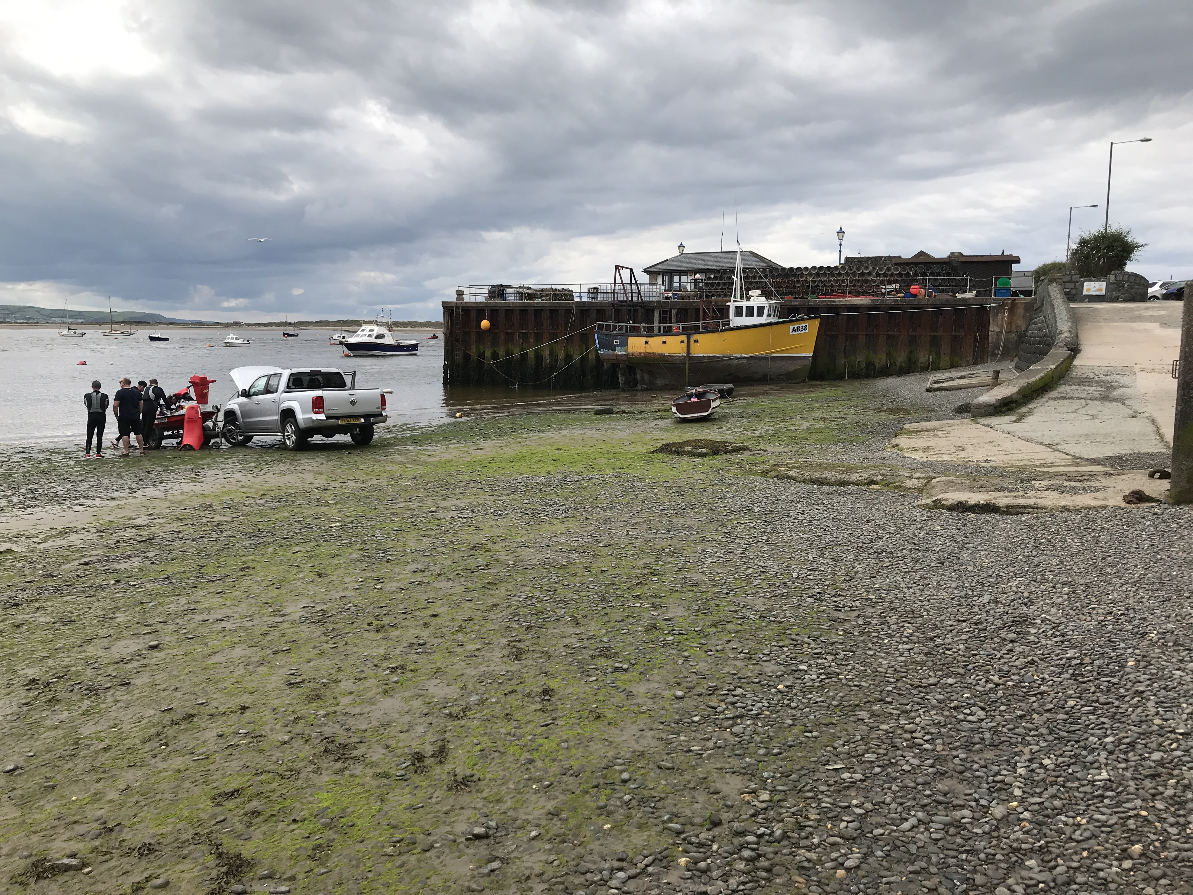
A few minutes later, the last picture above depicts a broken down jet ski being revived on the beach / what’s the opposite of serendipity? Seems that idea never got off the ground! It would never float

The next twelve or so miles were unimportant to me as I headed inland. I had been unsuccessful in my attempts to get a lift across the Dovey at Aberdovey despite asking the RNLI Station, Outward Bound, the Harbourmasters Office, fishermen, the yacht club, charter fishing boats and any kids with a lilo or even an inflatable toy. .Here is a selection of the trip photos which for the most part followed the railway line and the main Aberdovey road to Machynlleth – with no footpath! And it rained and the off- road parts of the walk were poorly signed.


I was constantly changing into wet weather gear, sun gear, hi-viz gear and dodging traffic on the country lanes while searching for non existent waymarkers on this redundant bit of the Wales Coast Path.


At last I’ve reached the lowest bridging point of the River Dovey and I crossed and headed for Machynlleth Railway Station, Nobby and home after a slightly resentful walk inland away from my beloved coastline.


AA50244F-0AFA-412D-B570-76BE7AC10837

Next visit I will resume from this Machynlleth station heading along the south bank of the R Dovey to get back to the beach at Borth. I will then be back in position on the opposite bank of the River Aberdovey heading for victory for the north in the Crimson Worm stakes ….

Episode 128 -walking The Wales Coast Path from Whitesands Bay near St David’s heading for Porthgain on Friday and Abermawr on Saturday adding 18 miles making new grand total of 4,231 miles

Nanny’s favourite picture of AbereiddyD2299306-39E5-49EC-B482-1CC01E353650F426F37F-8B7D-4ED7-9A97-BF2837554D0D

The theme for this walk is rain.

The patches proved useless and the pockets all rapidly filled with rainwater otherwise prepared for anything! On Friday it rained all day, but Saturday was sunshine all the time.

Progress map around Wales by courtesy of Ordnance Survey below and similarly around mainland Britain further below…

621B16FB-3895-4FED-8D69-252C22C65404

Closing in on Aberystwyth

5A24B243-A203-4EA2-8DEB-D6867372C0B4

The overall picture of the journey round mainland Britain with Aberystwyth spotted white and brass tacks pinpointing my present positions of Tywyn, north; Abermawr, south.

Dear Rosie, Lauren, Stan, Jake, Rowan and Maisie!

Running low on time to complete the circumnavigation of Wales before the finale in Aberystwyth at the end of July. Which is why we found ourselves heading out from Whitesands Bay in the pouring rain on Friday in the general direction of Aberystwyth. It was genuine unrelenting Welsh rain, the kind that soaks to the skin despite several layers of waterproofs and also the kind that reminds you that, although it is June, Summer is still far away.

Consequently, despite the superb scenic quality of my surroundings, it was real trouble and strife to use the camera and it wasn’t long before the damp and humidity had rendered all pictures sub-marine, so apologies in advance, and also for large gaps in the spacing due to being preoccupied with possible drowning  .

Clug..Gluggle  gulf gluggg..

Ramsay Island being left behind in the midst and mist of rain

7BD2D9DA-1F69-4C00-8BBF-33B3095B5370


Keeping to the treacherous, slippery path was tricky when you couldn’t look up in driving, stinging rain


There were no rendezvoussss for ten miles with no vehicle tracks intercepting the Wales Coast Path until Abereiddi where  Nobby and Nanny found me washed up on the beach and a rare picture of a road…


7478DB50-16DC-4E24-9C9C-9F1E8CFA5E95Leading to late lunch and a change of clothes

…. which allowed me to wring out another couple of miles towards Porthgain


Porthgain, back and front- a welcome port for any storm

Back to our warm, dry, welcoming b&b in Carnhedryn with Rhian, followed by a meal at the Farmers Pub at our usual table in St David’s – everywhere else was reserved

Forecast for tomorrow is no rain – hardly surprising, they used it all up today.

We’ll see!

What a difference a day makes. Twenty four hours and the sun’s shining and it’s warm


Saying farewell to Rhian after our second excellent visit to her b&b conveniently located in Carnhedryn with lots of help and advice.


Restarting from Porthgain

…..this time in the summertime!


Stopping for a break at Trefin, heading for Abercastle.


Still heading for Abercastle – Nanny warning – she has parked up and is heading my way

I have deviated off the Coast Path to visit Pen Castell Coch which juts out into the sea, at height, giving two glorious views up and down the coast and then the glorious view of Nanny coming to check I haven’t fallen off!


Below- Descending to Abercastle Harbour at the same time as a party of ladies Coasteering their way along the rock face opposite us, and when the rock face ended they dived off into the water- some more reluctantly than others!


Looking back on the way to Abermawr beach followed by the beach…..


………Below – Descending from the cliff top of Castell Coch through dense, steep undergrowth to find Nanny waiting on the Wales Coast Path, or beach, with a short walk back to Nobby waiting in the car park to take us home. The rain yesterday had exacted its toll and my legs refused to go any further.


Episode 127- Resuming my Wales Coast Path tour in North Pembrokeshire for 2 days, walking twenty miles from Newgale to Whitesands Bay. Making grand total of 4,213 miles in 343 days spread over six years and counting….

Y

Nanny’s favourite photos this trip

Porth Clais ……and …….Solva

Walking round Britain’s coastline

Progress map below by courtesy of Ordnance Survey with my crimson worms highlighting the completed route so far.

England finished; Wales nearly done: Scotland nothing yet.

To complete Wales there remains most of Cardigan Bay left to finish before the end of July, but I have reached the most westerly point of mainland Wales, Penmaen Melyn. See the LHS – white dot.A747CC22-FE5D-4F87-9F7D-3B0E8B2F9B03.jpegDear Rosie, Lauren, Stan, Jake, Rowan and Maisie,

A sad weekend seeing Spurs losing the Champions League Final to Liverpool – no more need be said!

So I immersed myself in walking and the memory of the dubious penalty in the first minutes of the game, dissipated. Maybe – time will tell …..

which is how I became to be heading down to South Wales with Nanny and Nobby within hours of the bitter result, to resume walking North from Newgale. I have almost put it out of my mind? Not surprising considering how stunning the scenery was. And it’ll soon be Rosie’s Birthday

The route after a very damp Newgale start was via Solva, Porth Clais, Pen Dal-aderyn (or is it Penmaen Melyn, which form the most westerly point?) , Ynys Dinas, RNLI and Whitesands Bay. The weather was perfect and gave rise to several early season ice creams!

Excellent accommodation was afforded by Rhian Thompson for our overnight stay, at a B&B in Carnheydryn a few miles short of St David’s on the A487 , so good we’re going back next time – and soon

Off we go……..except,

we had to wait for some unsolicited  heavy rain to pass over, which it did and never looked back….

Starting off from Newgale Sands heading  north for a rendezvous at Solva.

Below- scenery starting to get impressive on the way to Solva


In Solva we discovered a redundant life boat shed to add to that collection; the tide well out and plenty of people messing around in boats; we watched a father carrying aloft a six year old, fording the River, being towed by a large recalcitrant puppy dog .which tangled in the mooring lines and chains. I wondered if there was an ancient rescue boat in the ancient boathouse for an accident about to happen?

And there was other boating activity to watch on the tidal estuary of the River Solva before moving on along the Wales Coast Path with its variety of weathered rocks and cliffs daring you to peer over cliff edges or walk into great clefts in the ground where more cliffs were getting ready to detach themselves.. The cliffs were eroding under my feet.

Sometimes there is no choice but to walk along the edge hoping my extra body weight made no difference to the cliff’s stability!


Finishing the first day at Porth Clais and returning to our b&b in Carnhedryn to freshen up before a night out in the big city of St David’s, at the Farmers Arms where the food was good but getting a table was a bit of a bun fight.

Day two

On Monday fuelled up on a full English we were away early from Rhian’s excellent acommodation to resume walking from Porth Clais  – day two. The target was Whitesands Bay with a halfway visit to RNLI Station at Porthstinian . The usual problem is it’s impossible to leave out any pictures…..


Porth Clais – looks like day one of new diet – after I’ve finish up current supplies of snacks in my rucksack. Essential grazing along the way  include water, figs, prunes, muesli bars, oranges, apples, dark chocolate, werthers, meat slices, cheese slices and Tom Pugh’s delicious meat pies which never seem to last long?


Porth Clais – River Alun – St Brides Bay  at sunrise


Carreg yr Escob and Carreg Fran


Soon to Turn the corner to see the RNLI Station as a white speck


Turning the same corner at sea finds Ramsey Sound – looks treacherous; understand why there’s a lifeboat station just past St Justinians.

Ramsey Island top right.

Porthstinian RNLI Lifeboat Station below ahead;  visitors about to descend on St David’s Lifeboat and the new and old Stations alongside each other with Martin on duty guarding the new £2.7m boat named after the benefactors Mother Norah Wortley. After a long chat with Martin, something from the gift shop and a rest, it was time for lunch


WhitesandsBay was just round the next corner and I began my descent down to sea level where Nanny and I finished off proceedings with ice cream and a promise  to diet tomorrow.

The speck below is Nanny waiting for me to land as I descend the near vertical steps    to the bay.5


Whitesands Bay – not a bad place to fetch up – complete with rescue centre and cafe.

Studying the maps we found the next stretch heading for Aberedie difficult to plan. There was limited access to the coast and once started, no choice but to keep going the full 15 miles. It wasn’t prudent to start after lunch with today’s mileage already approaching double figures. If we needed help making a decision – it started to rain!

And so we decided to go home via Aberystwyth to recce the scene for the Finale.


Finally here’s the overall progress map again by courtesy of Ordnance Survey, showing my completed walk round mainland Britain’s coastline – in crimsom585BCC05-60E7-46B4-AEAA-3A6668F8BF98

Tywyn to Aberystwyth plus Aberystwyth To Whitesands       =   115 miles to finish

If there were no ferry across River Dovey add 27 miles going inland to Pont ar Dyfi and back to Borth ie 142 miles to finish- better get checking the ferry!

Nominal end……..

Episode 126 – 27 miles walked from Llanbedr to Tywyn on The Wales Coast Path via Morfa Dyffryn, Barmouth, Fairbourne, Llwyngwril, and Tonfanu in two days making 4,193 miles in 341 days

Dear Rosie, Lauren, Stan, Jake, Rowan and Maisie,

A quick trip to Barmouth by Bobl and Nobby and one overnight camping puts the northern crimson worm in favourite position to get to Aberystwyth first.


Progress Map – Walking round Wales

The white spot indicates I haven’t moved the southern crimson worm any nearer St David’s recently……3868C165-1392-447E-B181-B34CA7A20CEB.jpeg

……Whereas the northern crimson worm has reached Tywyn and closing in on Aberystwyth. The slight hiatus around Tynwyn includes a previous excursion to climb Cader Idris, which is not yet on the coast, but global warming might sort that out.

I used my oldies railcard and the train to link Llanbedr, Fairbourne and Tynwyn. The rail track mirrored the WCP and also the stations  provided free parking quite legitimately and logistics proved straightforward

E6F46C44-2B64-49DF-9E99-8FC54A6F89E0.jpegThe southern crimson worm (the white dot), is still stranded short of St David’s. Better get moving otherwise it’s a walkover for the North.


Nobby and tent at Bwlchgwyn  Camp Site with views over Barmouth Bridge906DB591-2D5A-49A8-B744-4104D8A48220.jpeg


Crossing the Barmouth bridge after leaving the campsite

4D8371D5-7535-4C9E-8674-6AAB2A02D1D4.jpeg


Barmouth RNLI boathouse and Sue in the gift shop. Another mug for the collection


Off the road at Llanaber and proper coast walking getting wet


Morgan Dyffryn nature reserve


Crossing Barmouth Bridge by train


The railway features large in this episode


Clever editing…Fairbourne beach with road and rail fighting for space – the WCP gets shifted inland


These close ups of the bush show what happens when you lose the path – short cuts . Vertical routes. And bramble rash. Break our the Elastoplast .


The WCP retreats in land a lot whereas the railway and main road hug the coastline, I much prefer getting as near to the waves as possible – l must go down to the sea again……- I get unsettled if I’m out of sea sight. To me it’s not proper coastal walking unless you feel the sand between your toes, or boots soaked by rogue waves that take you by surprise. Anyway a visit to the Tonfanu Quarry to witness the decline of industry and derelict workings was fascinating


The final stretch approaching Tywyn gave views back over the Tonfanu Quarry, high point 178 metres right below

And left below, looking down on the rail bridge and footbridge over Afon Dysynni


And so to Tywyn and I’m ready to finish but not before driving to Aberdovey and recce-ing the shortest river crossing. It seems the map takes a very long inland estuarine detour when a perfectly respectable “ferry” from Aberdovey would cross the river in minutes. I’m asking the local sailing club for help- conveniently placed alongside RNLI Aberdovey!


Overall progress walking round Britain’s coastline below455DF939-00A8-4329-A715-6F6EBB679C4E.jpeg

Even more unfortunately for the south, our visit to recce Aberdovey today has paid off. It would seem there might be plenty of takers to stand in for the missing ferry service – it’s been missing these last 30 years! And the ferry refuge is now gone,  so that means a trek inland will not be necessary. I might organise that while the going’s good.


Episode 125- Alternative pictures by Justina taken on the walk from Pwllheli to Llanbedr. Supplement to Episode 124


Dear Rosie, Lauren, Stan, Jake, Rowan and Maisie!

On the last walk from Pwllheli via Criccieth, Porthmadog to Harlech and finishing at Llanbedr, I was joined by Mark and, in particular, by Justina with her camera. This is her  take on The Walk….


colouring in time…

2623CED9-EF72-4467-8D49-8B616C7A1F71
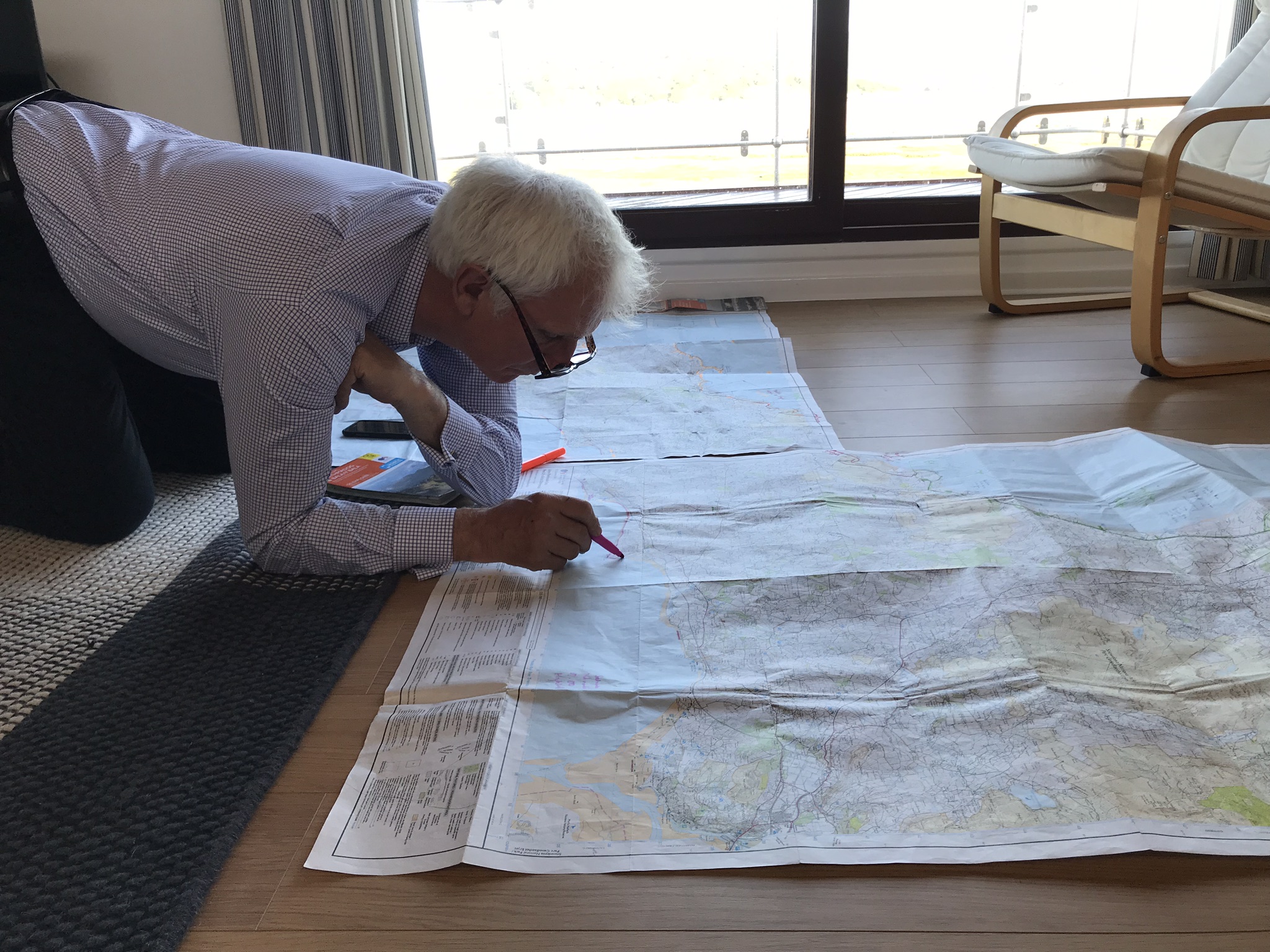
Restarting at Pwllheli after a planning session


Pwllheli lifeboat station – and the chart naming the hills on the horizon which can clearly be seen in the backgrounds..using a half decent camera


And a stranded shark


Near Pen ychain trig point

End of day one at Criccieth below


Mutiny  – Time for ice cream while Bobl walks on to RNLI Criccieth and the rendezvous at Dylan’s and day’s finish.

Day two

Restarting at Dylan’s in Criccieth through Porthmadog, Lunch,  Portmeirion, Pont Briwet and finish at Railway halt at Llandecwyn


Day three

Justina is last man standing to accompany me on my final day from the pylons at Pont Briwet as far as we can walk


xxFFECEDA2-4F9C-423D-941F-D8A8319298BA

07F35E4A-B422-47C9-8569-B0378FA0423C.jpeg

Harlech Castle above

We arrived in Harlech for lunch rendezvous with Marilyn and a final stroll to the beach through Royal St David’s golf club and farewell to Justina who had her transport back to Porthmadog waiting.

I trudged on alongside the railway line seeing how many stations I could collect.

Starting with the Harlech cliff to Llanfair which did for me – and no station! I got to

Llandanwg followed by Pensarn, then had nothing left by Talwryn-Bach near Llanbedr. After 50 miles in four days, Nanny and Nobby miraculously appeared and I was whisked off home….